Katrina Images
Click on thumbnail to view or download full image
Images from Field Guide
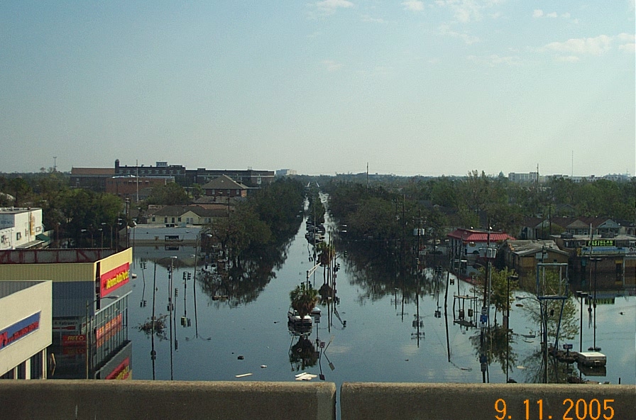
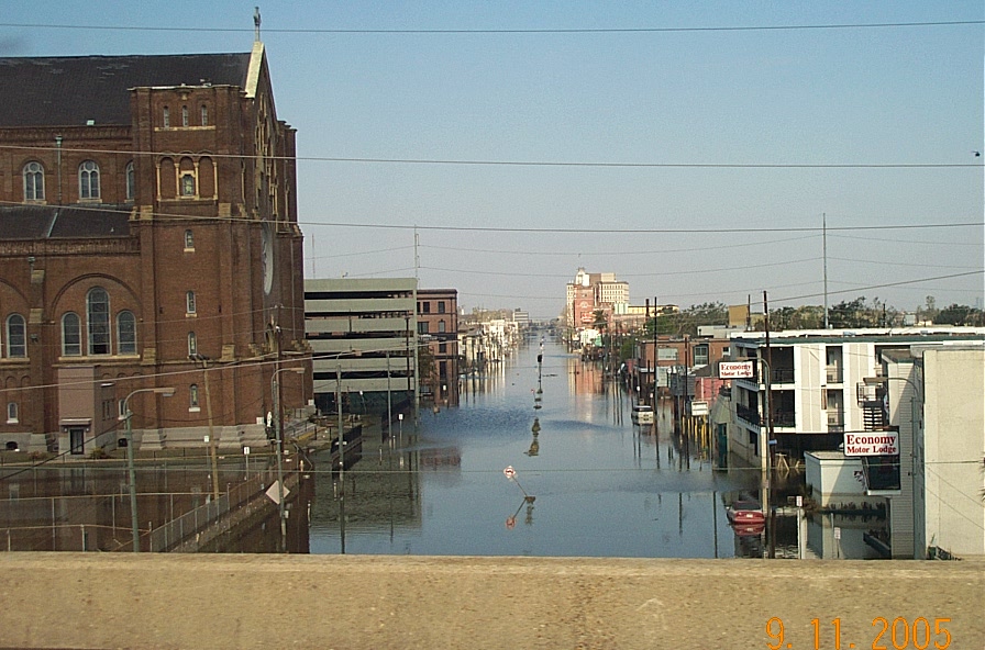
View looking North up Carrollton Ave. from I-10 overpass (Photo by S. Nelson)

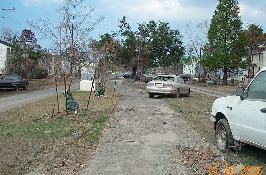
Park on Fleur de Lis near 17th St. Canal breach (Photo by S. Nelson)

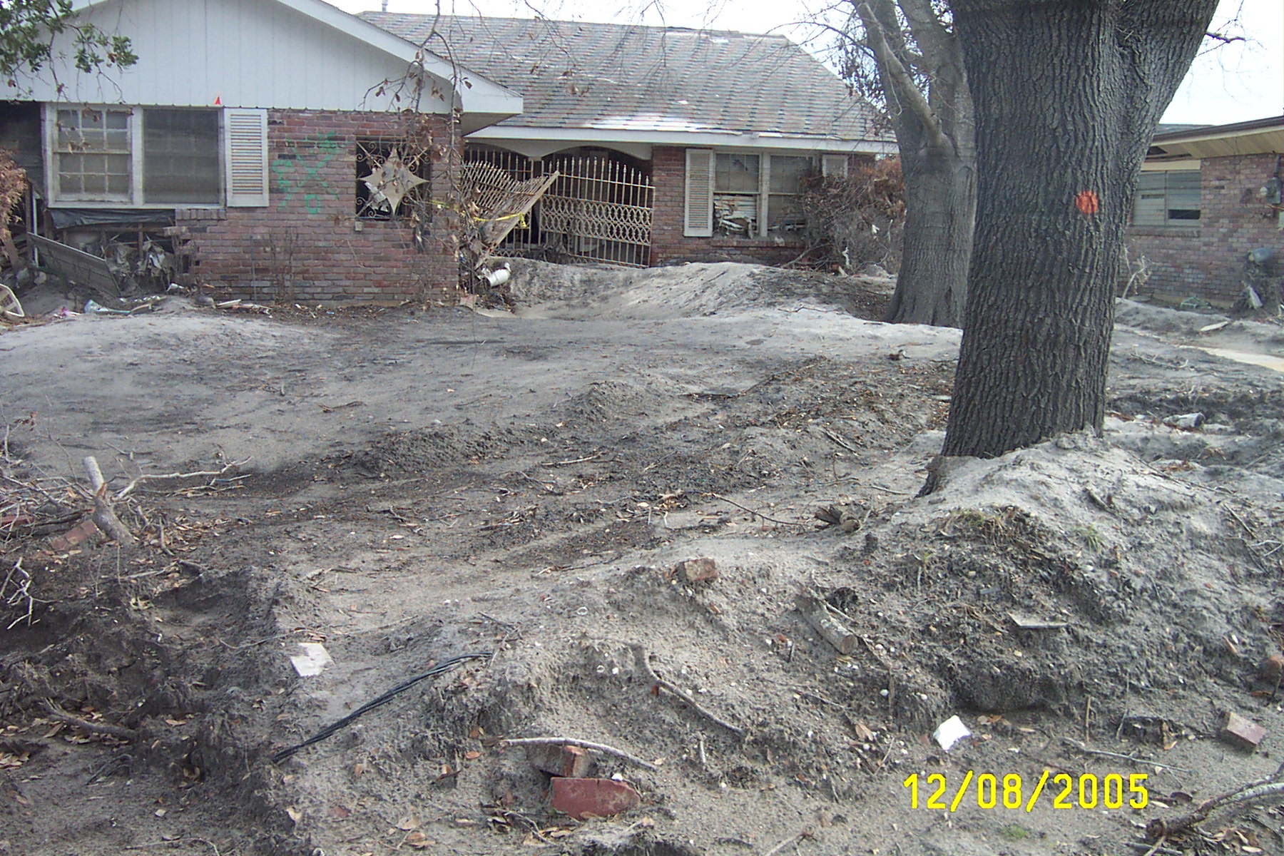
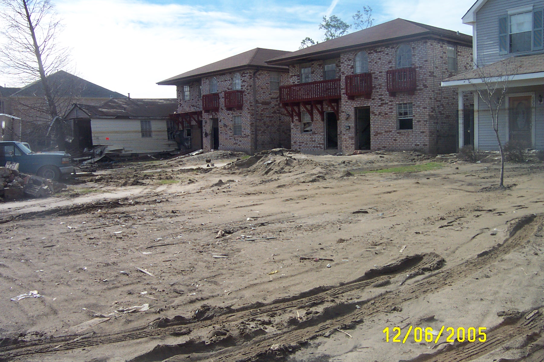
Home near 17th St. Canal breach (photo by S. Nelson
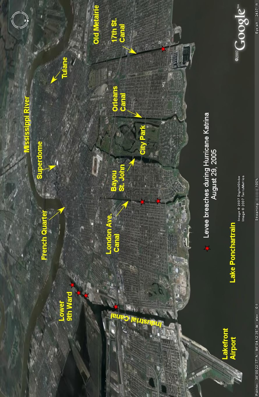
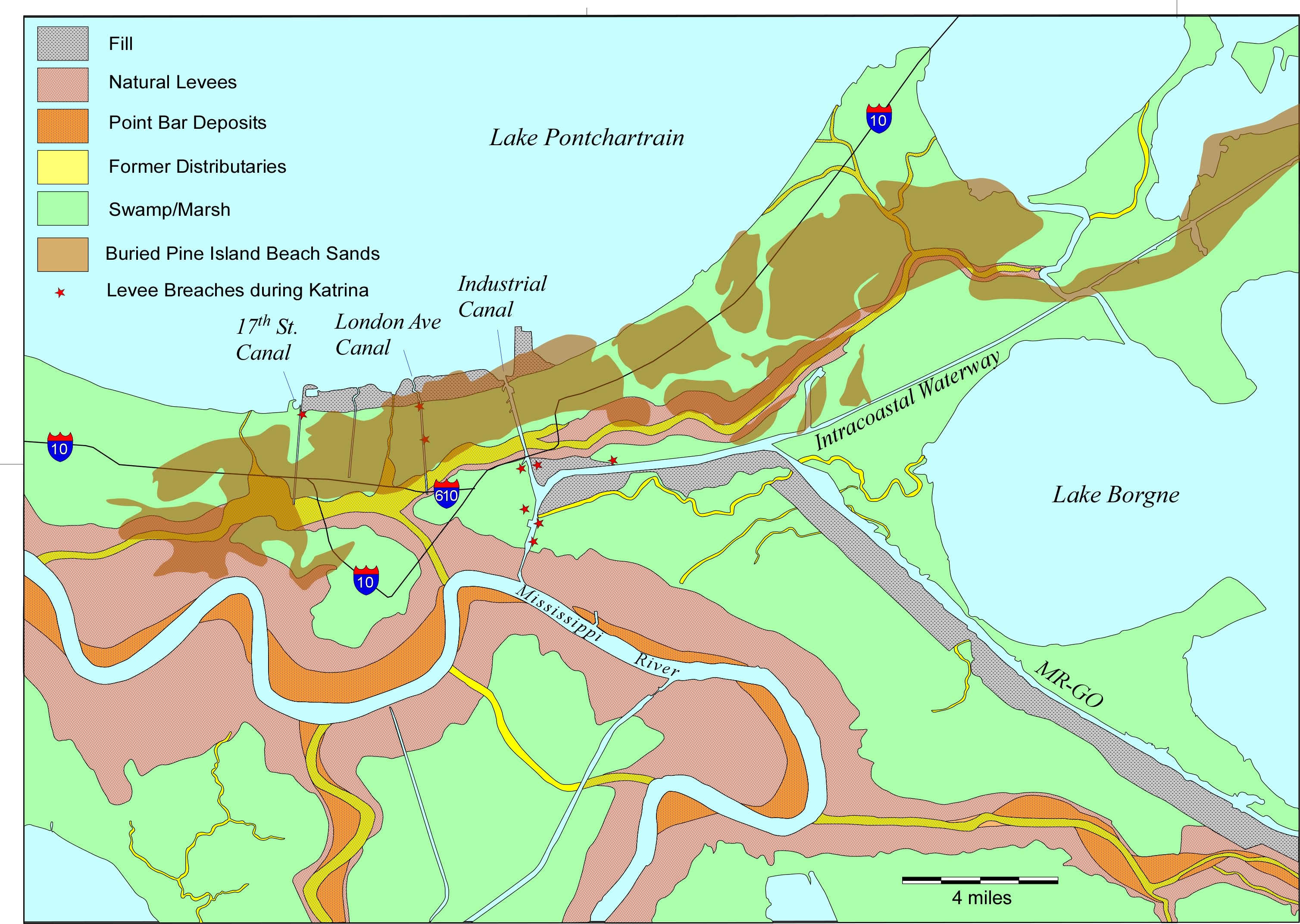
Google Earth view of New Orleans showing location of levee
breaches
Development of the Pine Island barrier Island trend (modified after Snowden et al. 1980)
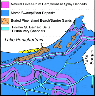
Generalized surficial geology of New Orleans
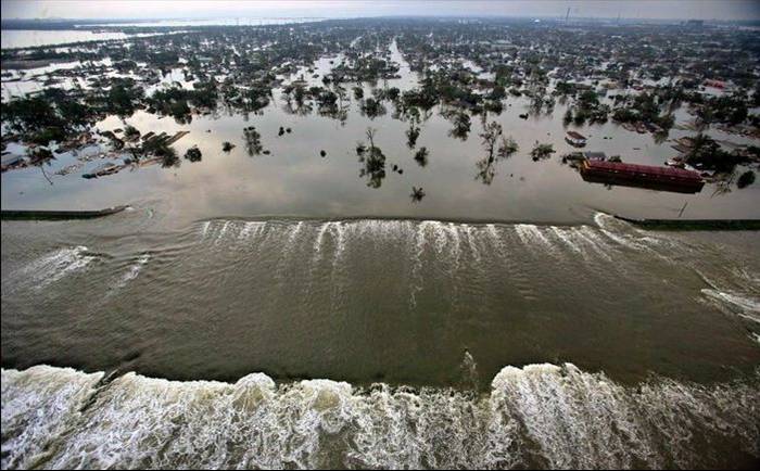
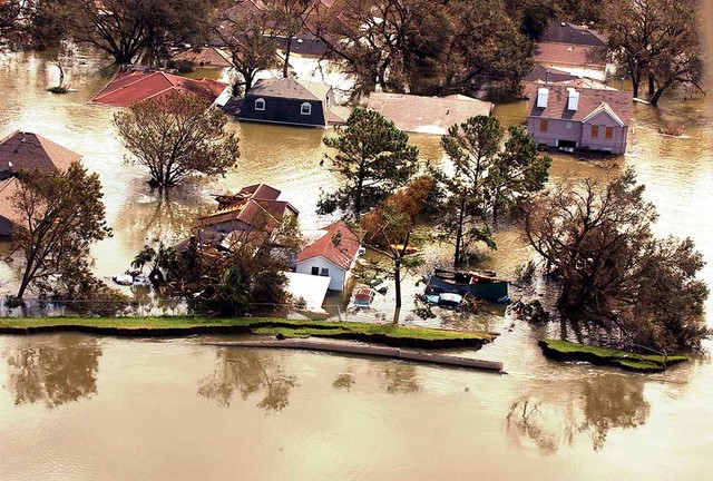
Map showing flooding in New Orleans from Times Picayune
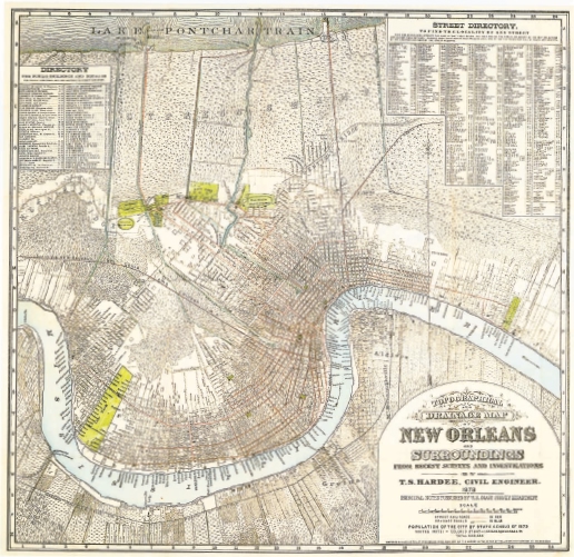
1878 Map of New Orleans from Times Picayune
![]()
Geologic & topographic profile across New Orleans, showing Gentilly
Ridge.
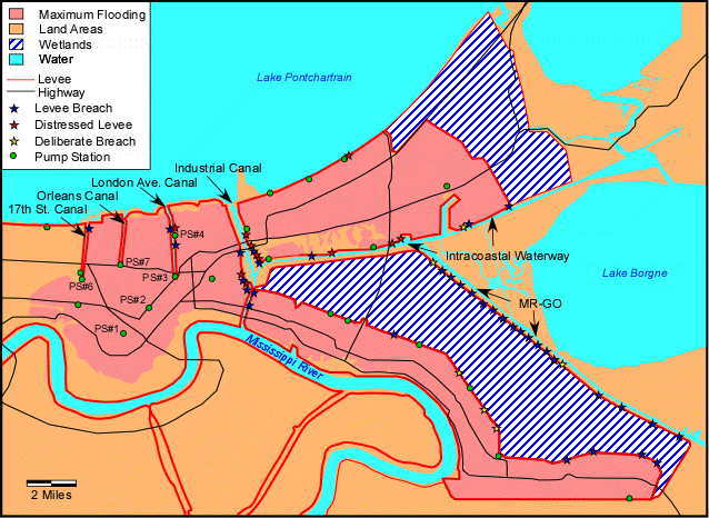
Maximum flooding area, levees, breaches, & pump stations modified after U.S. Army Corps of Engineers.
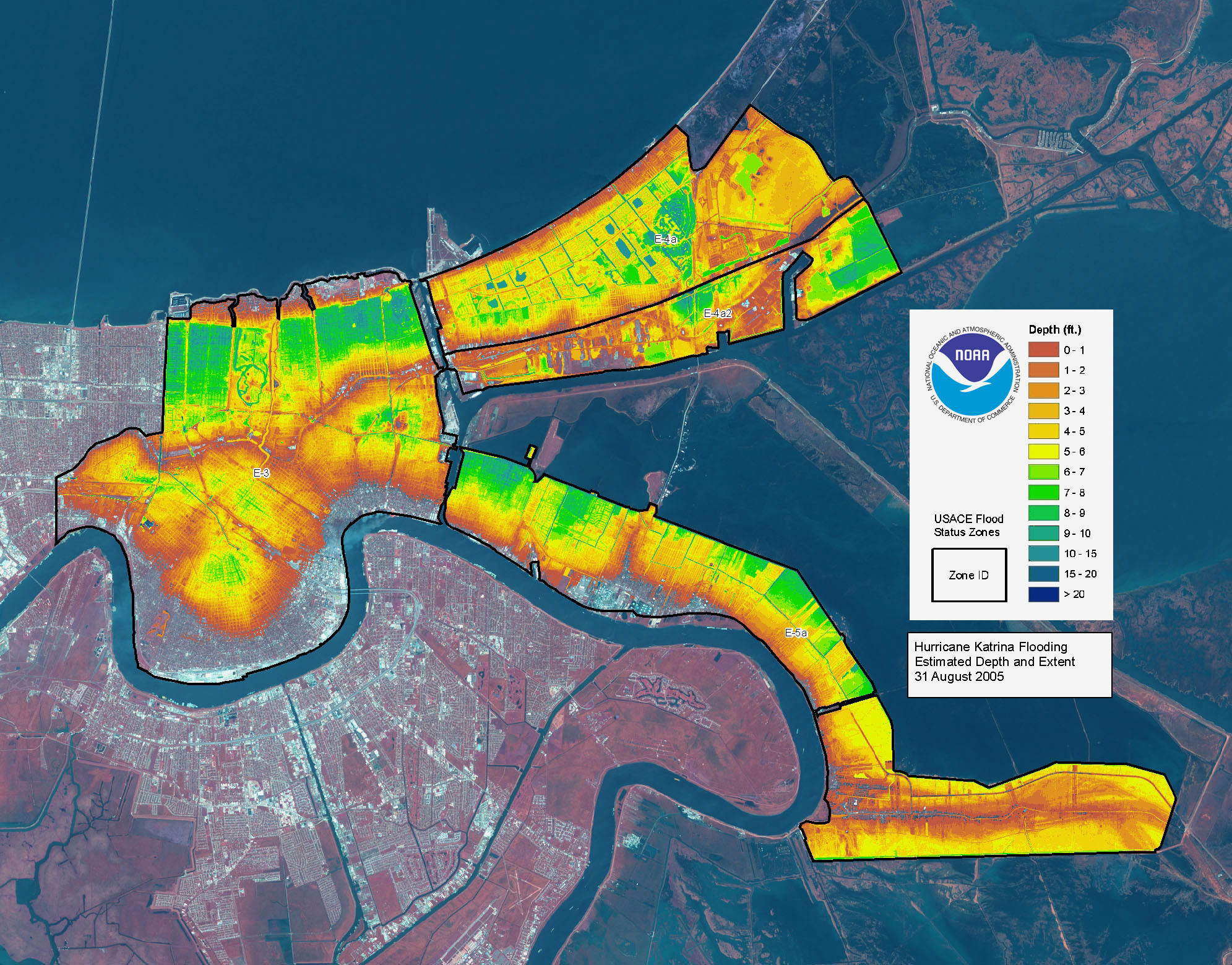
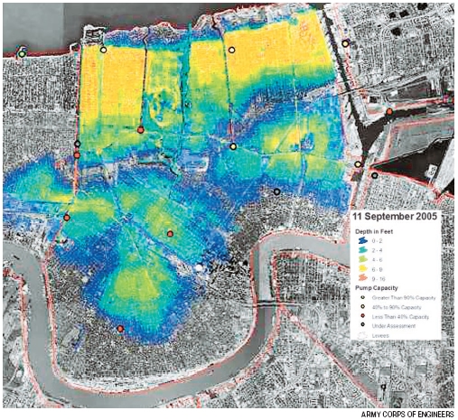
Estimated flood depths 8/31/05 from NOAA
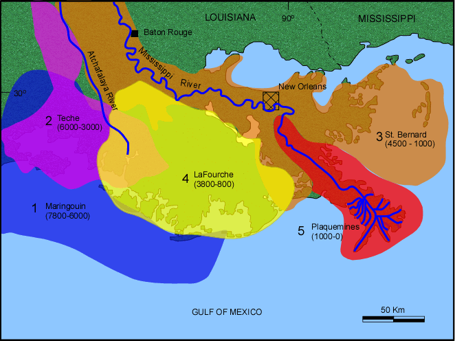
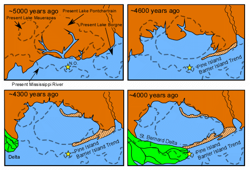
Stages of development of the Mississippi River Deltas
(modified from Saucier [1994] and Frazier [1967]). See field guide for
references.
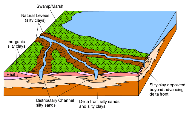
Block diagram showing types of deposits around distributary channels (modified after Saucier, 1994) See field guide for reference.
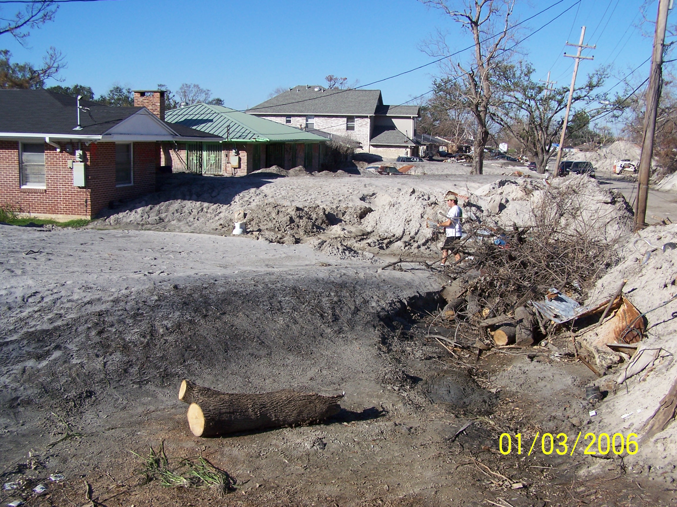
Oblique view of Industrial Canal breach and Lower 9th Ward (Vincent Laforet, AFP/Getty Images)
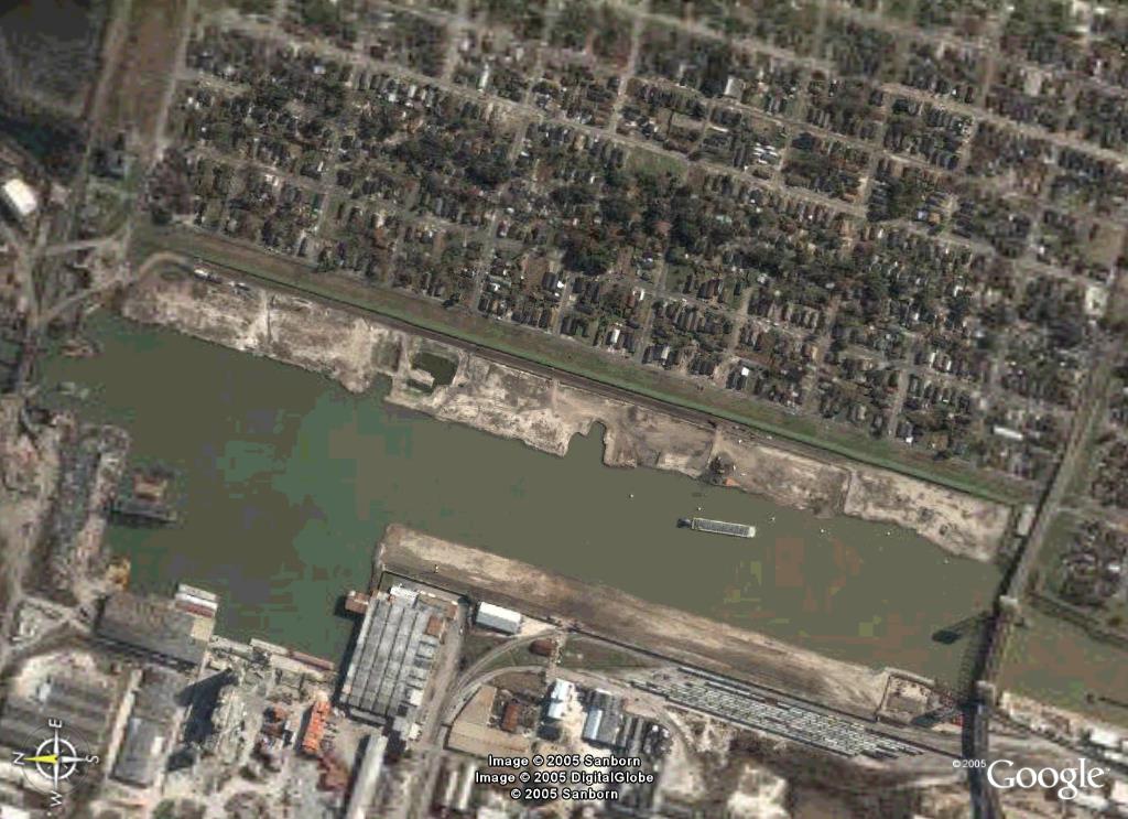
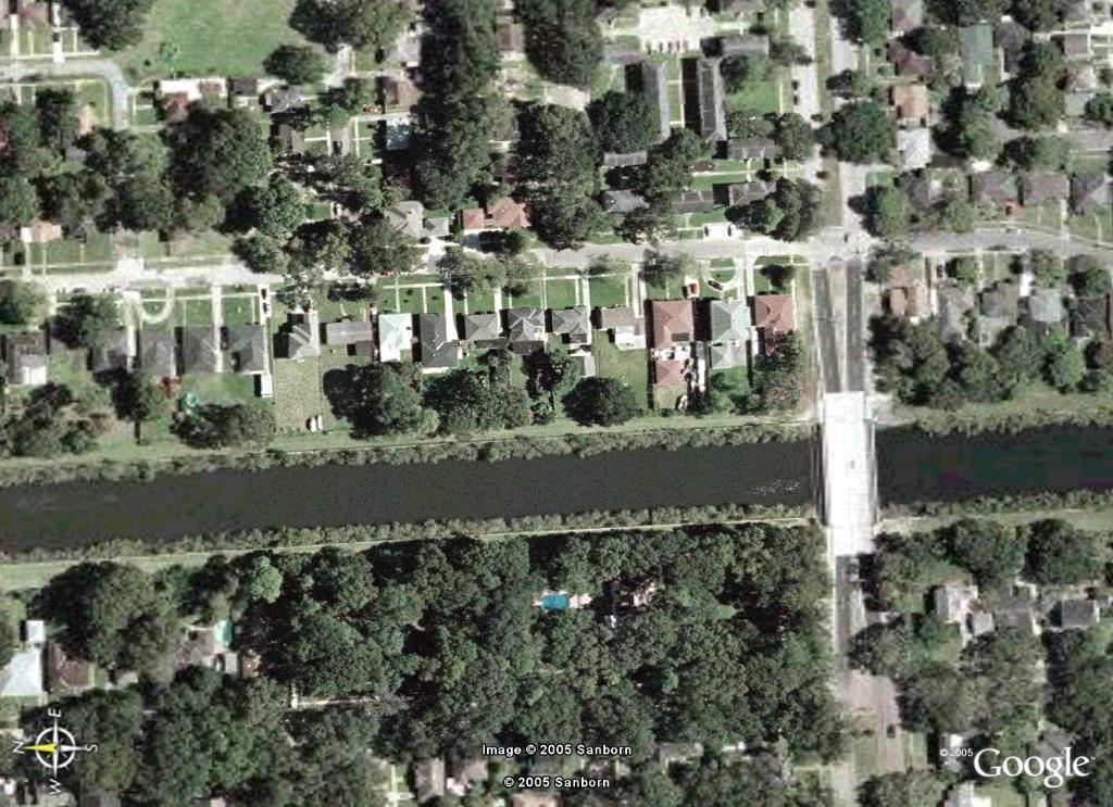
Industrial Canal area before Katrina (from Google Earth)
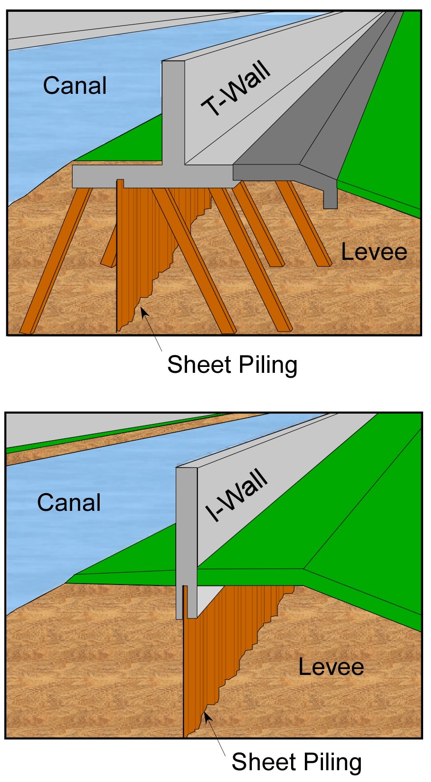
Floodwall Types
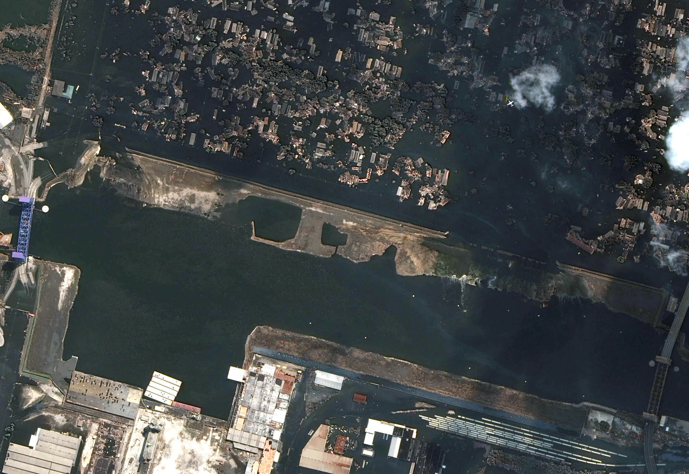
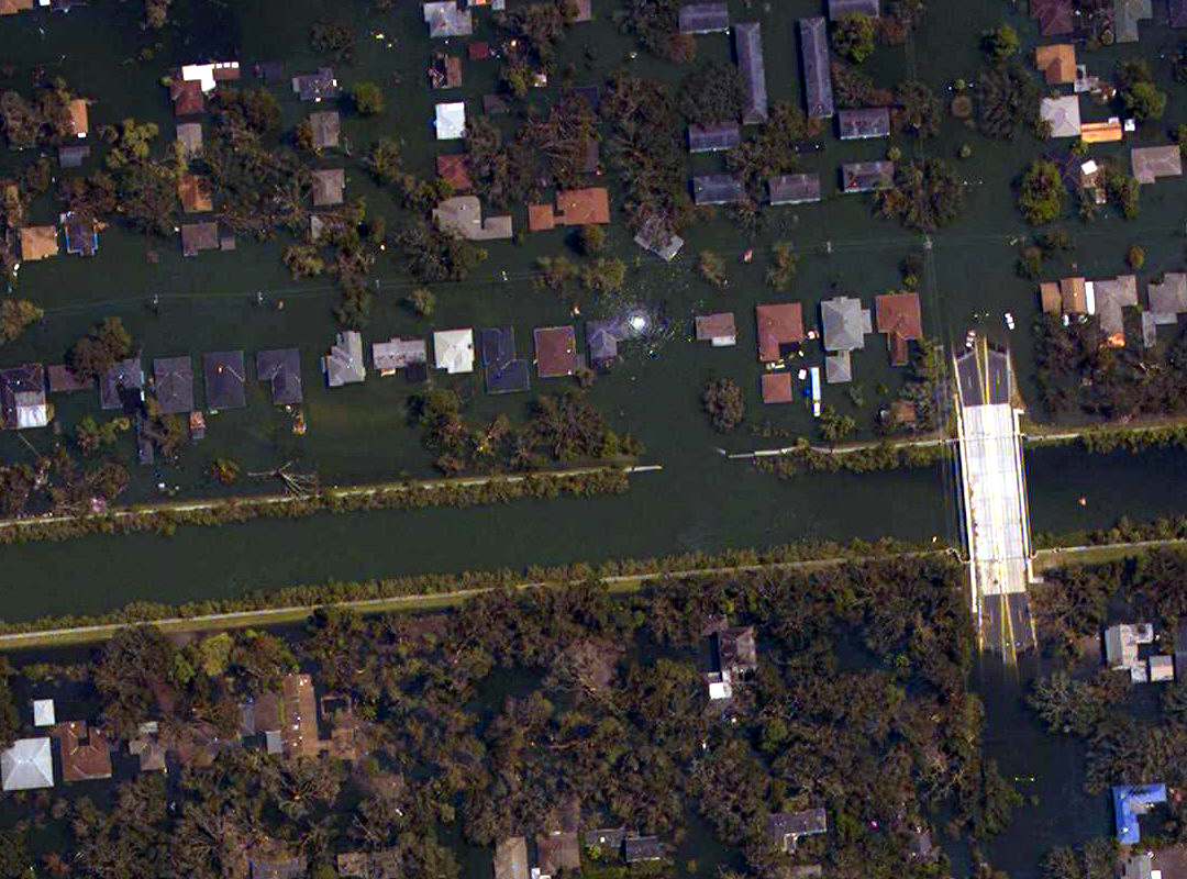
Industrial Canal breach area August 31, 2005 (NOAA)
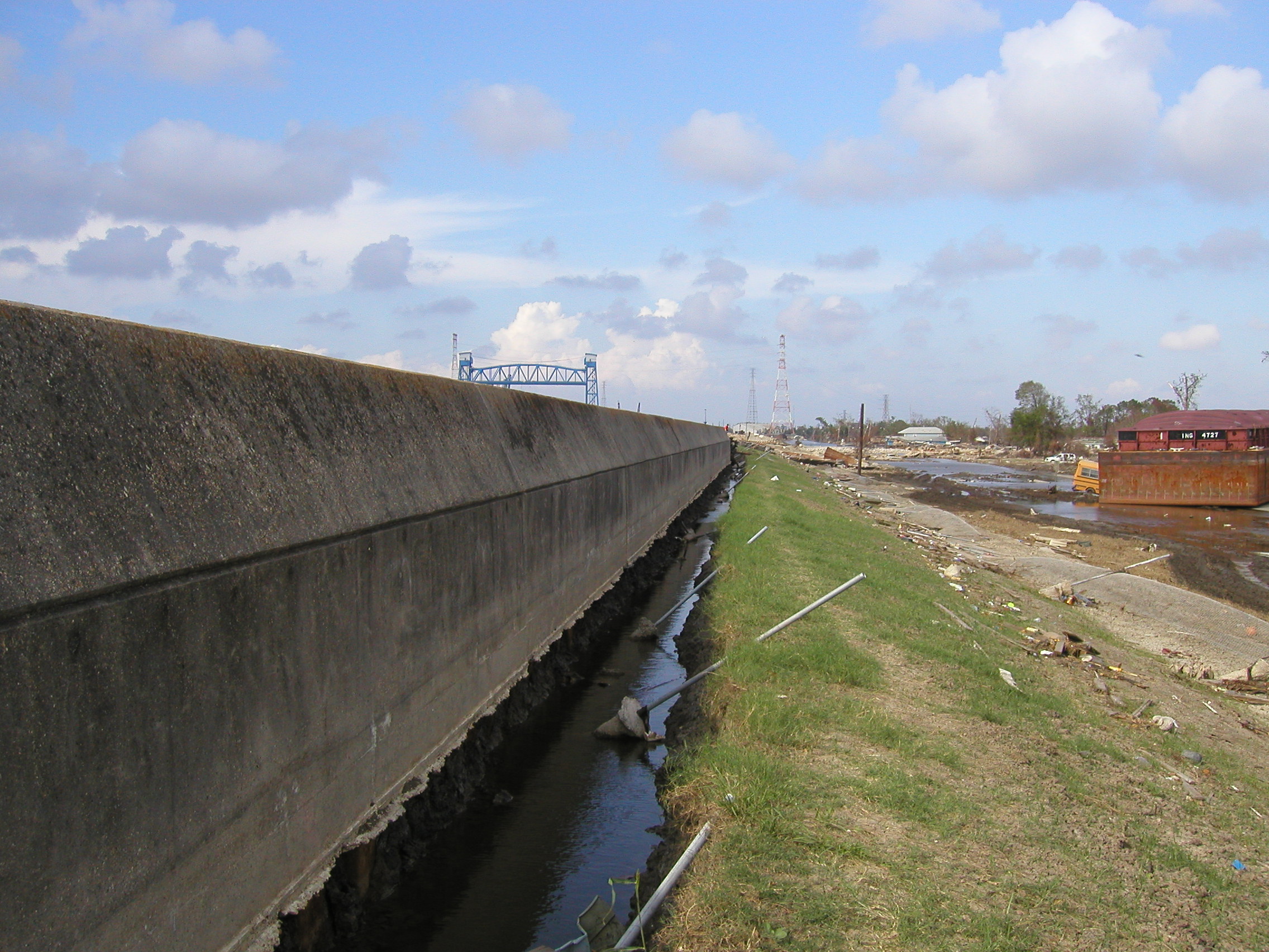
Floodwall of the Industrial Canal levee showing trenches eroded by overtopping. Photo from U.S. Army Corps of Engineers IPET web site
Floodwall and sheet piling strewn into Lower 9th Ward at the southern breach on the Industrial Canal. Photo from U.S. Army Corps of Engineers IPET web site
View of southern breach of Industrial Canal showing twisted sheet piling and floodwall strewn into Lower Ninth Ward. Photo by L. Harder - from Independent Levee Investigation Team Draft Final Report (see Links page).
View of northern breach of Industrial Canal showing twisted sheet piling and floodwall. Photo by L. Harder - from Independent Levee Investigation Team Draft Final Report (see Links page).
From southern breach on Industrial Canal looking east across Lower Ninth Ward.
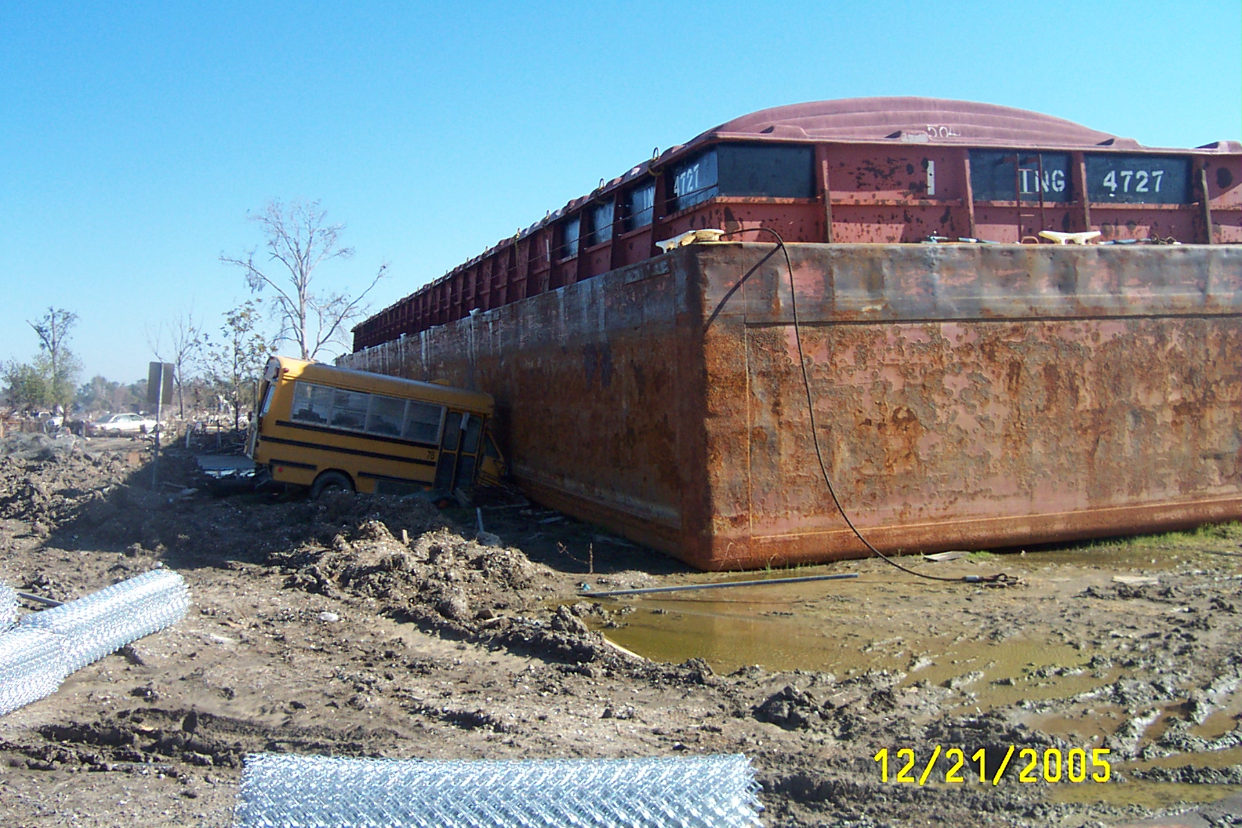
Barge on bus in Lower Ninth Ward near south breach of the Industrial Canal
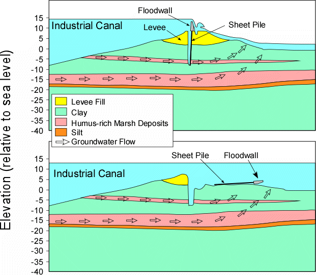
Diagram illustrating possible failure mechanism at Industrial Canal near Lower 9th Ward
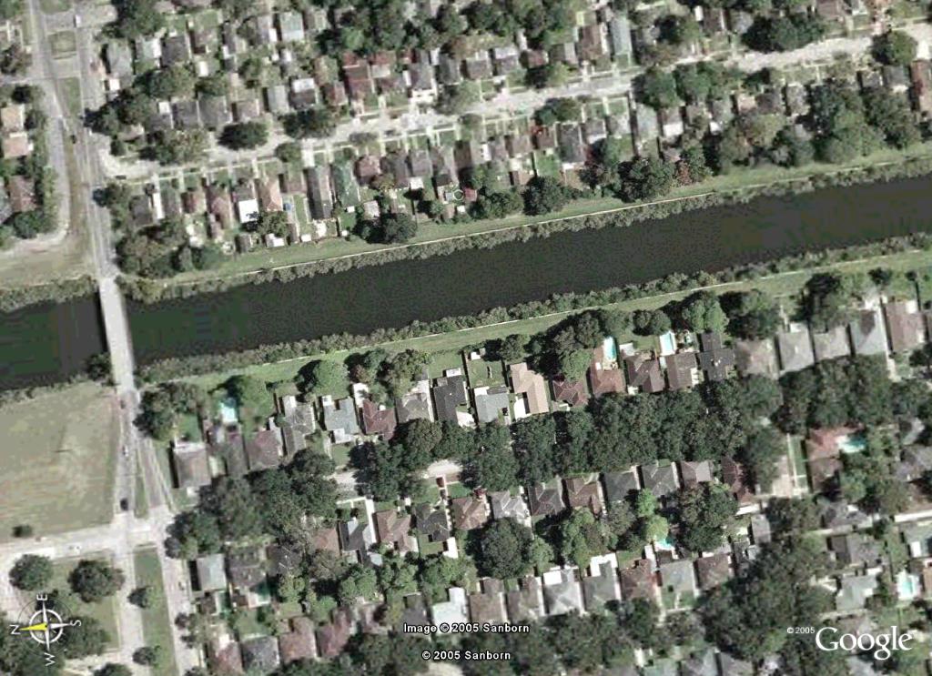
Google Earth image of the area on London Avenue Canal near Mirabeau Ave. and Warrington Drive before Katrina
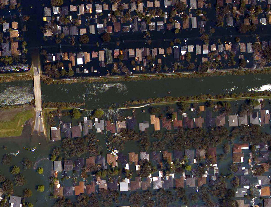
London Avenue Canal levee breach near Mirabeau Ave. and Warrington Drive - Aug. 31, 2005. (NOAA)
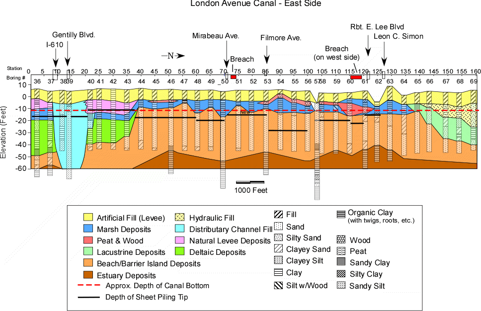
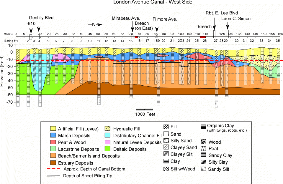
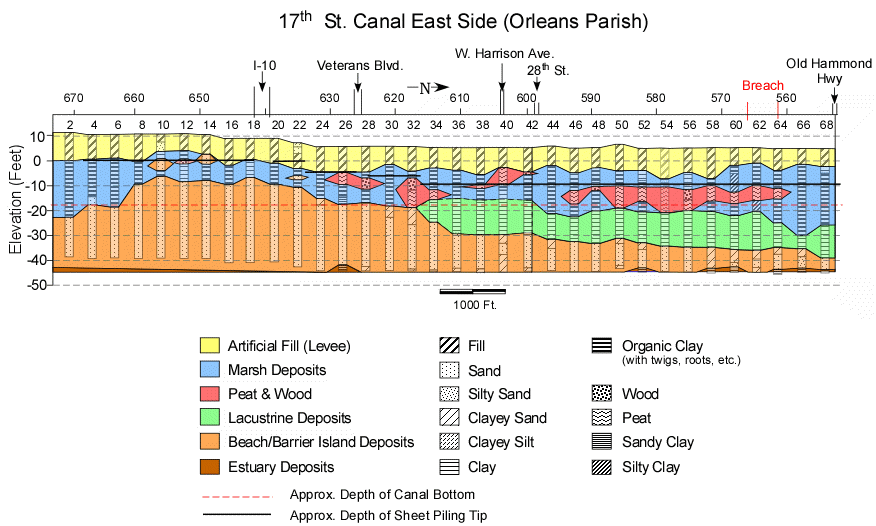
Geologic cross section along the east bank of the London Ave. Canal (See Word Document on previous page for data sources)
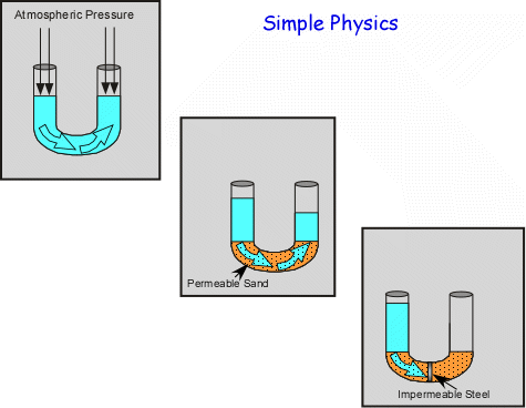
Diagrams illustrating principles of hydraulic equilibrium & permeability
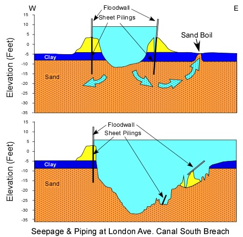
Diagrammatic model of possible failure mechanism at the south breach of the London Ave. Canal
Sand deposits on Warrington drive showing deposition in the wake of houses as the currents flowed down the driveways between the houses.
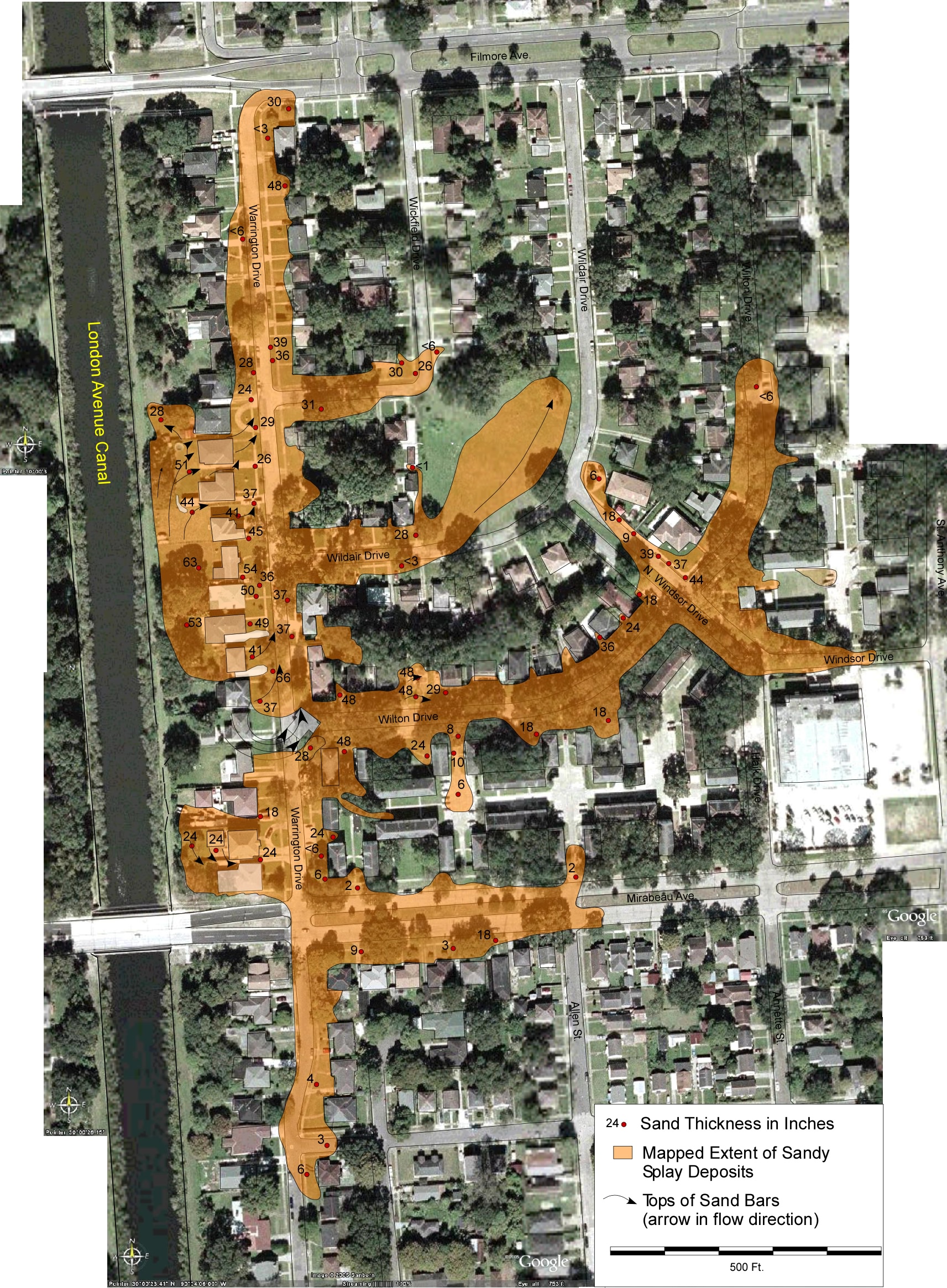
Preliminary map of sand deposits near south breach of the London Ave. Canal (superimposed on composite of Google Earth images)
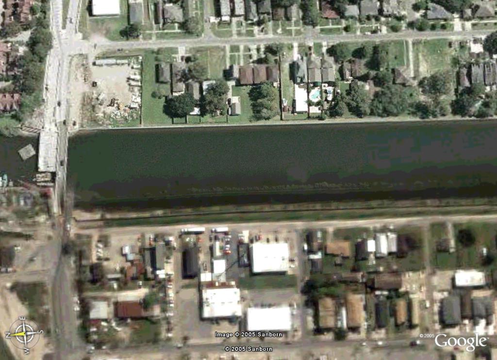
Google Earth image along the London Avenue Canal near Robert E. Lee Blvd. and Pratt Dr. before Katrina
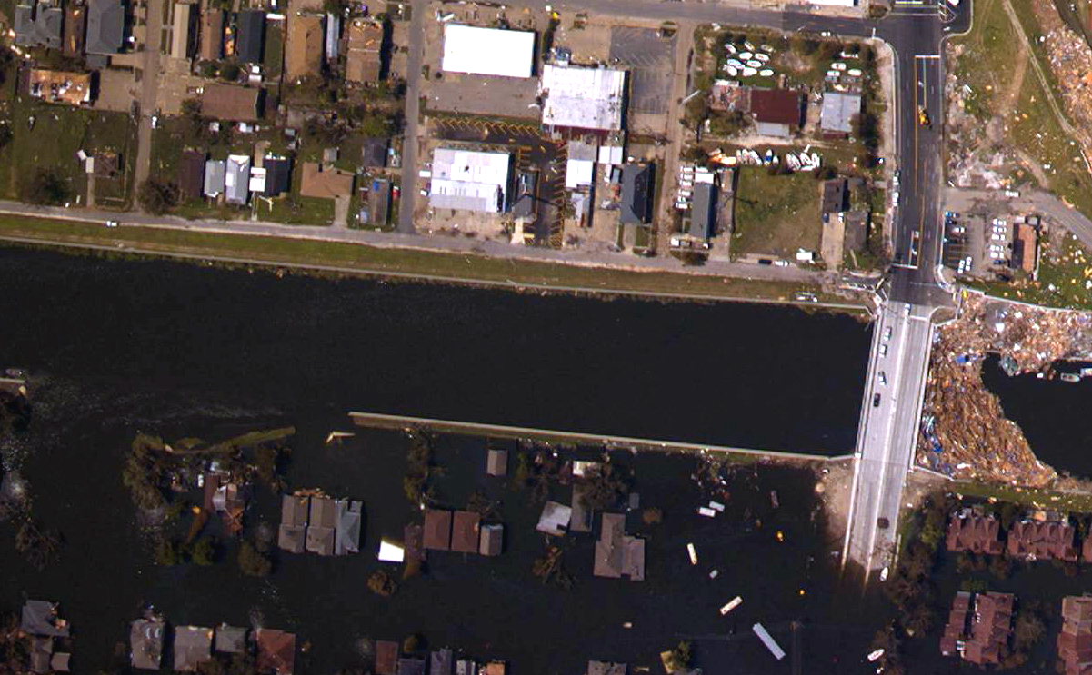
Area of London Avenue Canal Levee breach near Robert E. Lee Ave. and Pratt Dr. Aug. 31, 2005 (NOAA)
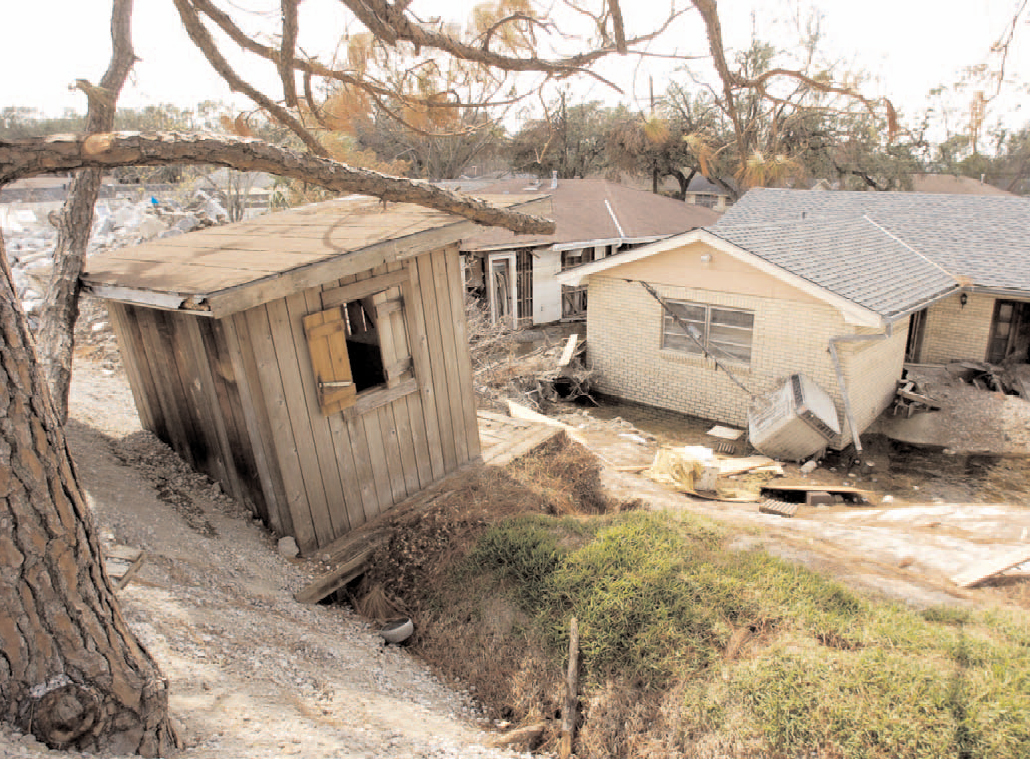
Child’s clubhouse uplifted along London Avenue Canal near the breach. (Times-Picayune Tuesday, October 4, 2005)
Geologic cross section along the west bank of the London Ave. Canal (See Word Document on previous page for data sources)
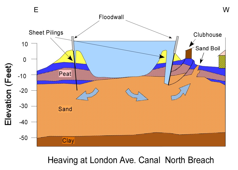
Diagrammatic cross section across London Ave. Canal at north breach, illustrating heaving
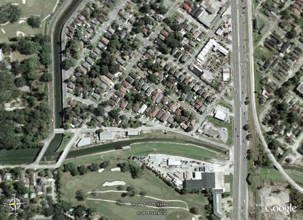
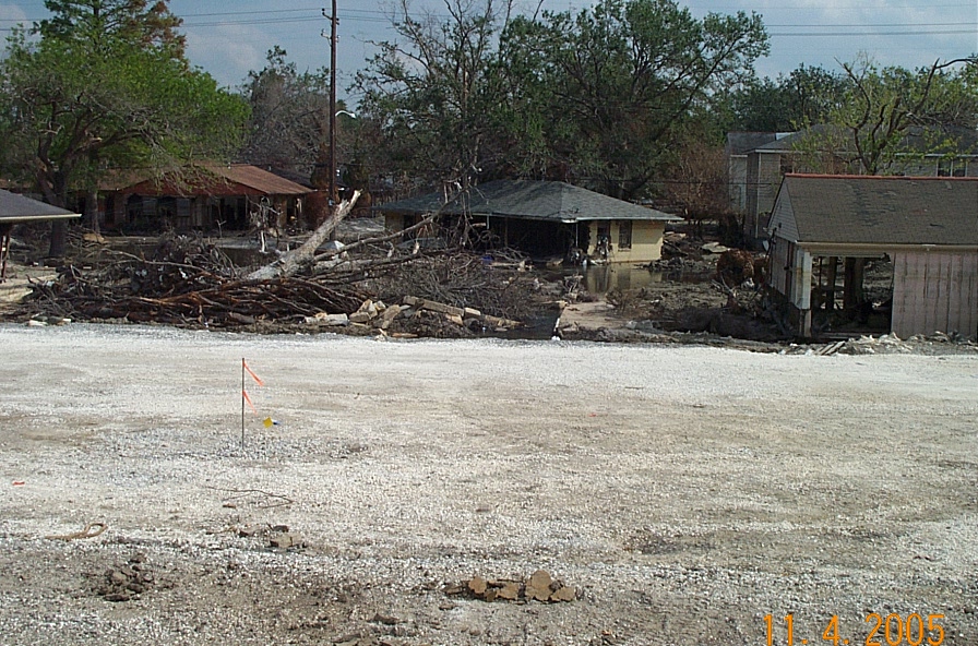
Google Earth image of 17th Street Canal near the Old Hammond Highway Bridge before Katrina.
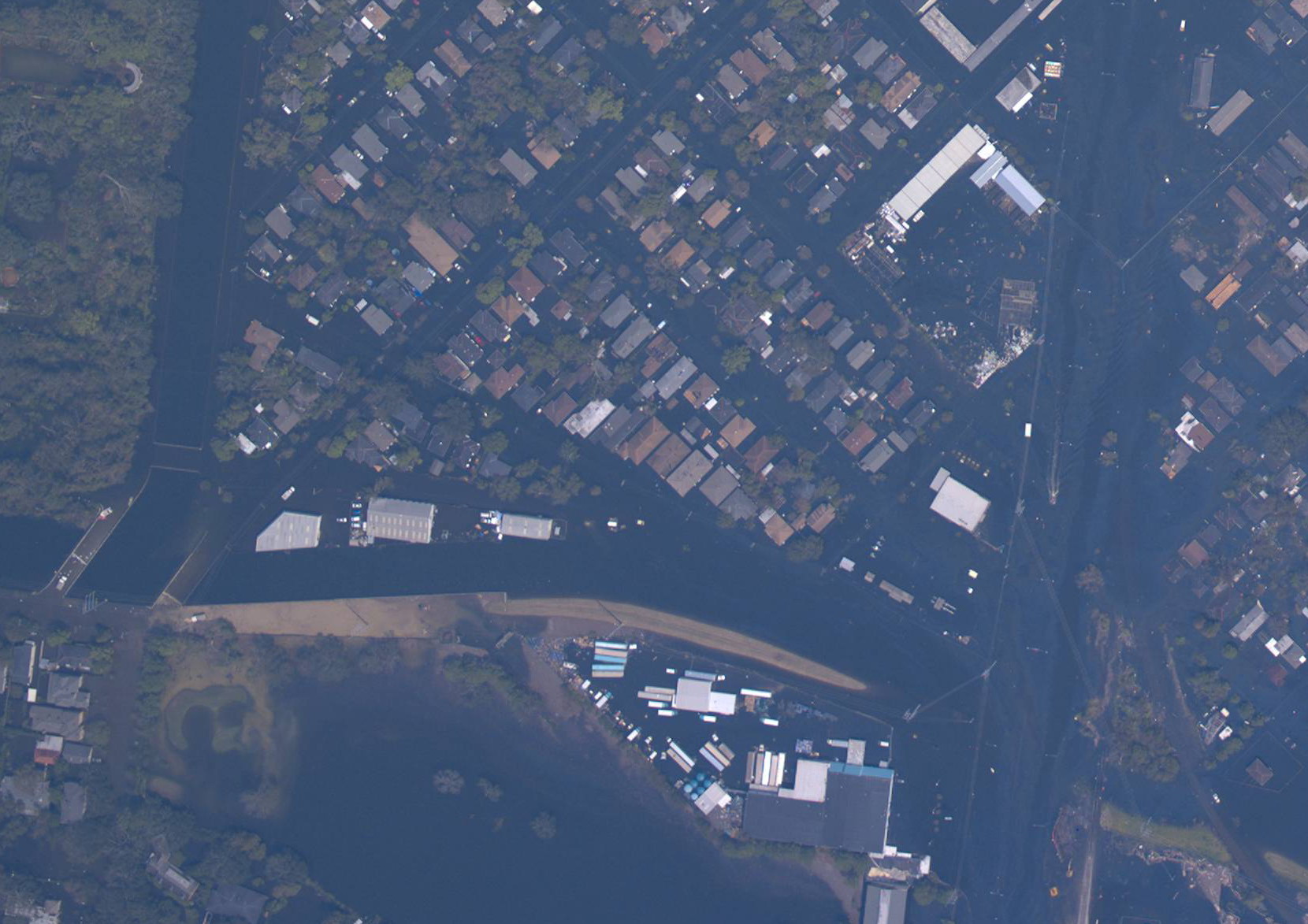
17th Street Canal Levee breach near Belaire Drive, Aug. 31, 2005. (NOAA)
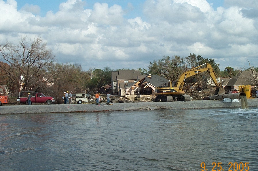
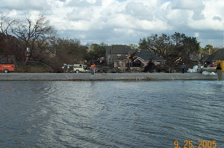
Aerial view of 17th St. Canal breach, looking south. Photo from IPET Interim Report 2
View looking east at the 17th St. Canal breach. Photo by J. Augustino - FEMA
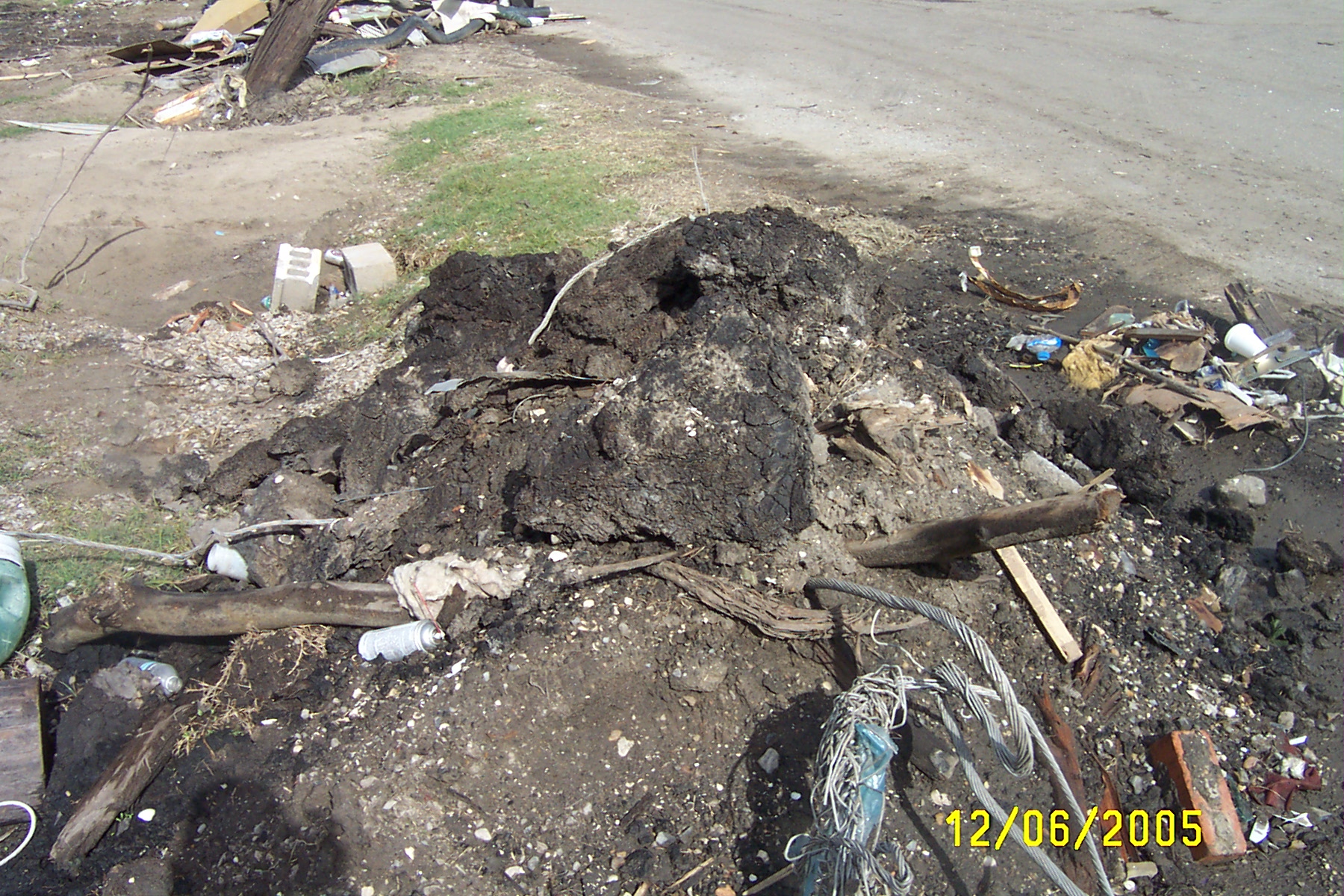
Debris along Belaire Drive near 17th St. Canal breach showing large blocks of peat.
Slide toe at front of levee section pushed out toward the photographer at the 17th St. Canal breach.
Geologic cross section along the east bank of the 17th St. Canal (See Word Document on previous page for data sources)
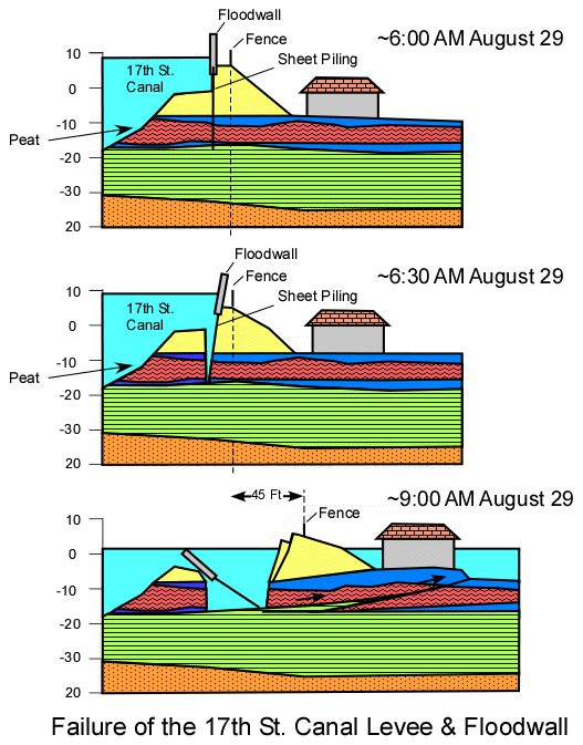
Diagram illustrating possible failure mechanism on 17th St. Canal
17th St. Canal breach on Aug. 31, 2005 (Kevin Himel). Compare with photo to right
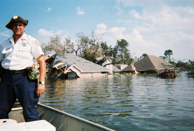
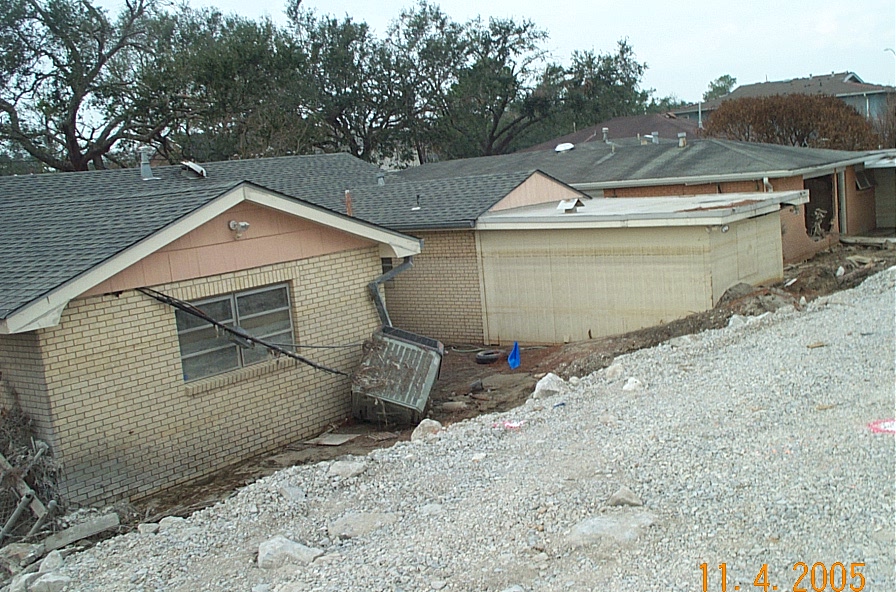
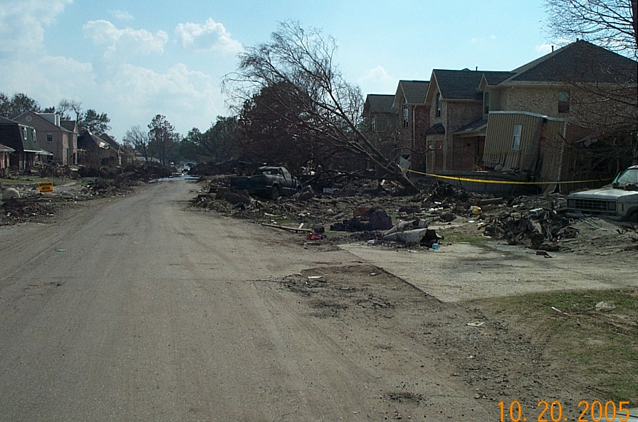
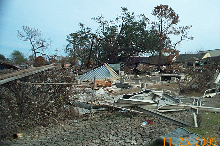
Remains of house at corner of Belaire Dr. & Spencer Ave. at 17th St. Canal breach (S.A. Nelson)
17th St. Canal breach on Aug. 31, 2005 (Kevin Himel). Compare with photo to right.
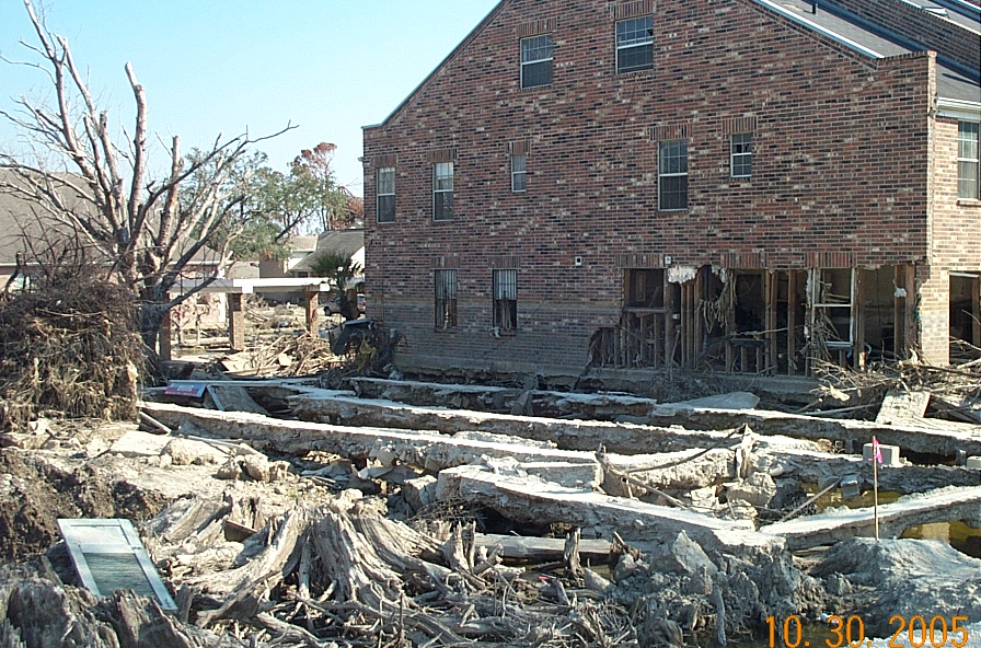
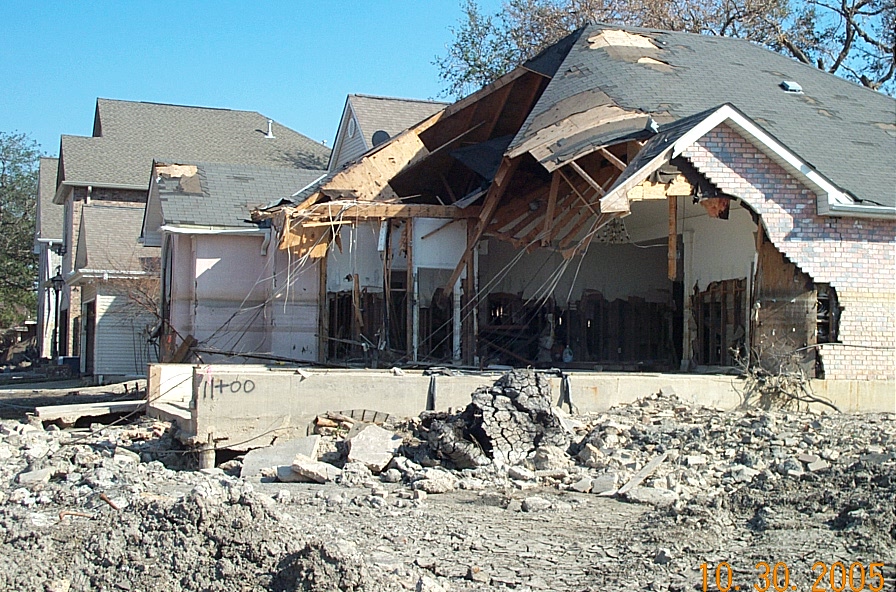
Foundation of house on Belaire Dr. - house removed by 17th St. Canal breach (S.A. Nelson)
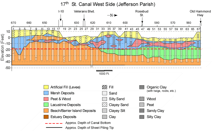
Geologic cross section along the west bank of the 17th St. Canal (See Word Document on previous page for data sources)
Centrifuge Model of the 17th St. Canal after failure from U.S. Army Corps of Enginners IPET Report 2, see Word file on previous page for source
Google Earth image of area near southern end of the 17th Street Canal in Old Metairie before Katrina
Area where water from the 17th Street Canal Breach ran back into Old Metairie, near Orpheum and Palm, Aug. 31, 2005. (NOAA)

Bridge at Orpheum & Palm (S. end of 17th St. Canal) showing flood debris on sidewalk (S.A. Nelson)
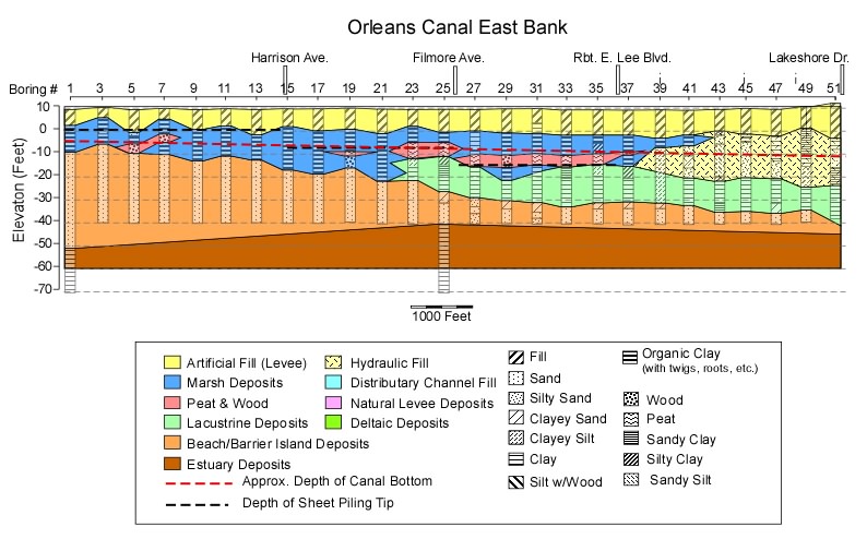
Geologic cross section along the east bank of the Orleans Canal (See Word Document on previous page for data sources)
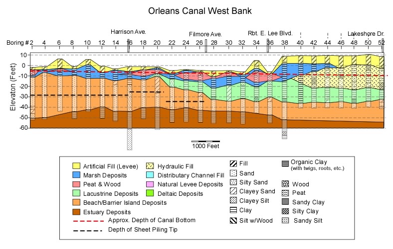
Geologic cross section along the west bank of the Orleans Canal (See Word Document on previous page for data sources)
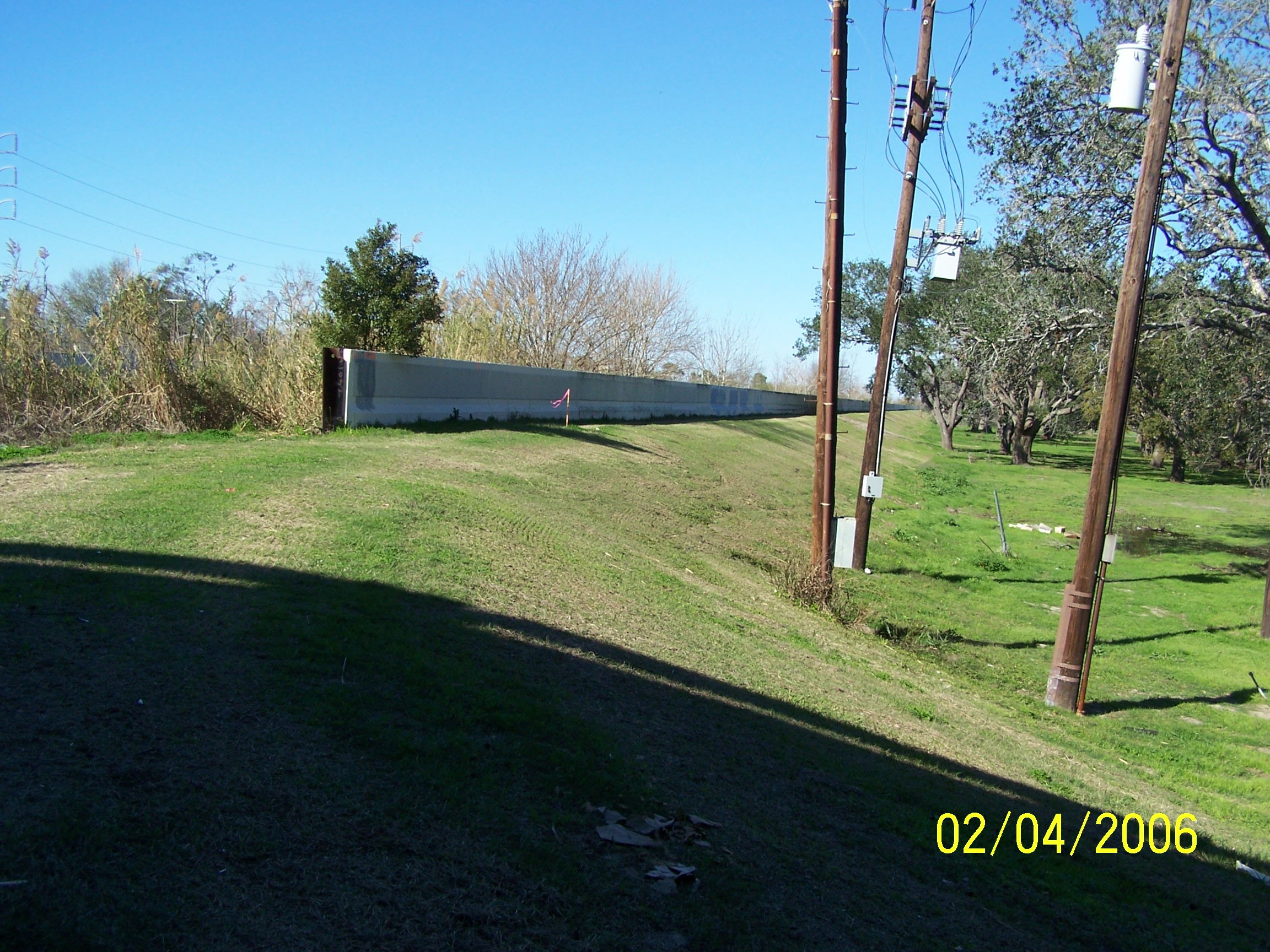
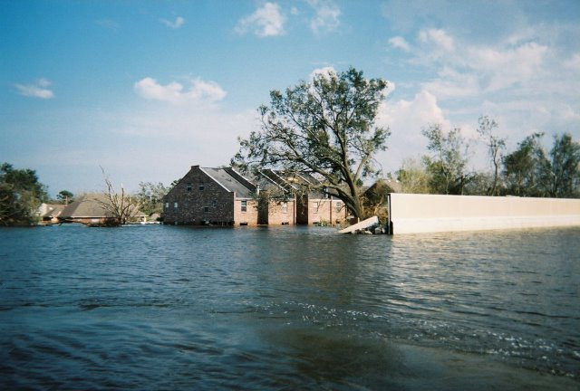
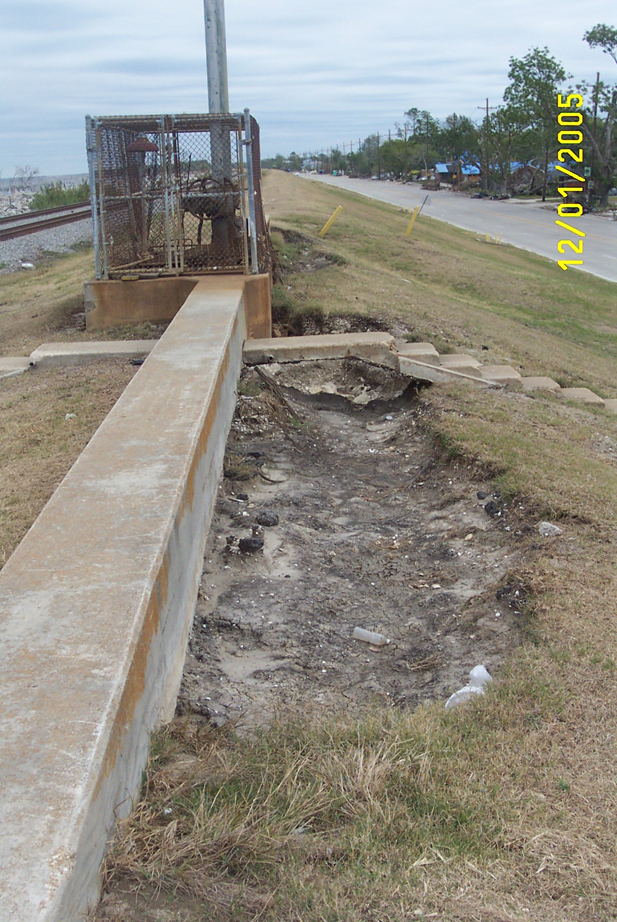
End of floodwall on the south end of the Orleans canal, just north of pump station #7.
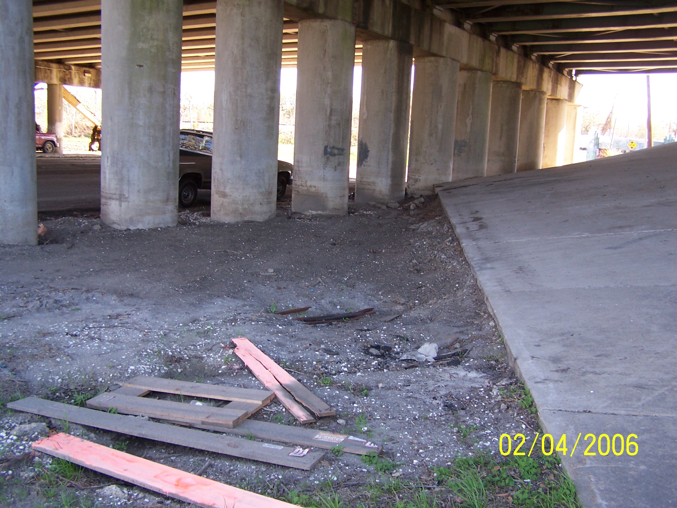
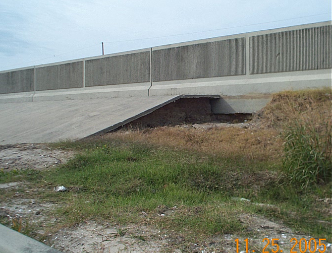
Erosion under I-610 overpass on Marconi Ave. due to water flowing out gap in floodwall on Orleans Canal.
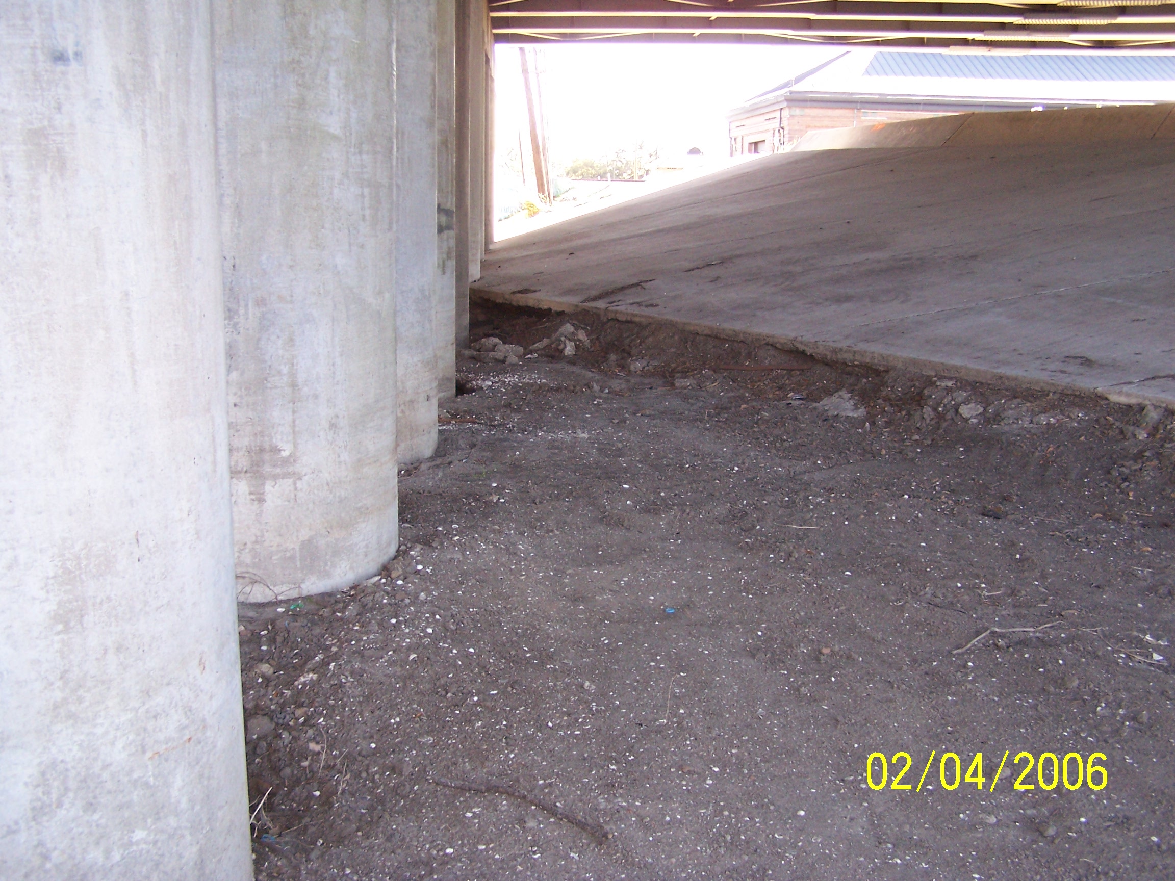
Erosion under I-610 overpass on Marconi Ave. due to water flowing out gap in floodwall on Orleans Canal.
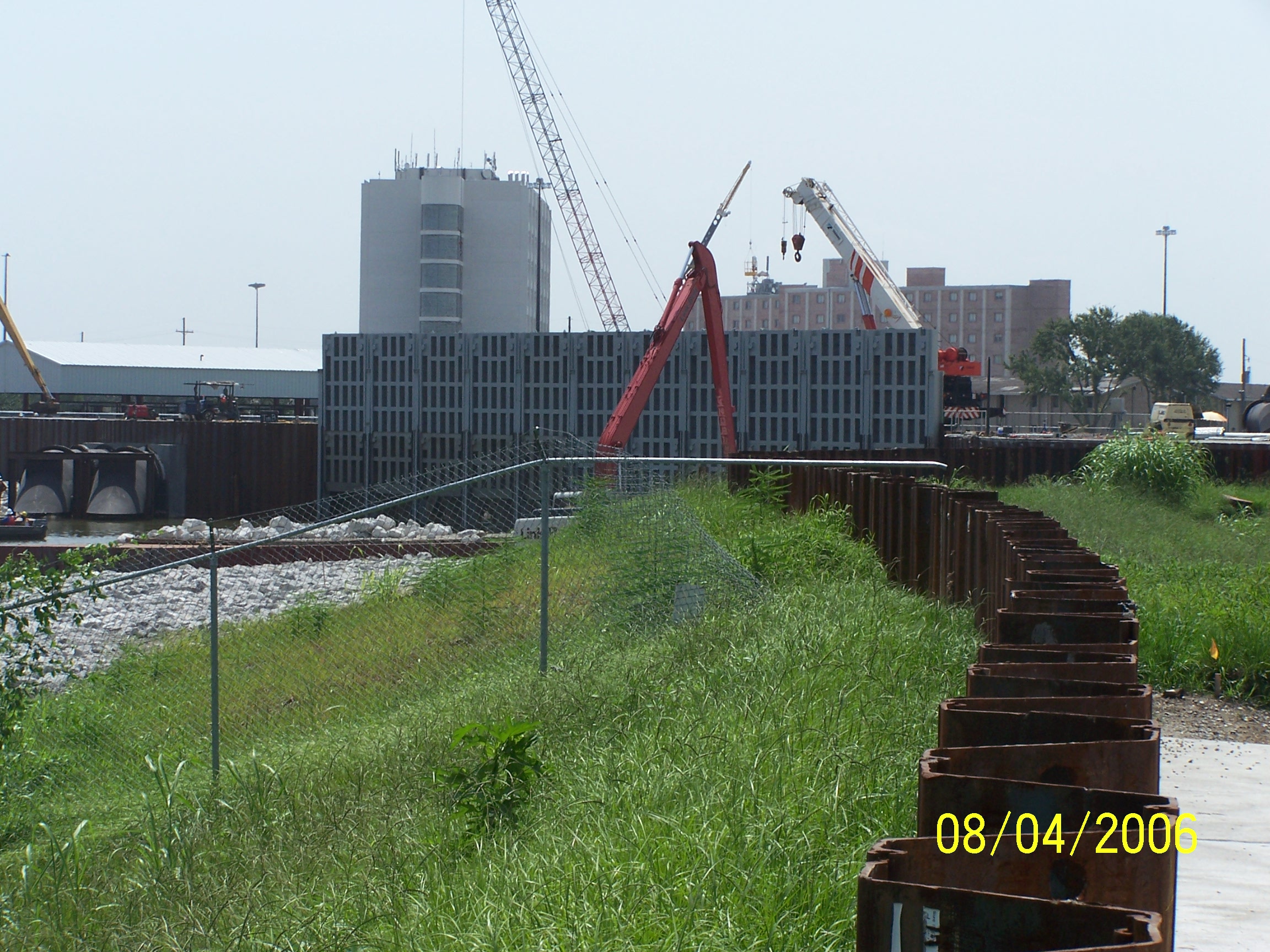
Newly installed closeable floodgates on the London Ave. Canal
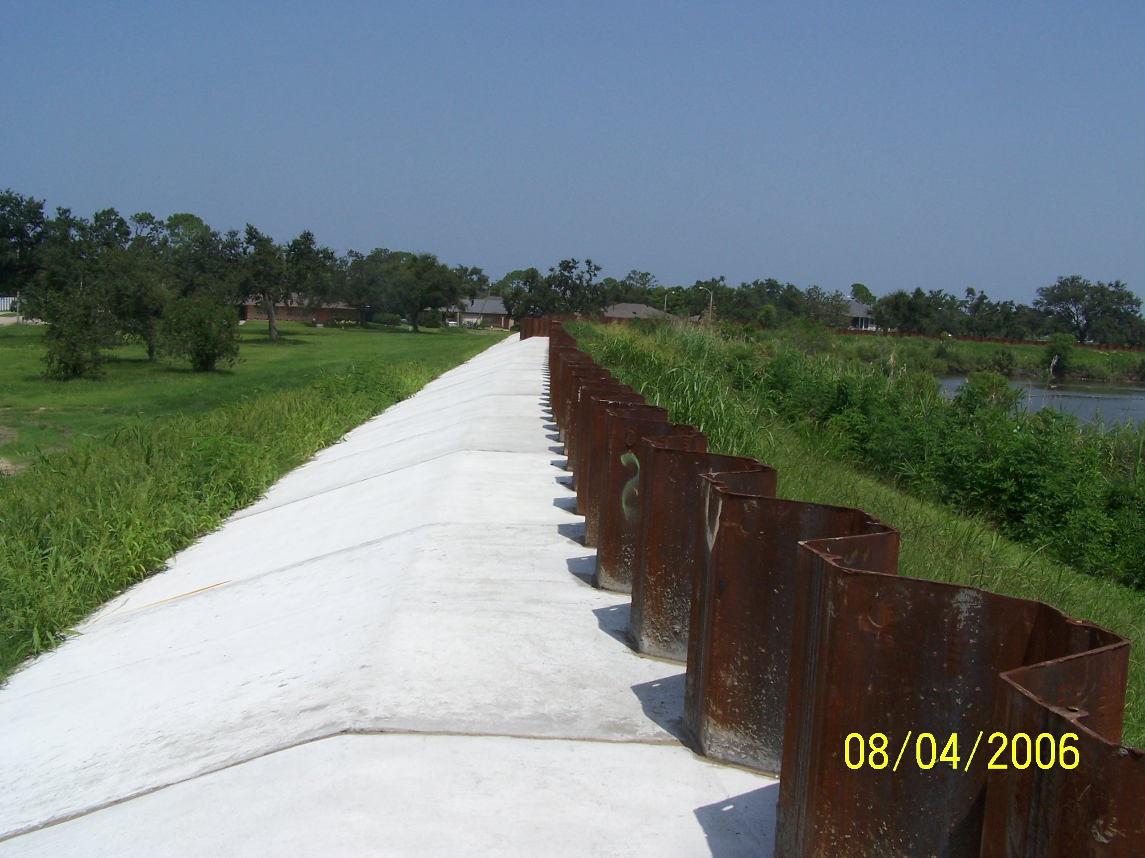
Freshly poured concrete armor on London Ave. Canal levee, North of new floodgate
Return to Katrina - What
Happened Page
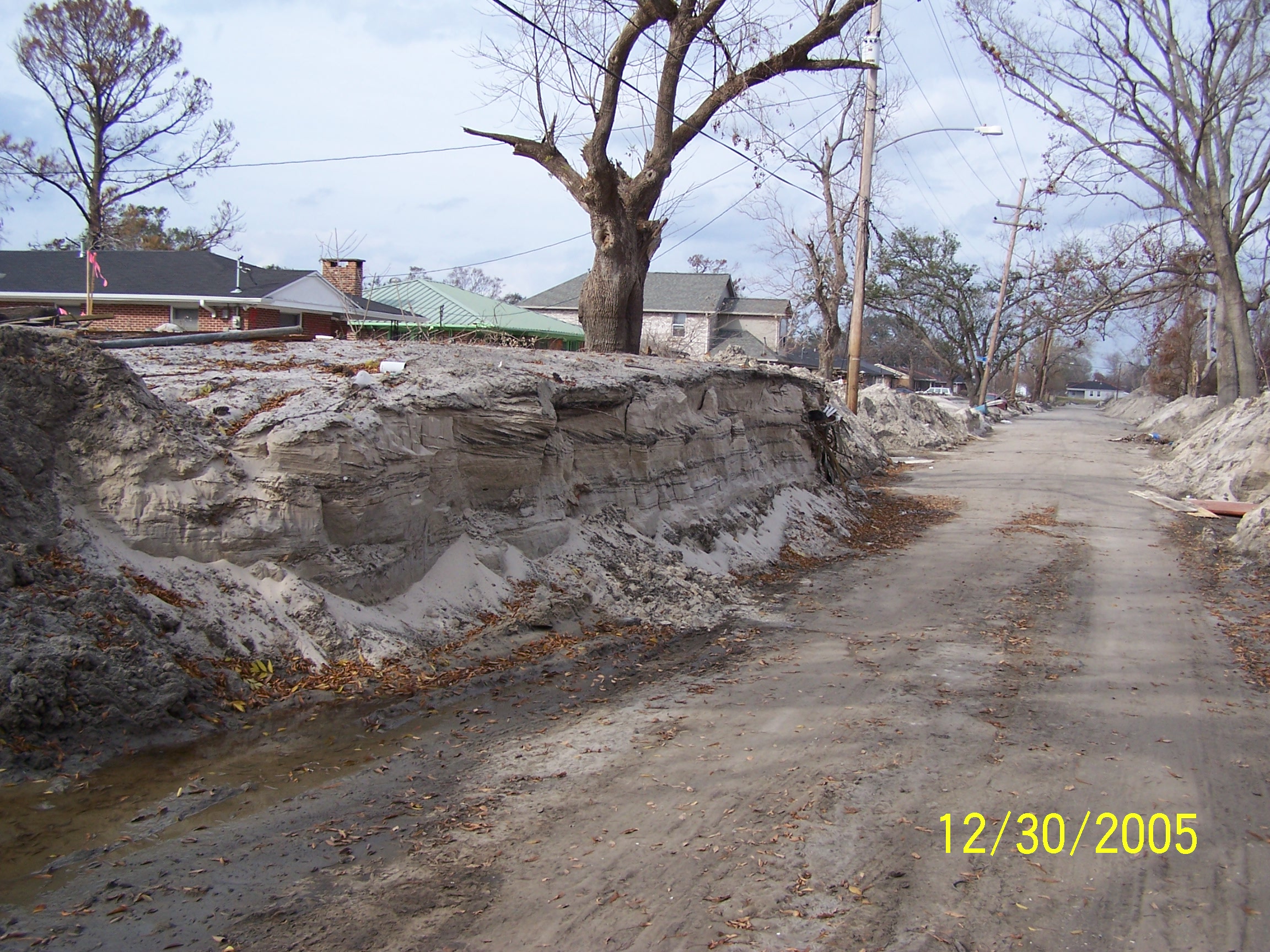
Sand Deposits at the London Avenue Canal Southern Breach by Stephen Nelson
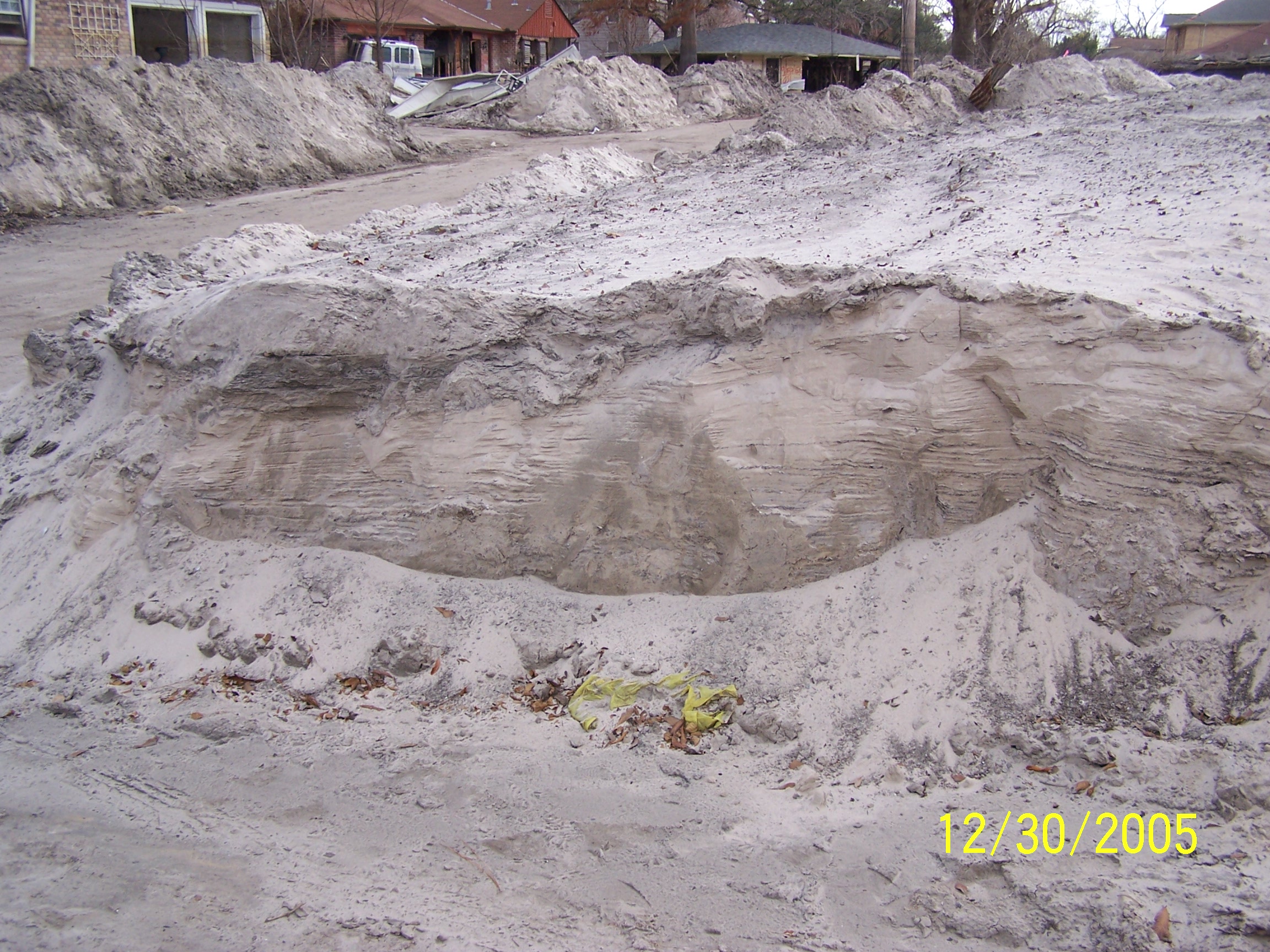
Sand deposits on Wildair Drive looking toward breach
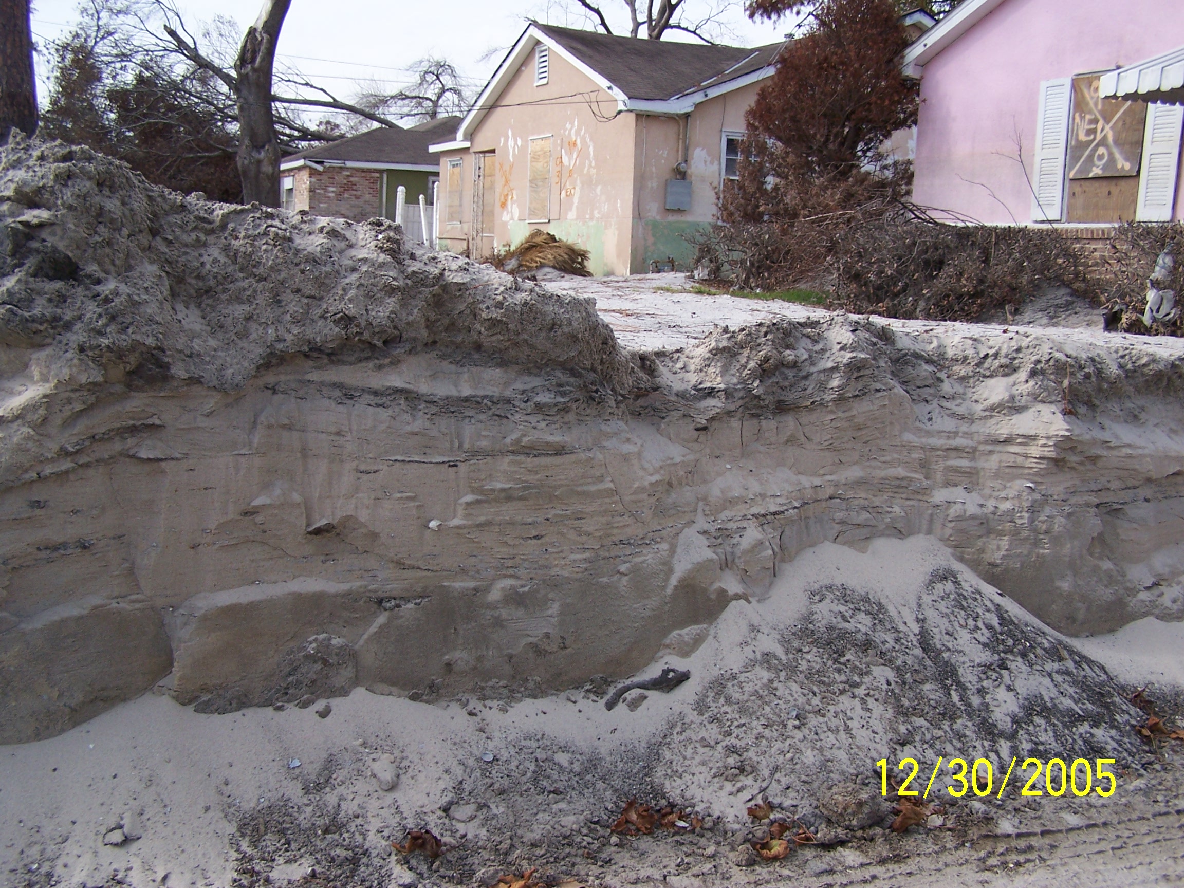
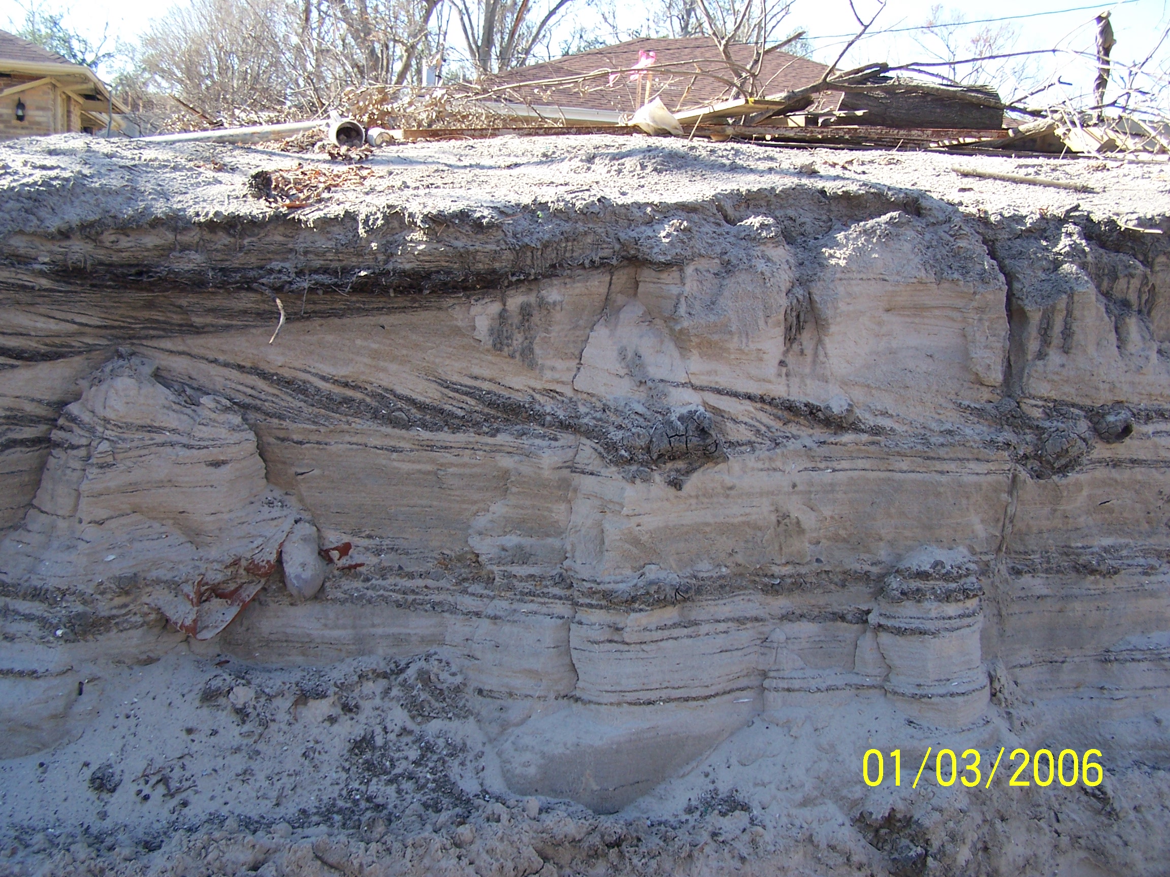
Cross-section through sand deposit on Widair Drive
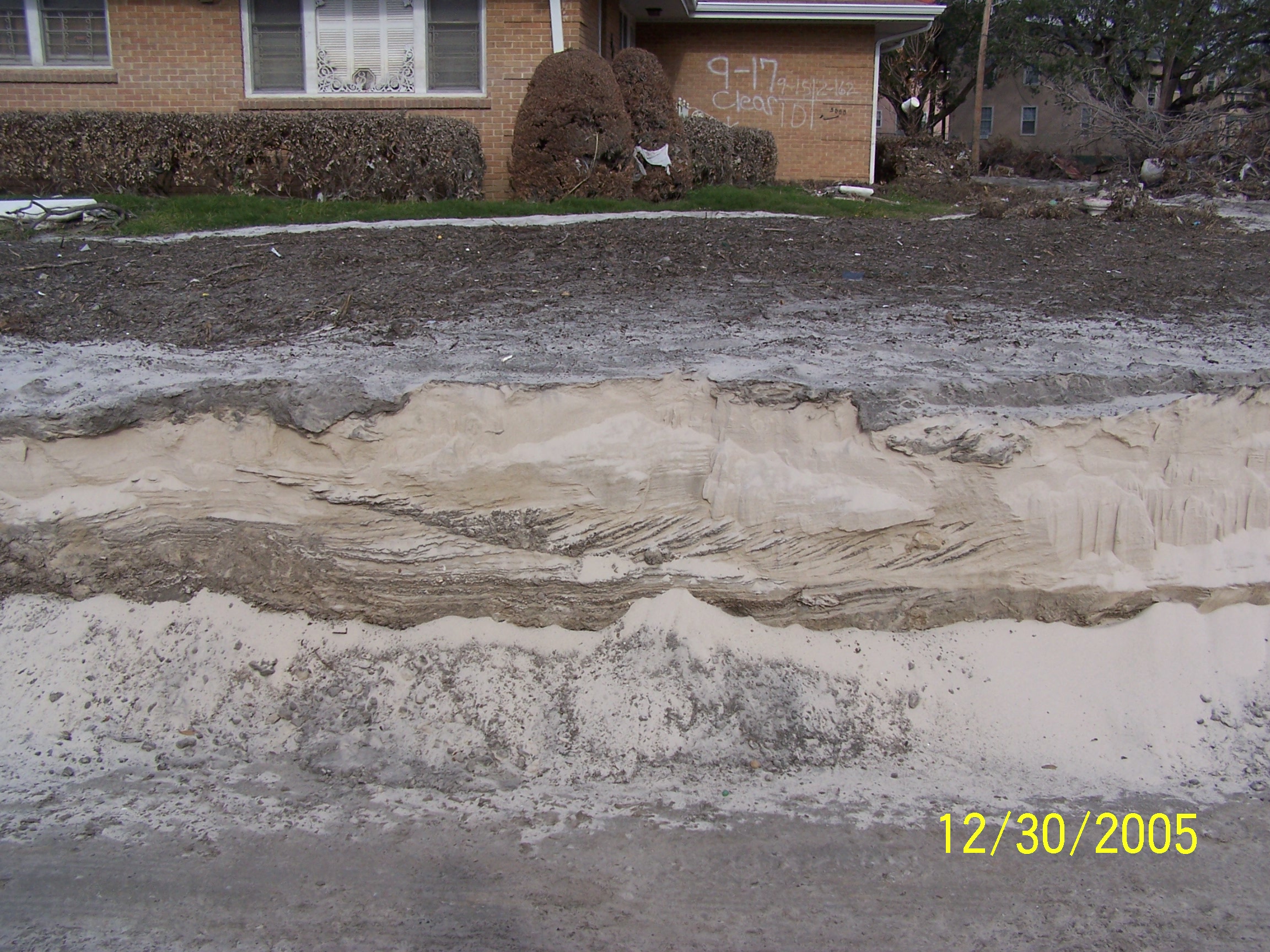
Sand deposits on Warrington Drive, north of breach
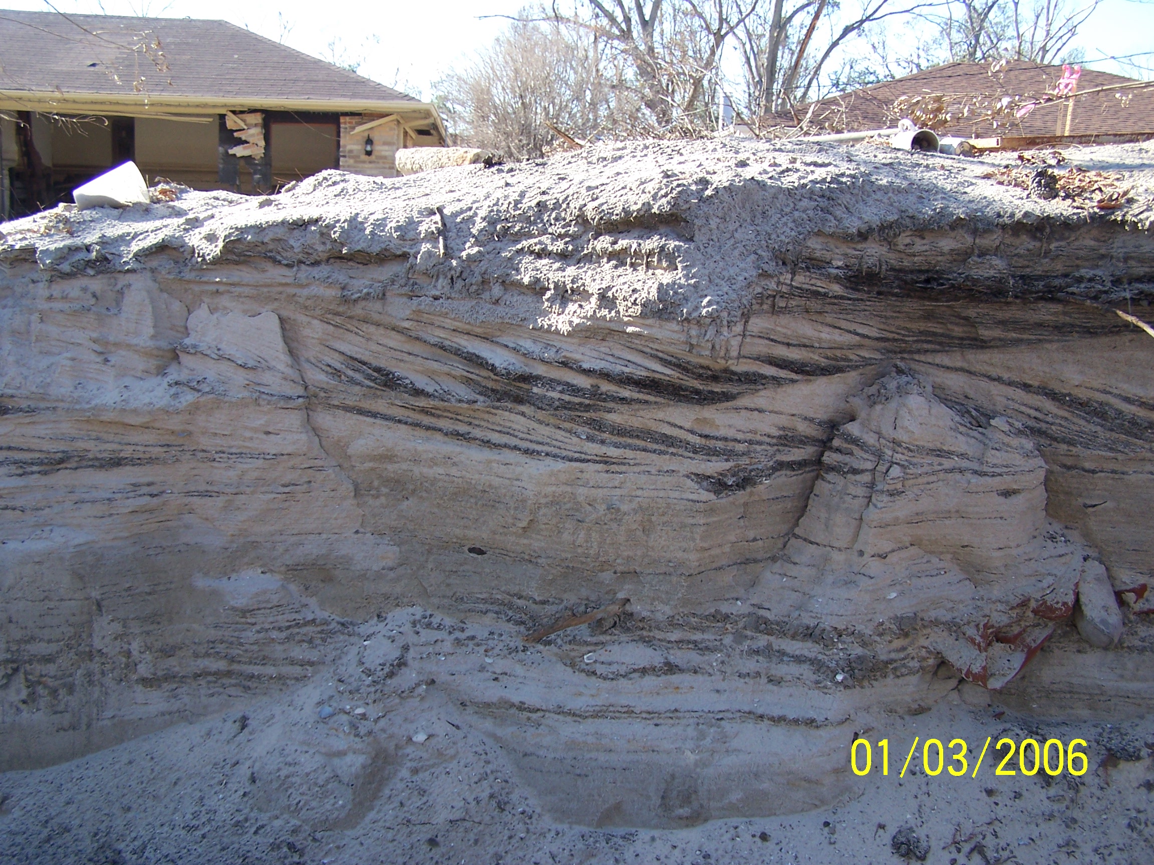
Structure in sand deposit on Warrington Drive north of breach
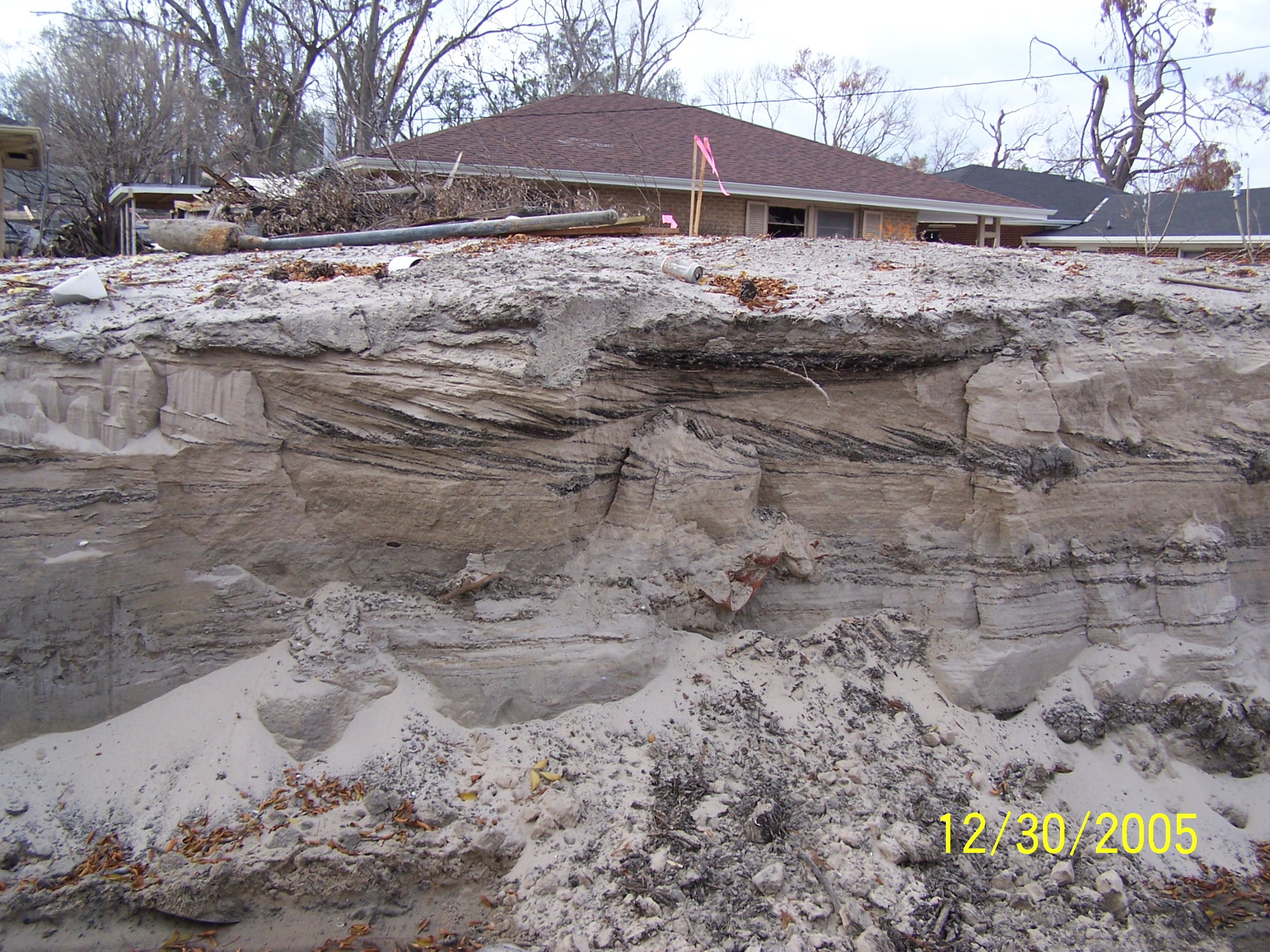
Structure in sand deposit on Warrington Drive north of breach
Looking north along Warrington Drive, north of breach
Structure in sand at corner of N. Windsor Drive & Wilton Dr.
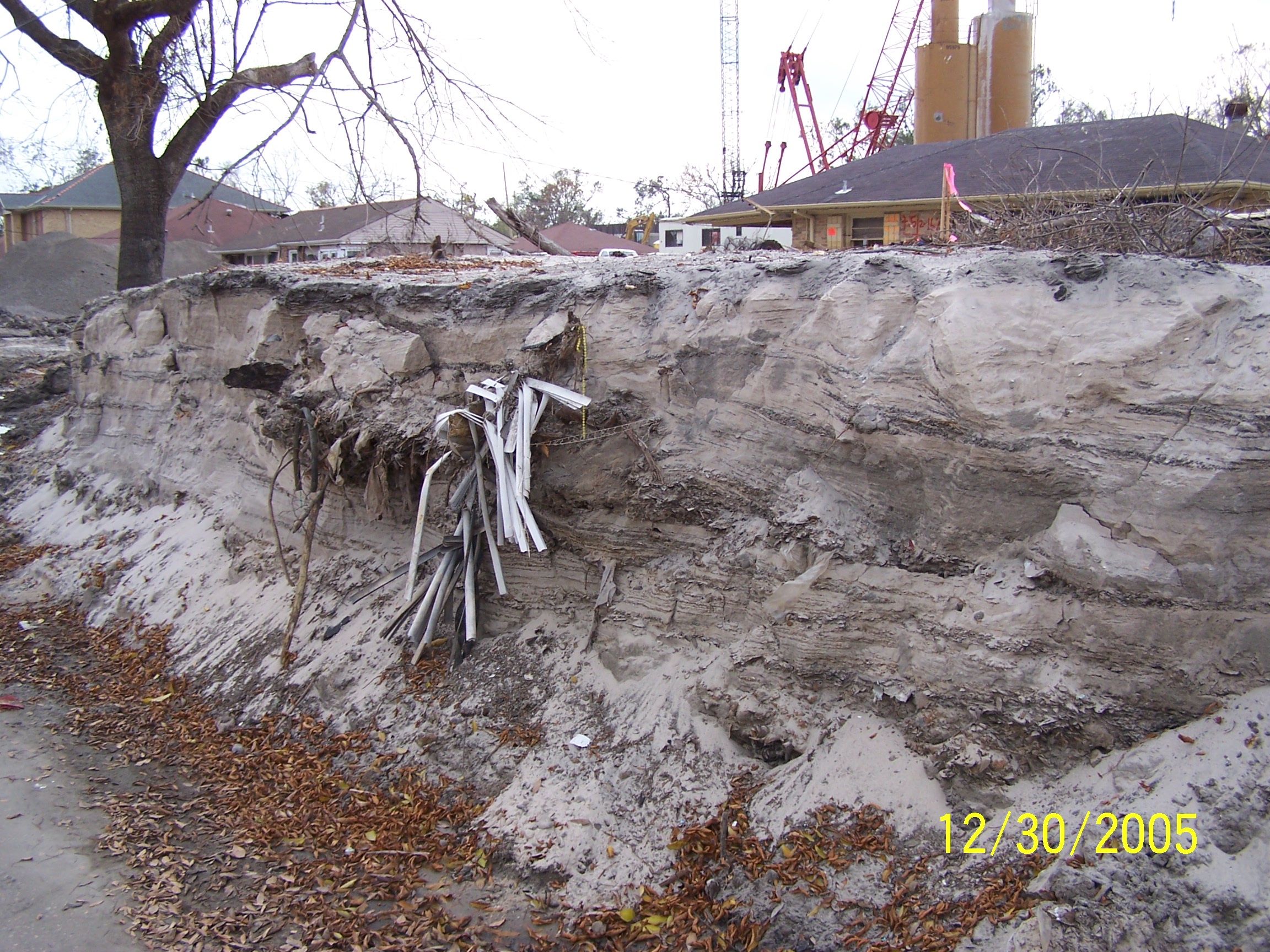
Structure in sand on Warrington Drive north of breach
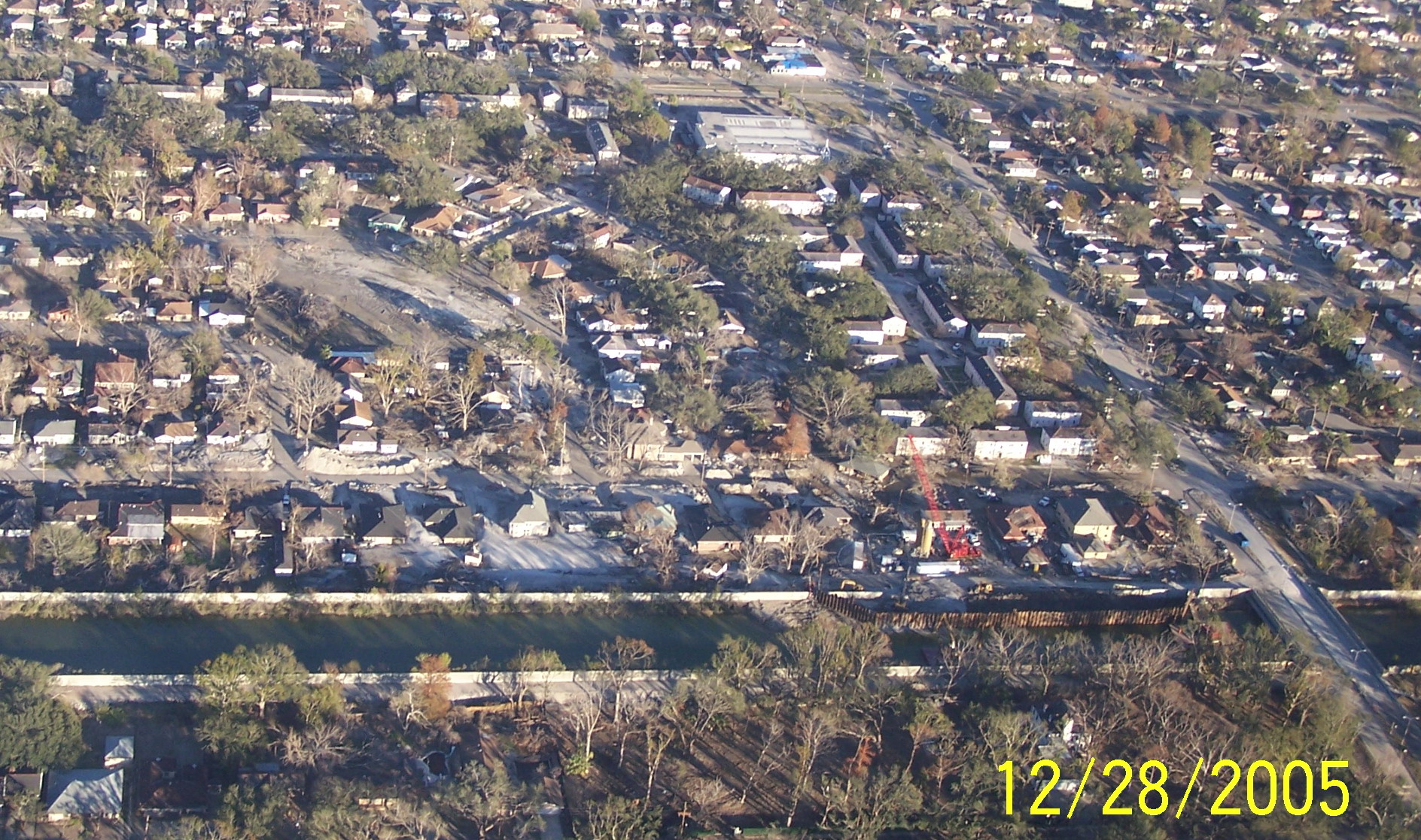
London Ave. Canal south breach and sand deposits from air 12/28/05
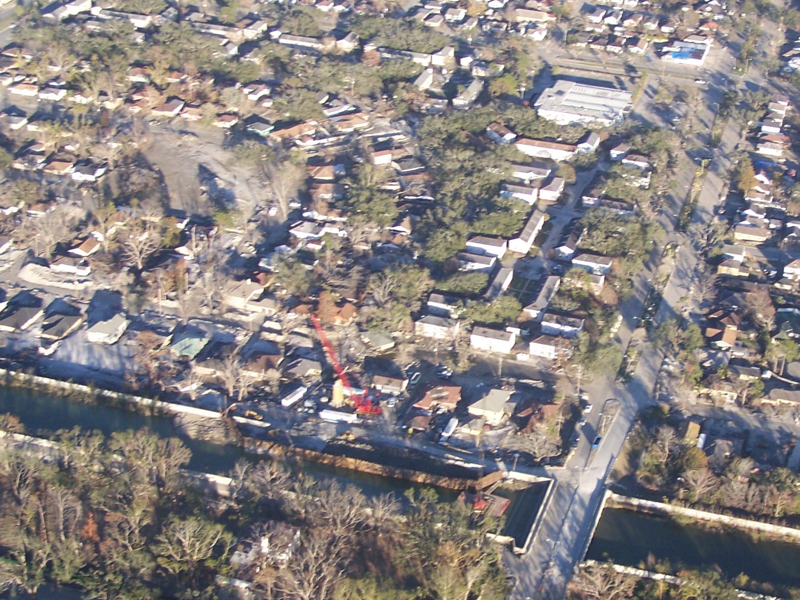
London Ave. Canal south breach and sand deposits from air 12/28/05
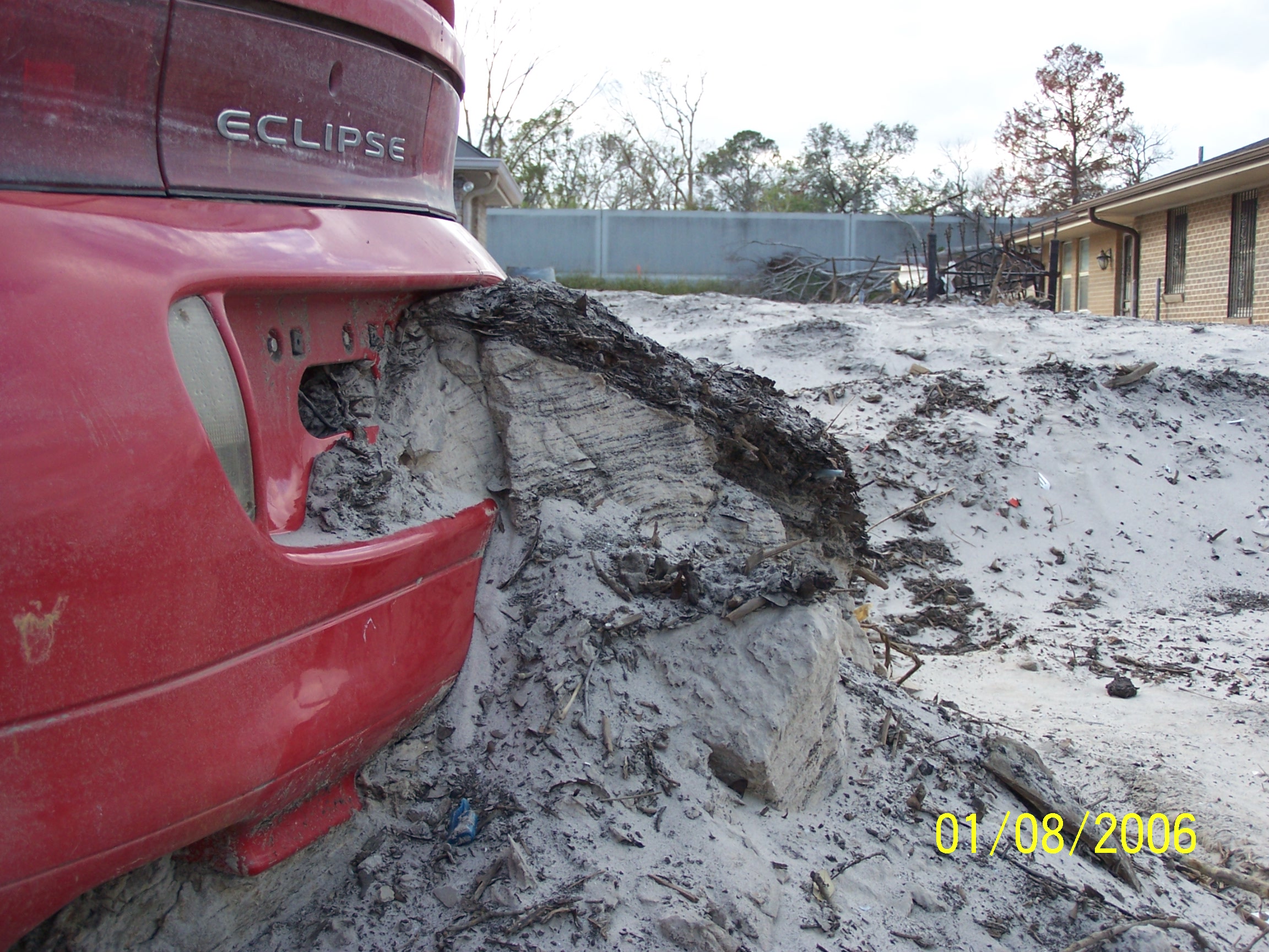
Sand deposit on car on Warrington Drive near breach
Structure in sand on Warrington Drive north of breach
Structure in sand on Warrington Drive north of breach
Deposits on Warrington Dr. showing channelization between houses
"Epoxy flow" (grout) from breach repair, north of breach
"Epoxy flow" (grout) from breach repair, north of breach
Other Post-Katrina Photos by Stephen Nelson
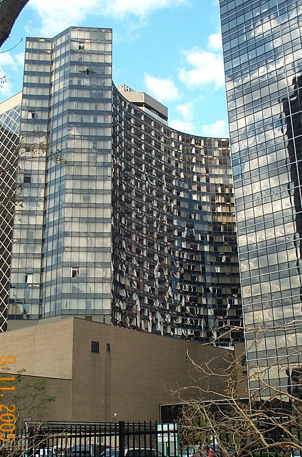
Hyatt Hotel from Loyola Ave. 9/11/05
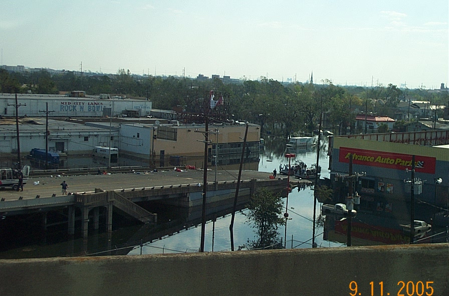
View up Tulane Ave. from I-10 overpass 9/11/05
Launching rescue boats from Tulane & Carrollton 9/11/05
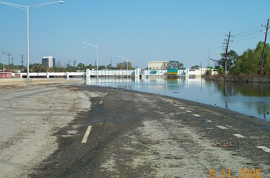
Railroad underpass on I-10 9/11/05
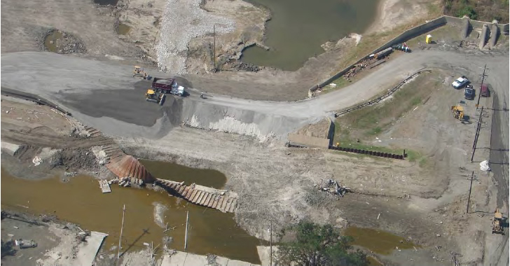
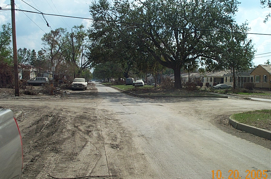
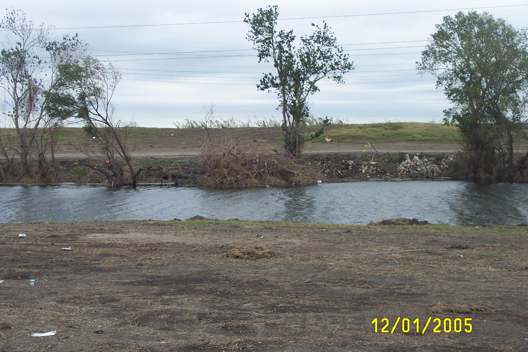
Looking across 17th St. Canal at repairs to levee breach
Looking across 17th St. Canal at repairs to levee breach
Looking across 17th St. Canal at repairs to levee breach
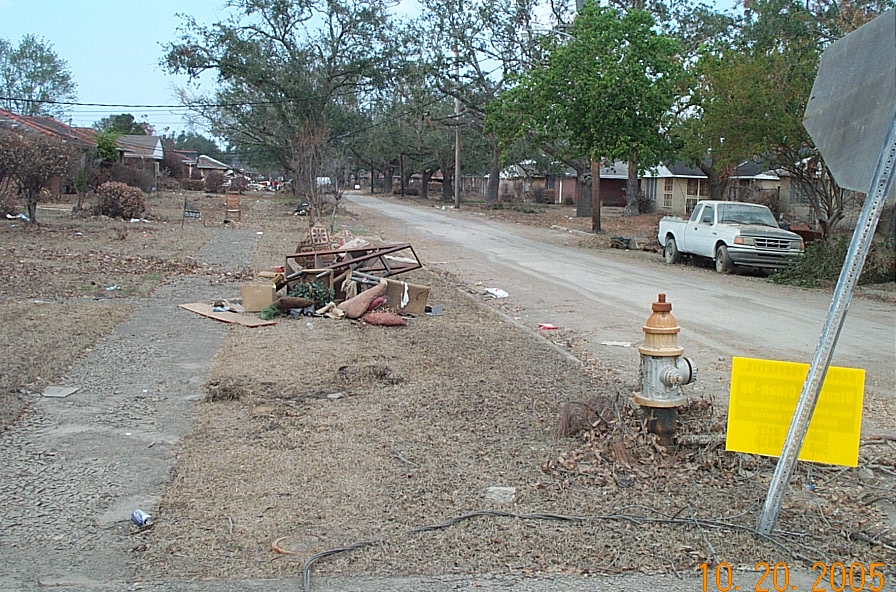
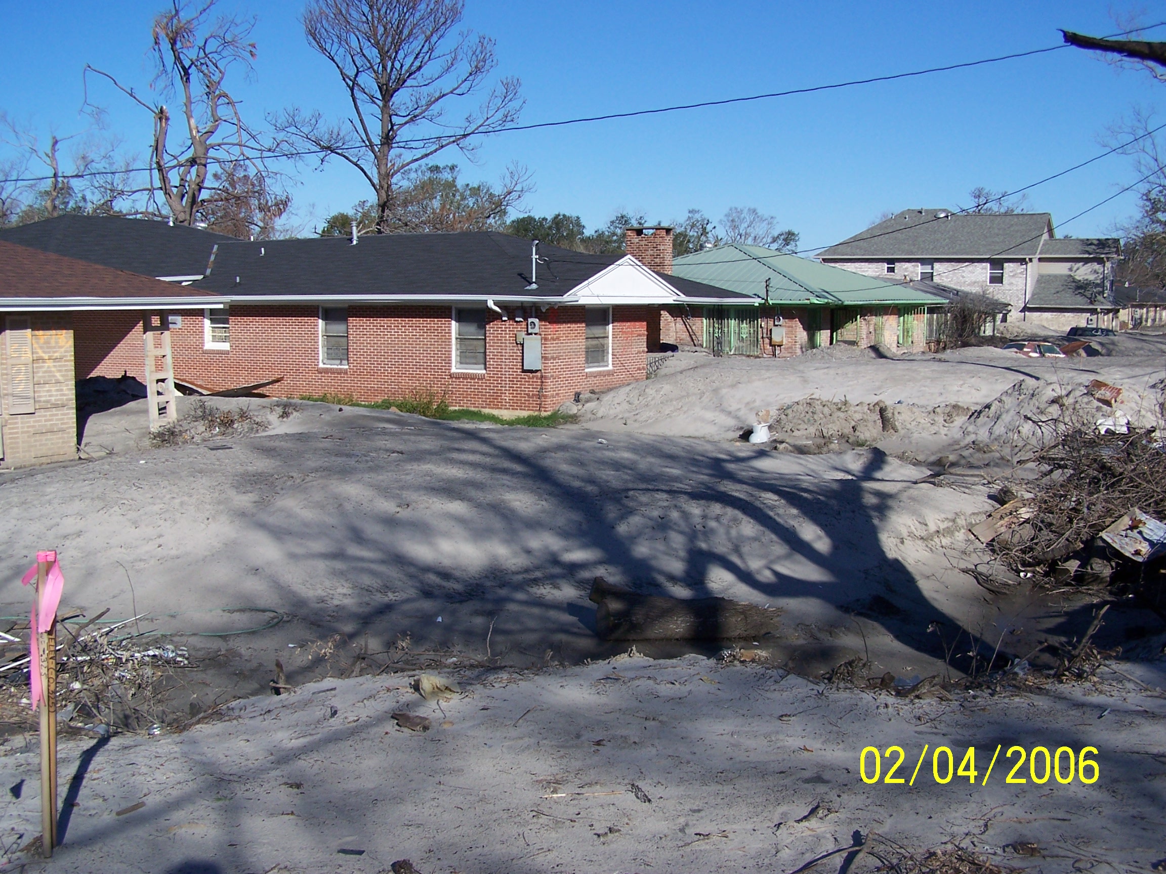
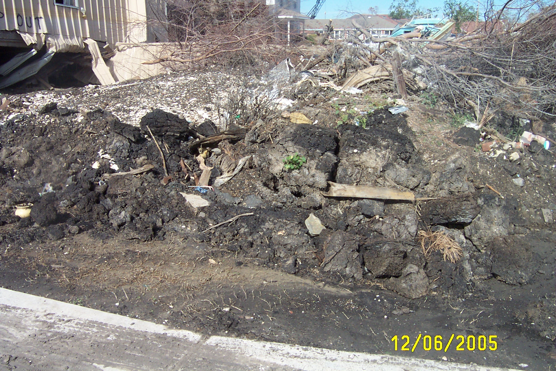
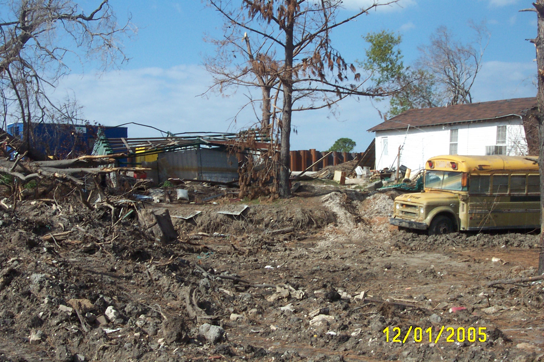
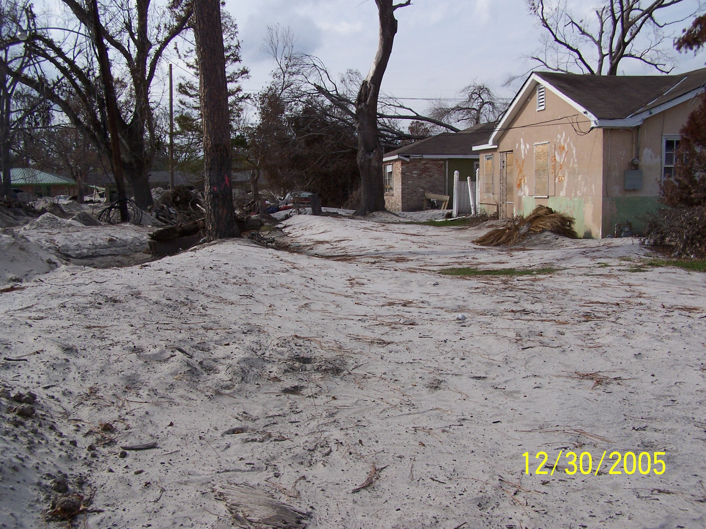
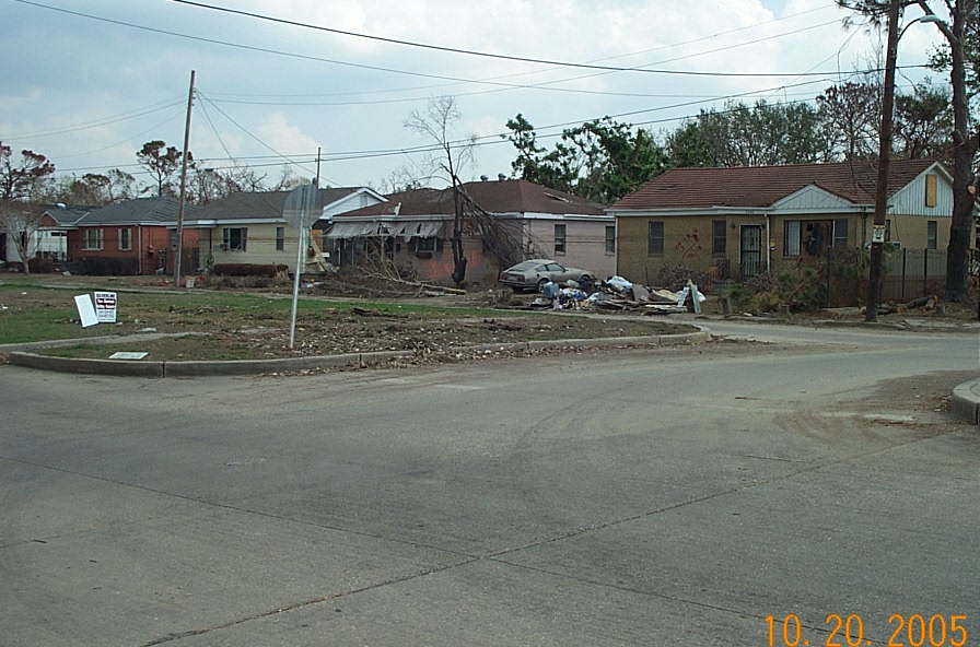
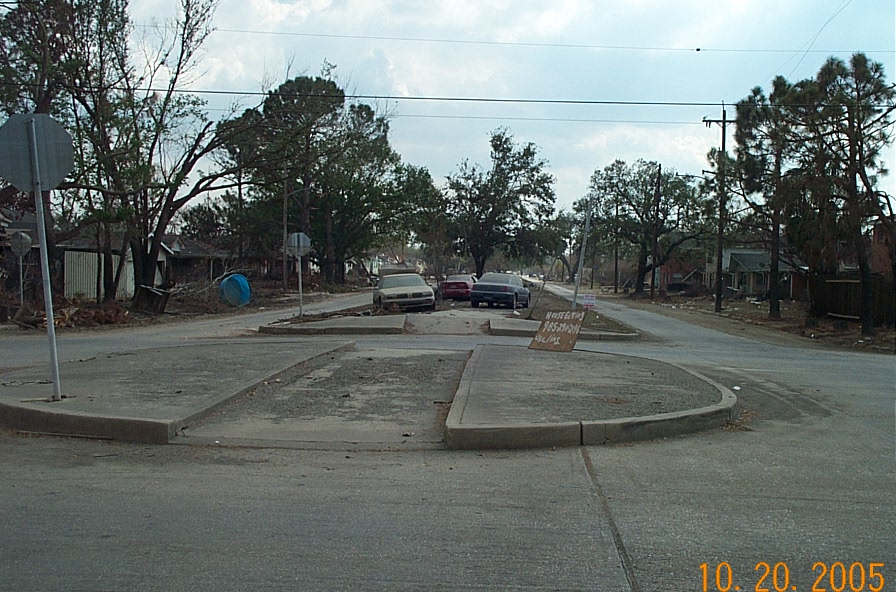
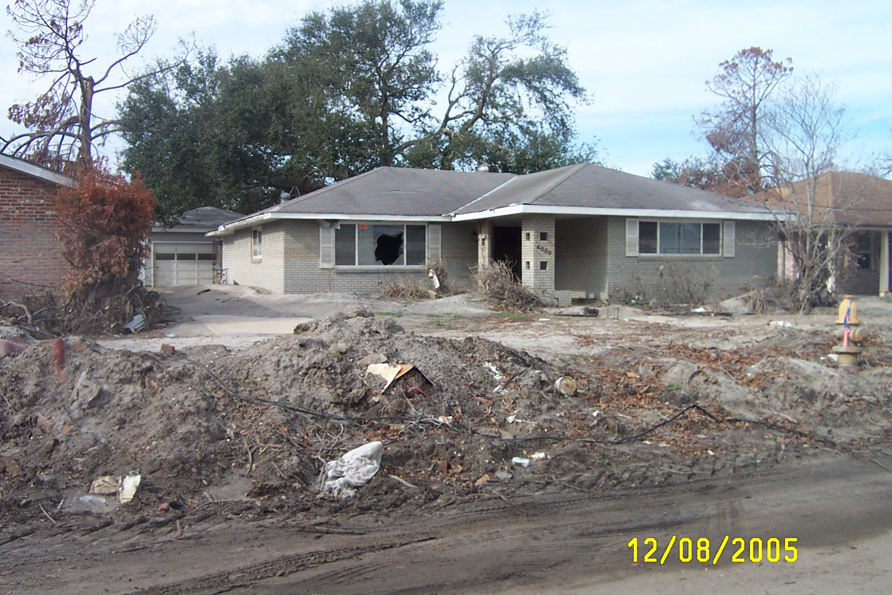
Abandoned neighborhood along Filmore St.
Water lines on homes on St. Anthony Street
flooded cars on neutral ground on St. Anthony Street
St. Anthony Street
Flooded cars on neutral ground on St. Anthony Street
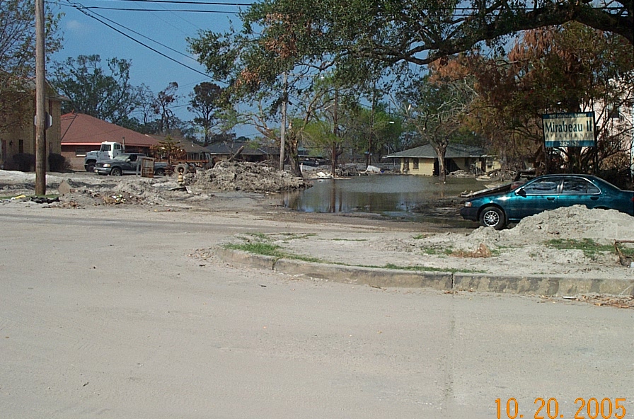
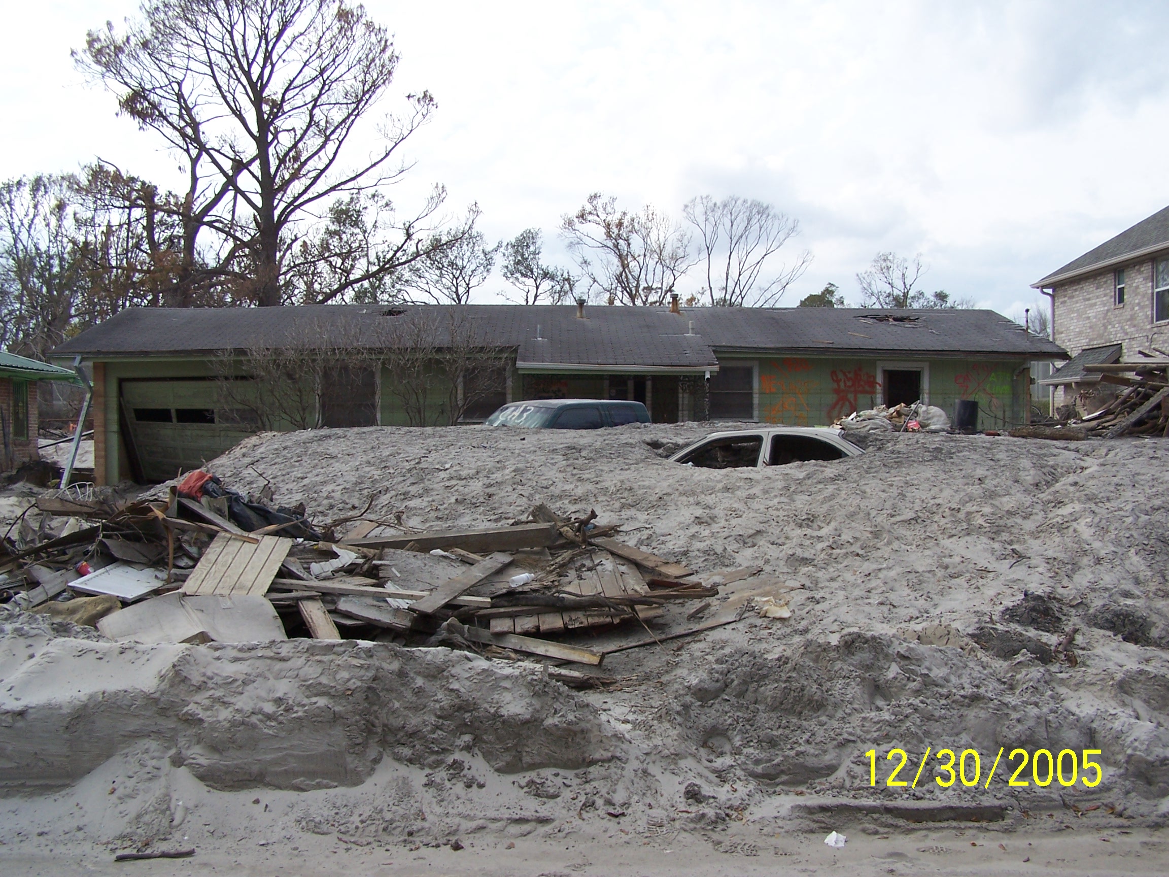
House in Warrington Dr. at London Ave. Canal breach near Mirabeau Ave.
Home displaced onto Warrington Dr. at London Ave. Canal breach near Mirabeau
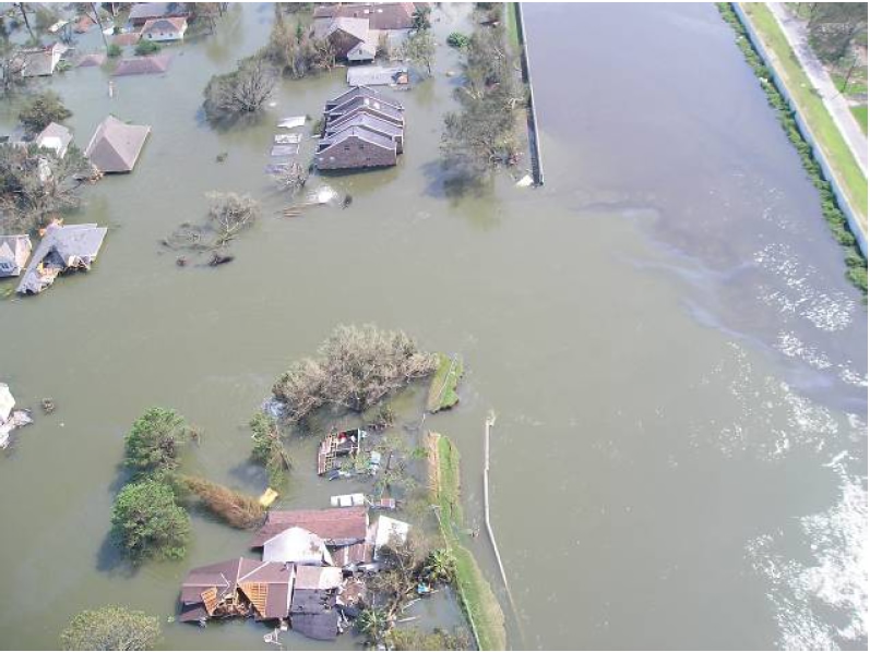
Homes along Pratt Drive at London Ave. Canal breach near Rbt. E. Lee Blvd.
Sand deposited by levee breach at London Ave. Canal near Rbt. E. Lee Blvd.
Sand deposits in front of home on Pratt Drive near Rbt. E. Lee breach of London Ave. Canal
Sand deposits in front of home on Pratt Drive near Rbt. E. Lee breach of London Ave. Canal

Sand deposits in front of home on Pratt Drive near Rbt. E. Lee breach of London Ave. Canal
London Ave. Canal Breach at Rbt. E. Lee Blvd. showing bridge and earthen levee in foreground are lower than floodwalls on canal.

Home in breach on London Ave Canal at Rbt. E. Lee Blvd. & Pratt Drive
Toppled floodwall and breach repair at London Ave. Canal & Rbt. E. Lee Blvd.
Homes destroyed by breach in London Ave. Canal along Pratt Drive
Trees and house displaced from levee at repaired breach in 17th St. Canal
Standing in the 17th St. Canal breach repair
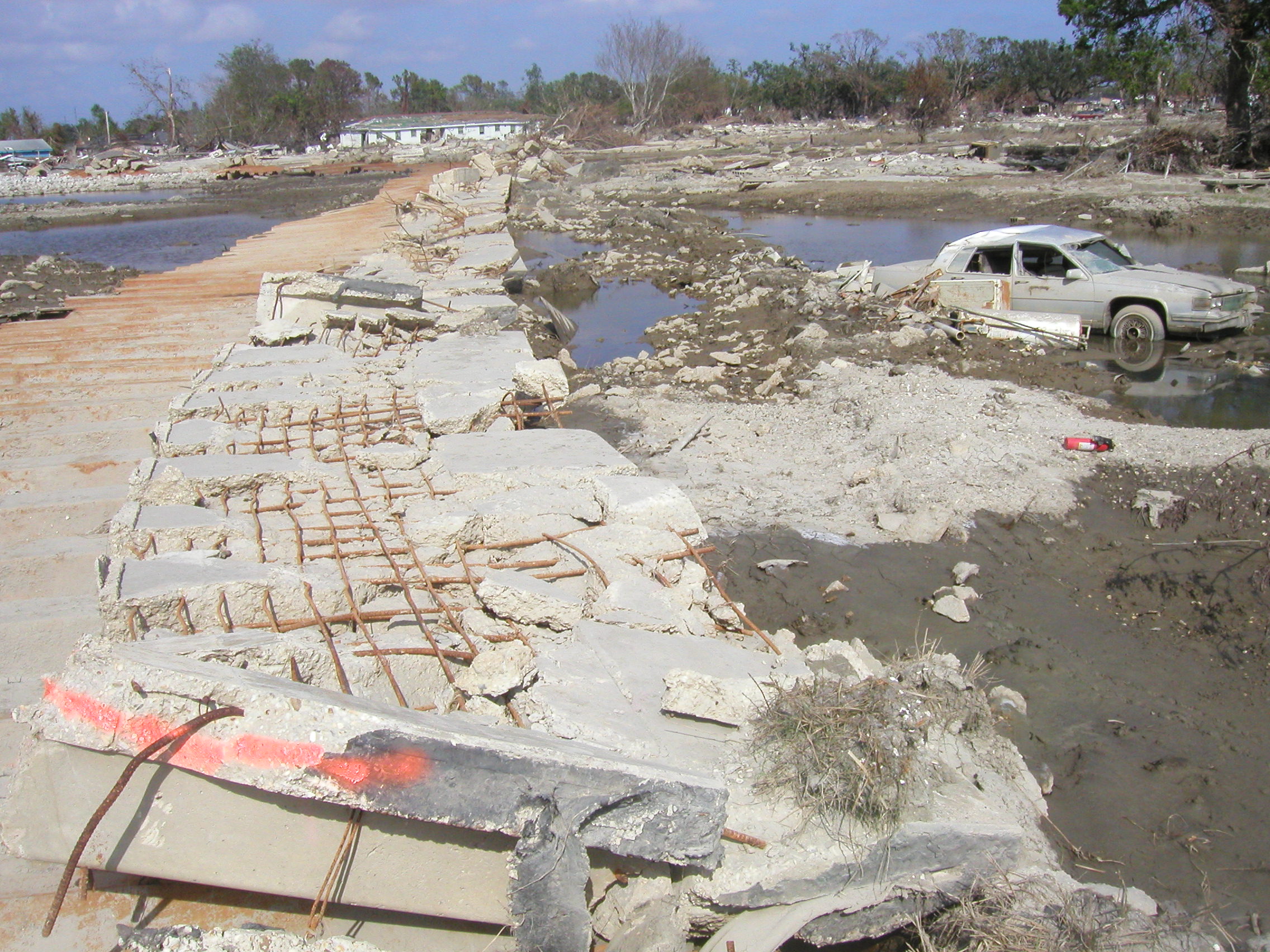
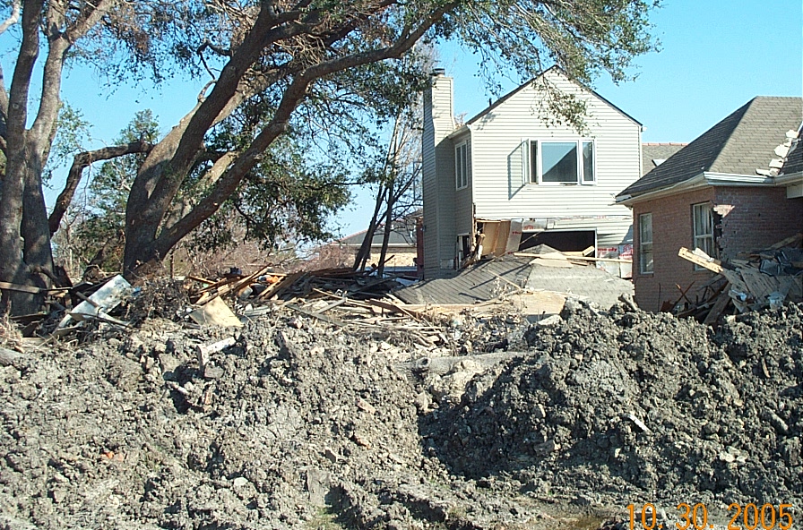
Piece of 17th St. Canal levee displaced about 40 feet east of canal during breach
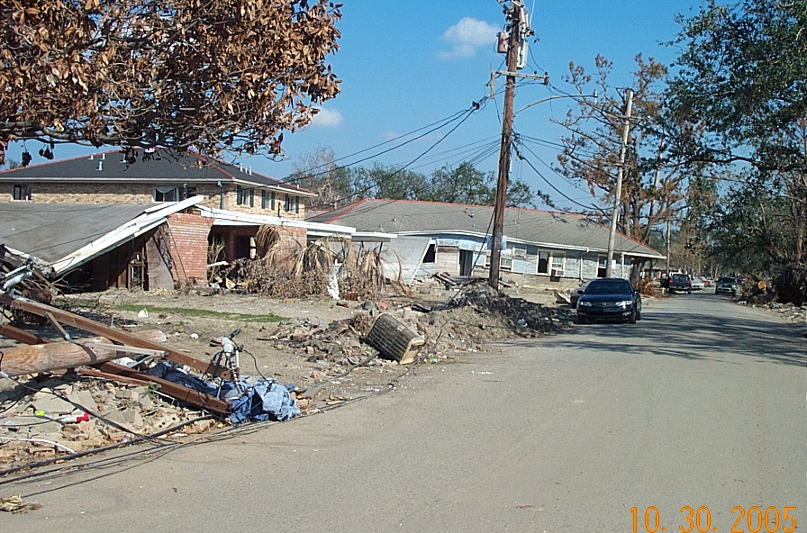
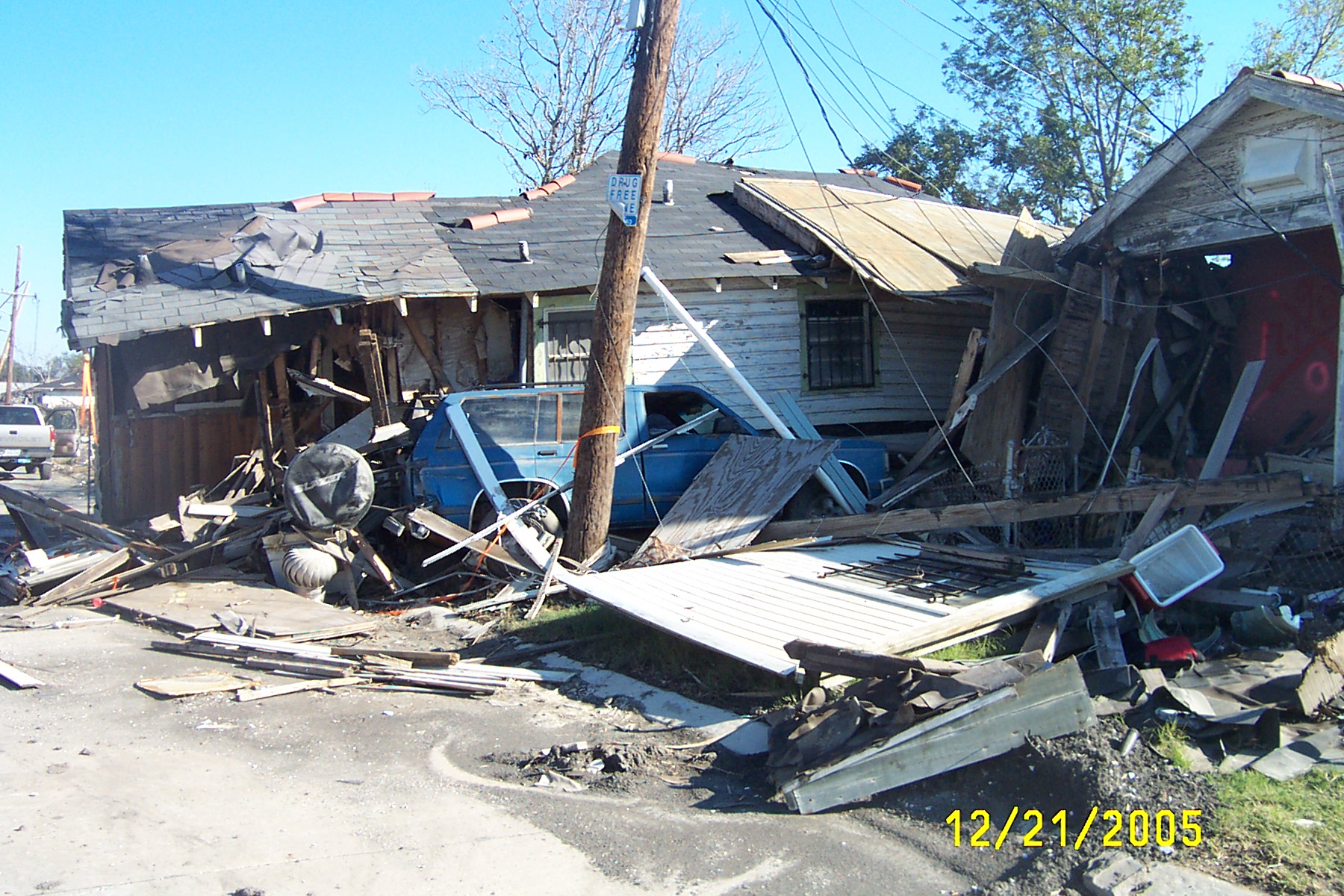
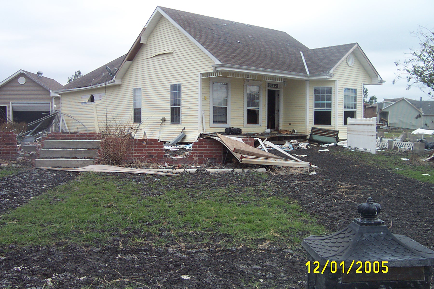
House on Corner of Belaire Dr. & 40th St. near 17th St. Canal breach
Looking South down Belaire Dr. at 17th St. Canal breach
Peat typical of that scattered about the neighborhood near the 17th St. Canal breach
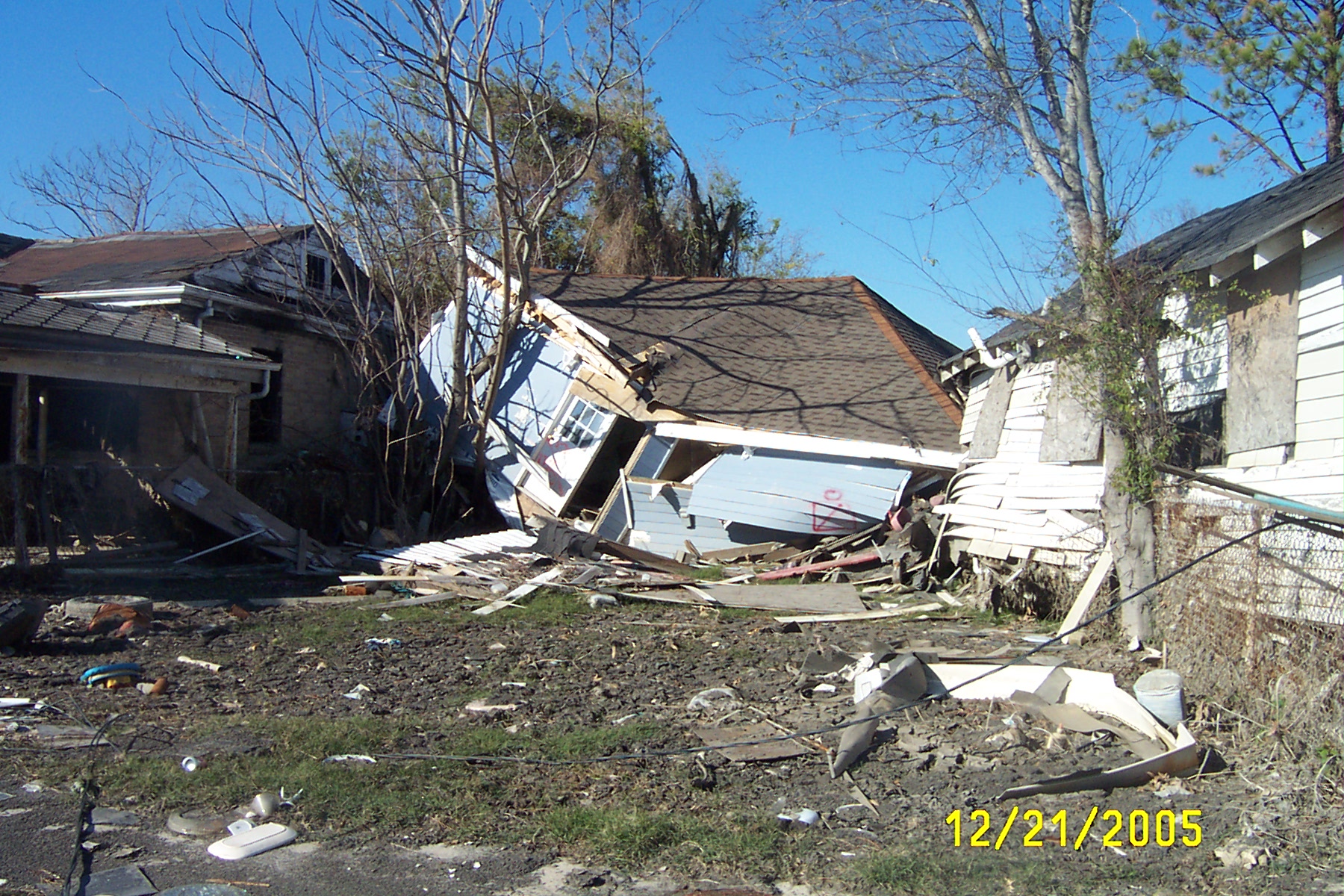
Floated house on 40th St. near 17th St. Canal breach
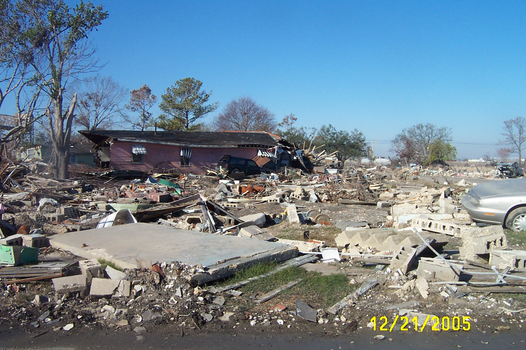
Homes immediately in path of 17th St. Canal breach
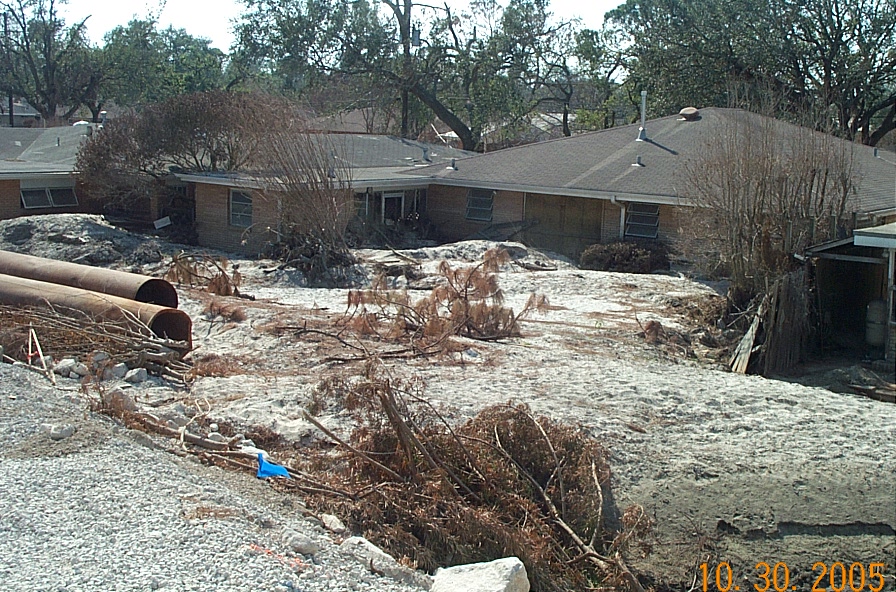
Sand deposits near north end of 17th St. Canal breach
Return to Katrina - What
Happened Page
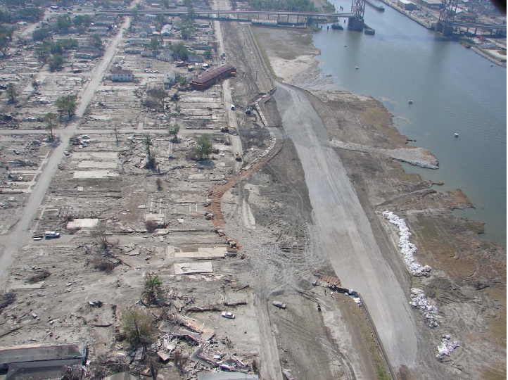
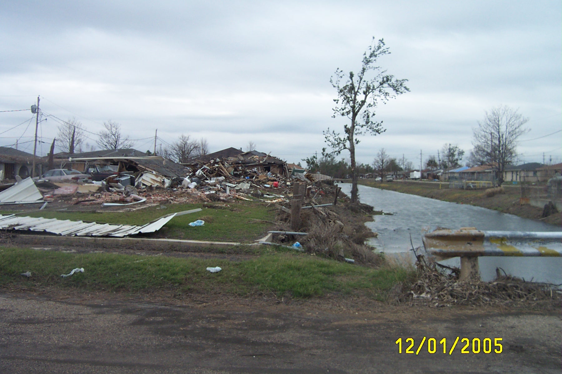
Industrial Canal Breach & Lower Ninth Ward
Levee failure on the Industrial Canal north of Claiborne Ave. from Claiborne Bridge
Just south of Industrial Canal levee failure looking into Lower Ninth Ward from Claiborne Bridge
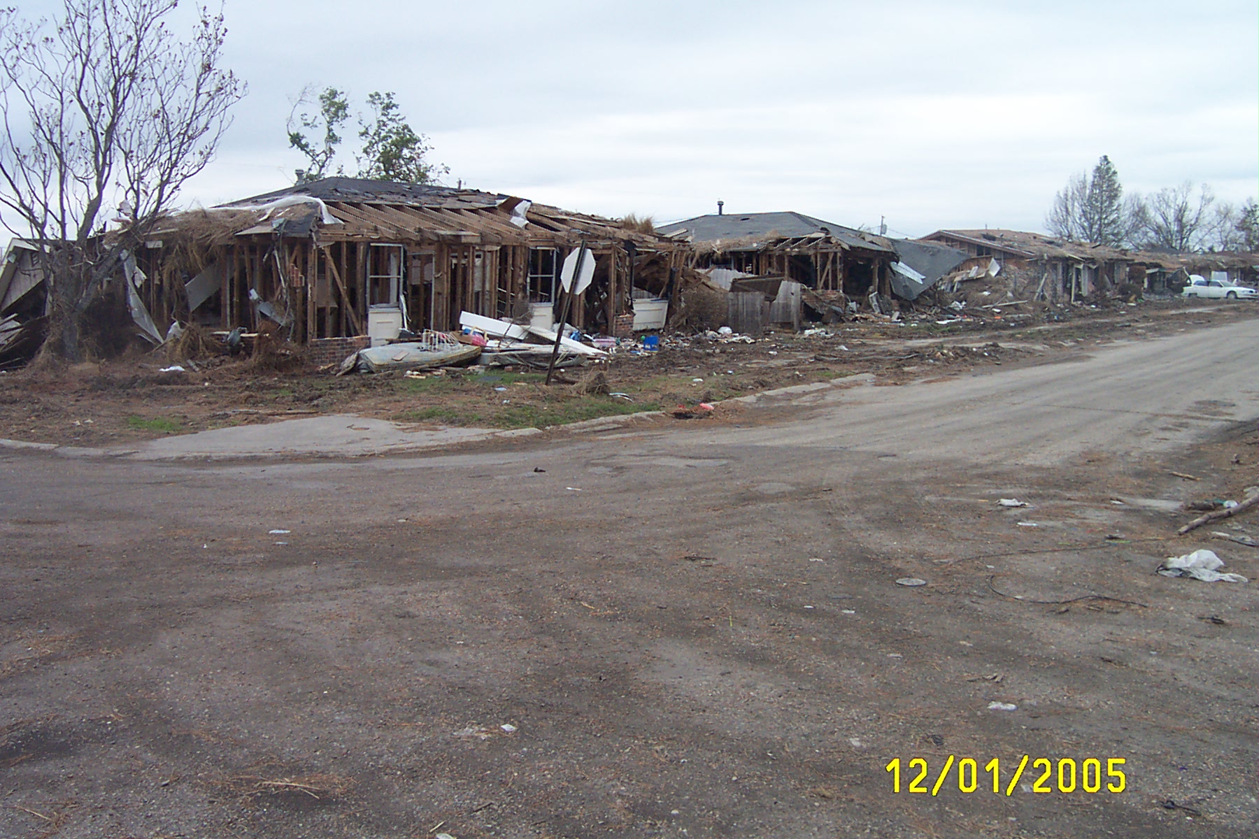
Displaced houses on Claiborne Ave in Lower Ninth Ward
Destroyed homes on Claiborne Ave. in Lower Ninth Ward
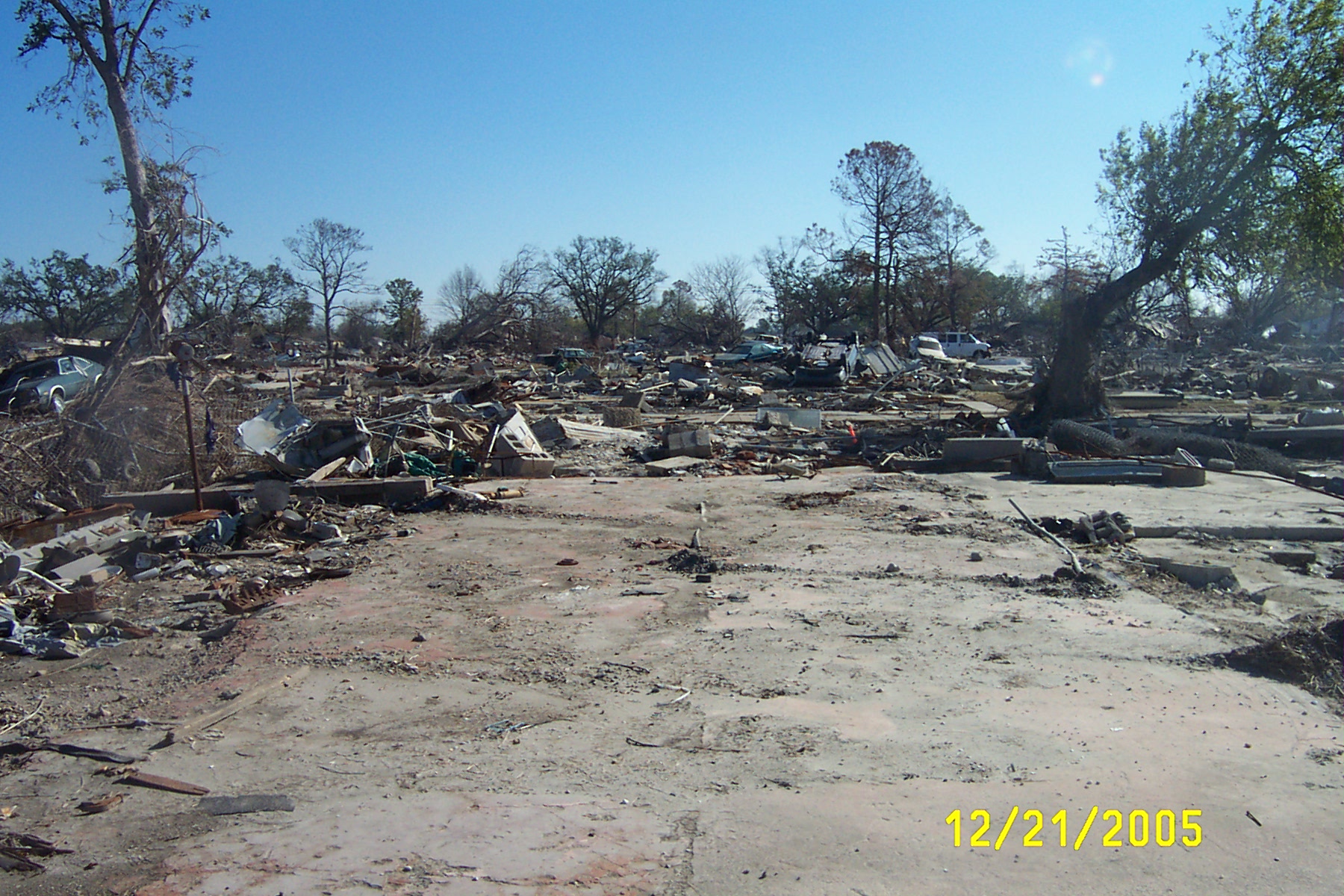
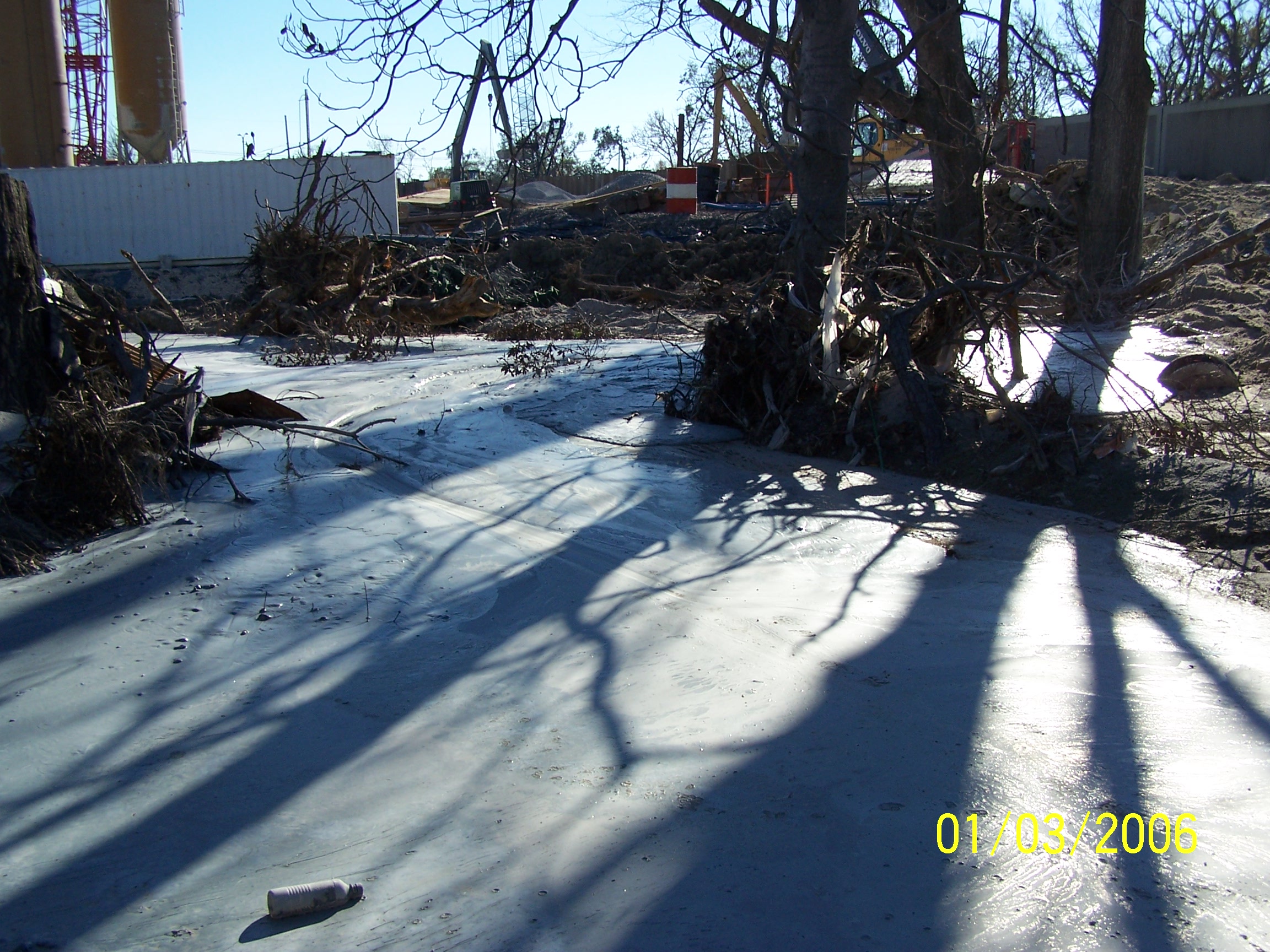
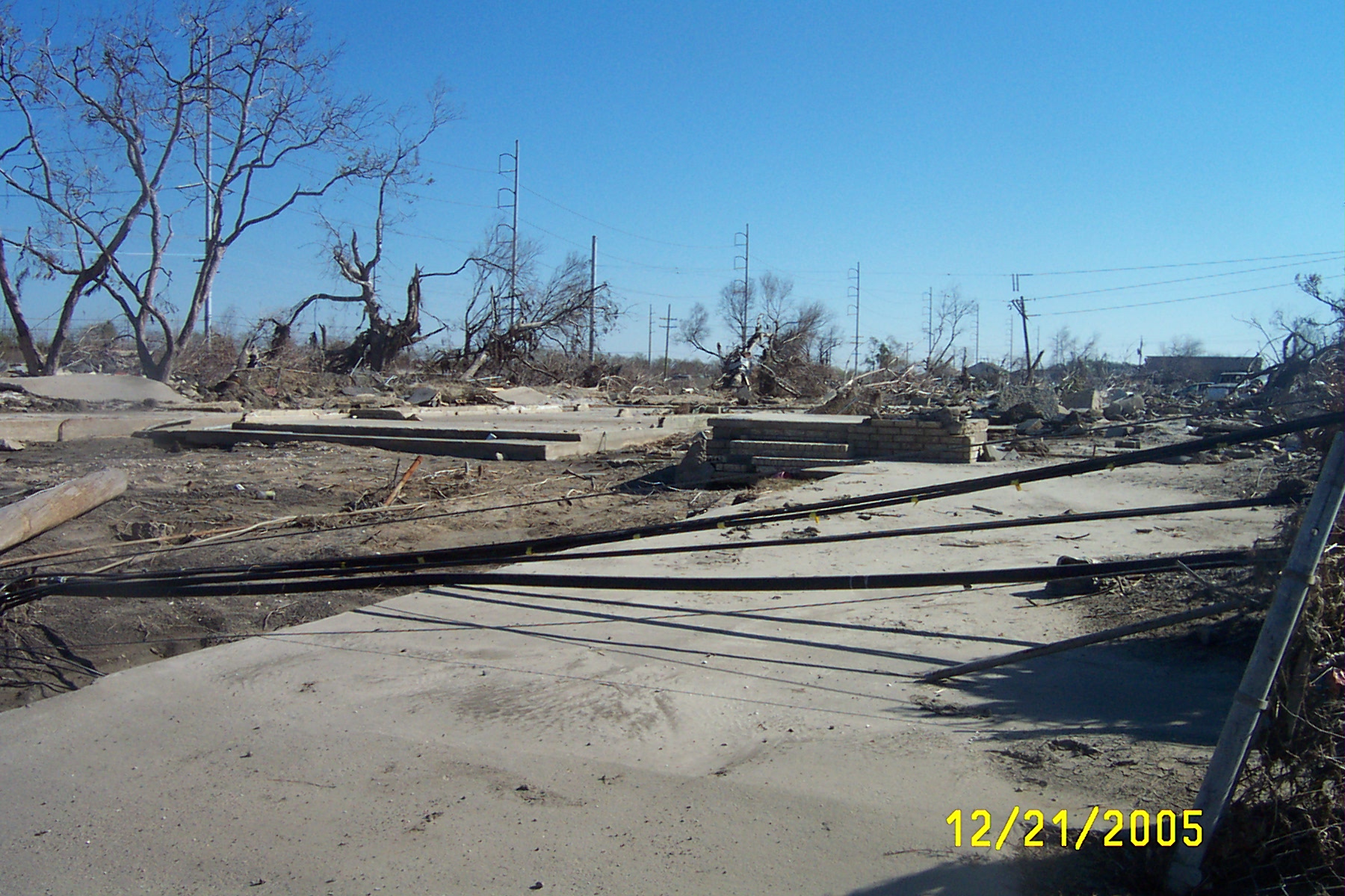
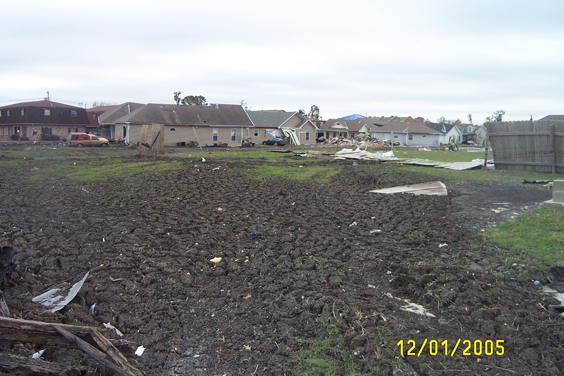
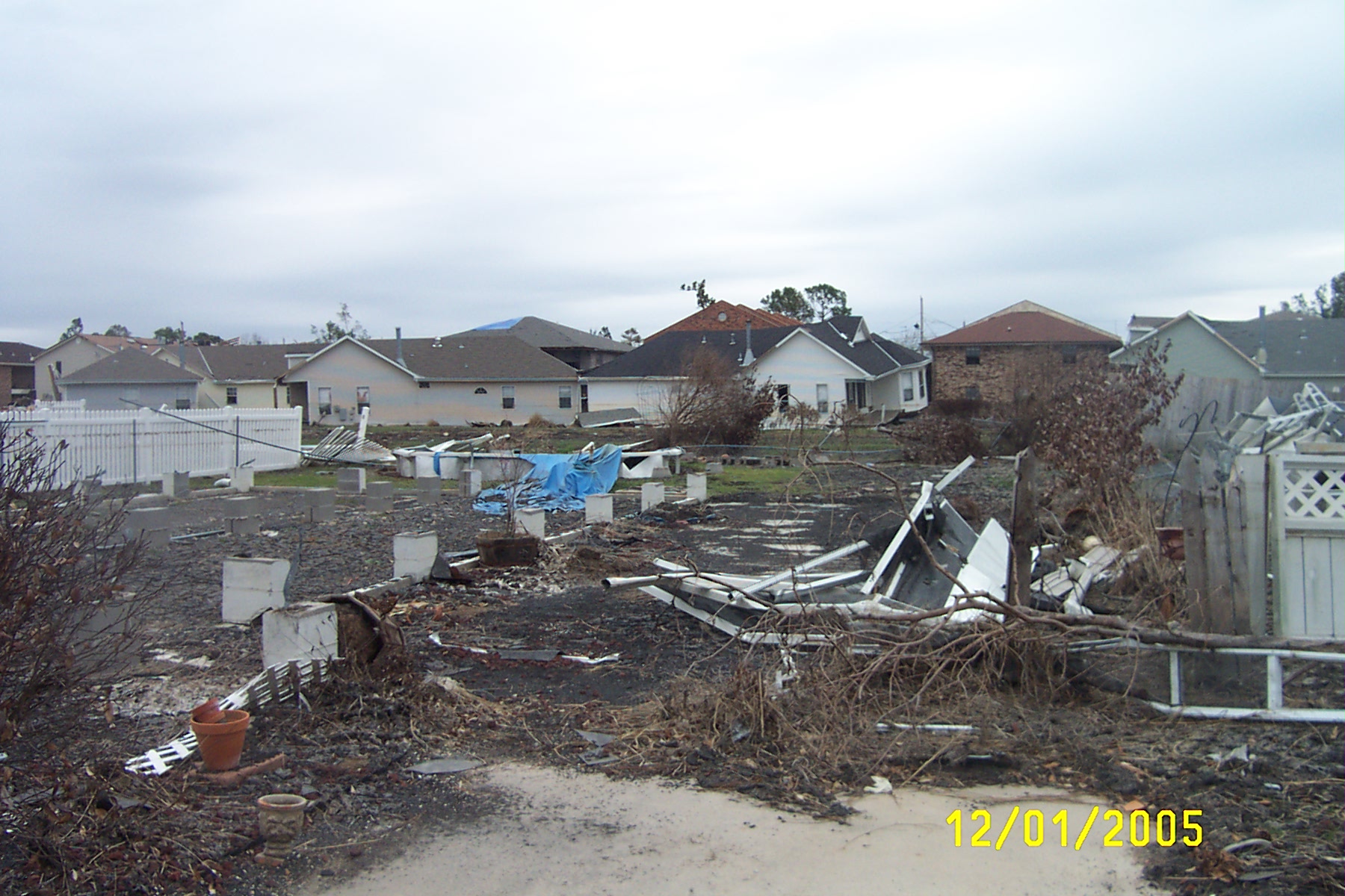
Destruction in Lower 9th Ward, looking toward breach on Industrial Canal levee
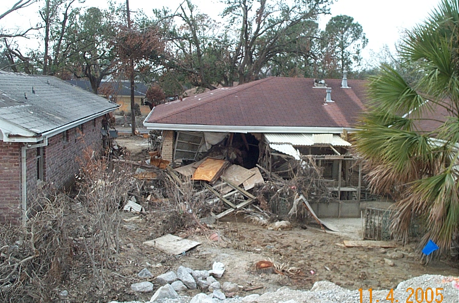
Destruction in Lower 9th Ward.
Destruction in Lower 9th Ward
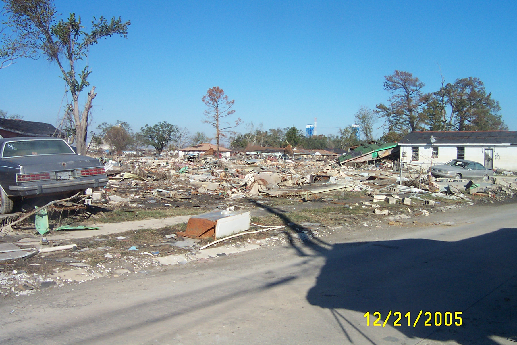
Destruction in Lower 9th Ward, looking NW.
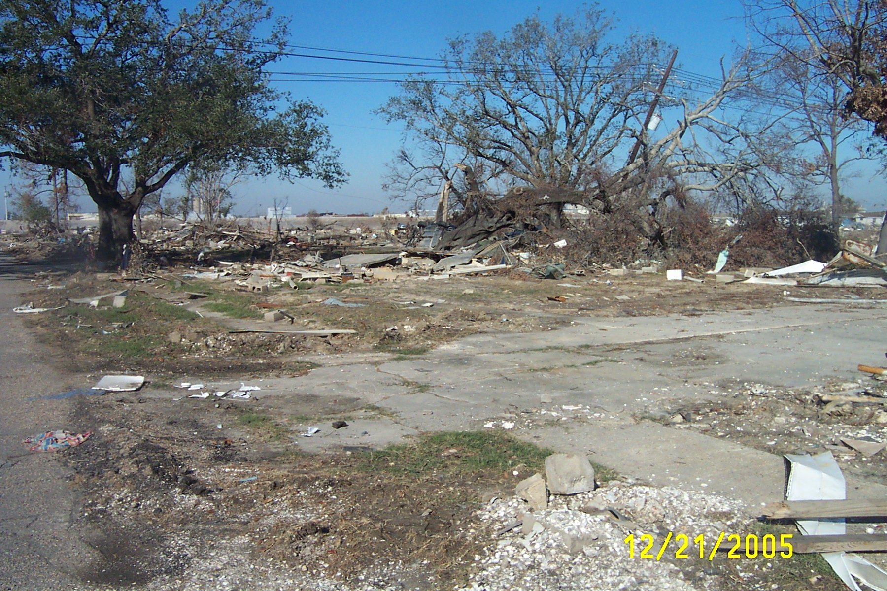
Destruction in Lower 9th Ward, looking toward breach on Industrial Canal levee
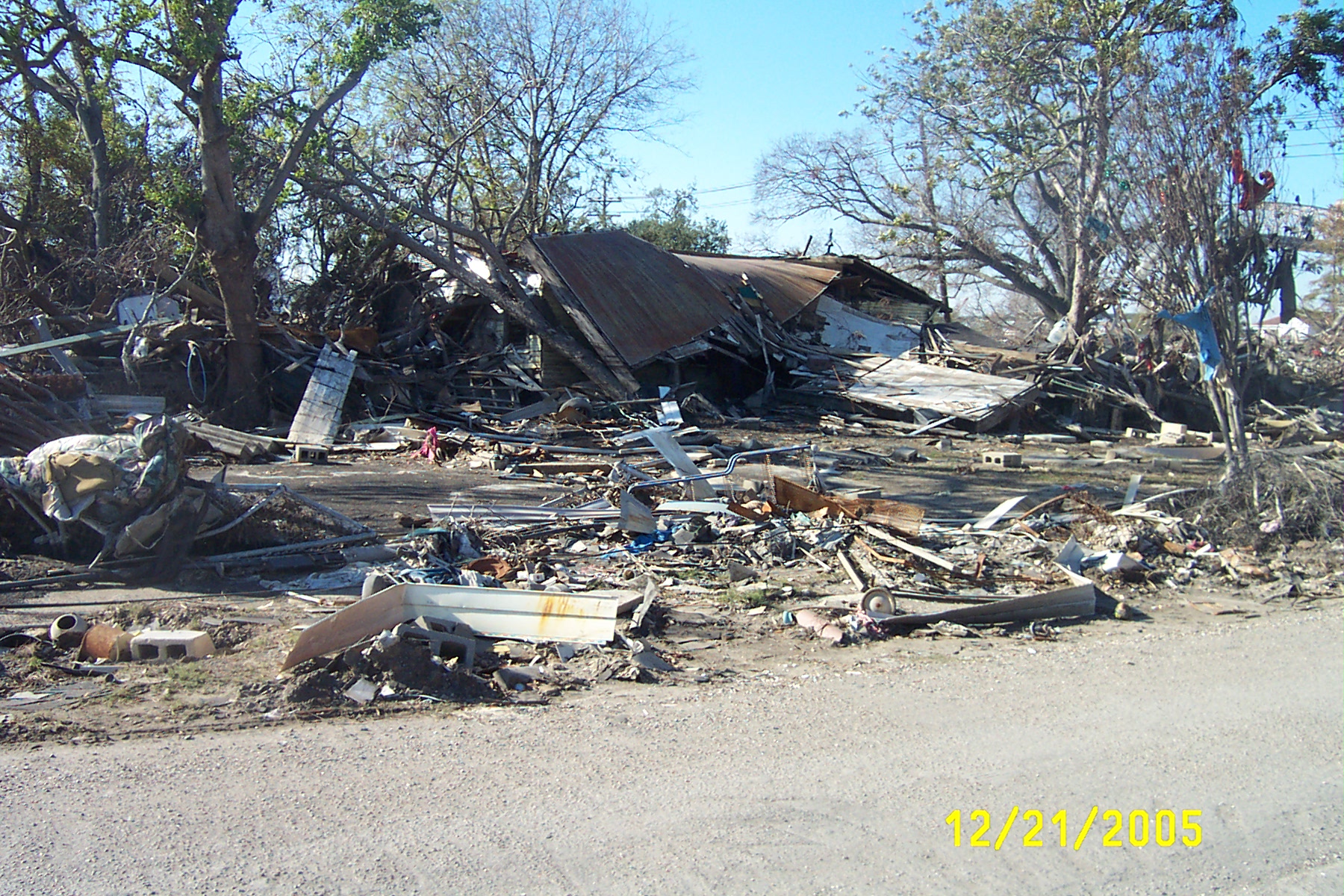
Destruction in Lower 9th Ward,
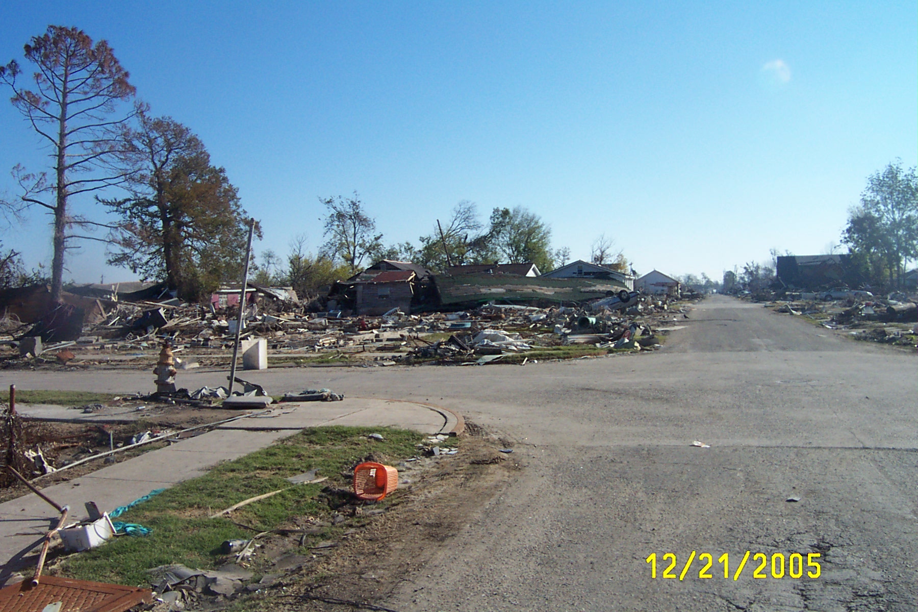
Destruction in Lower 9th Ward, looking east from near breach

Destruction in Lower 9th Ward
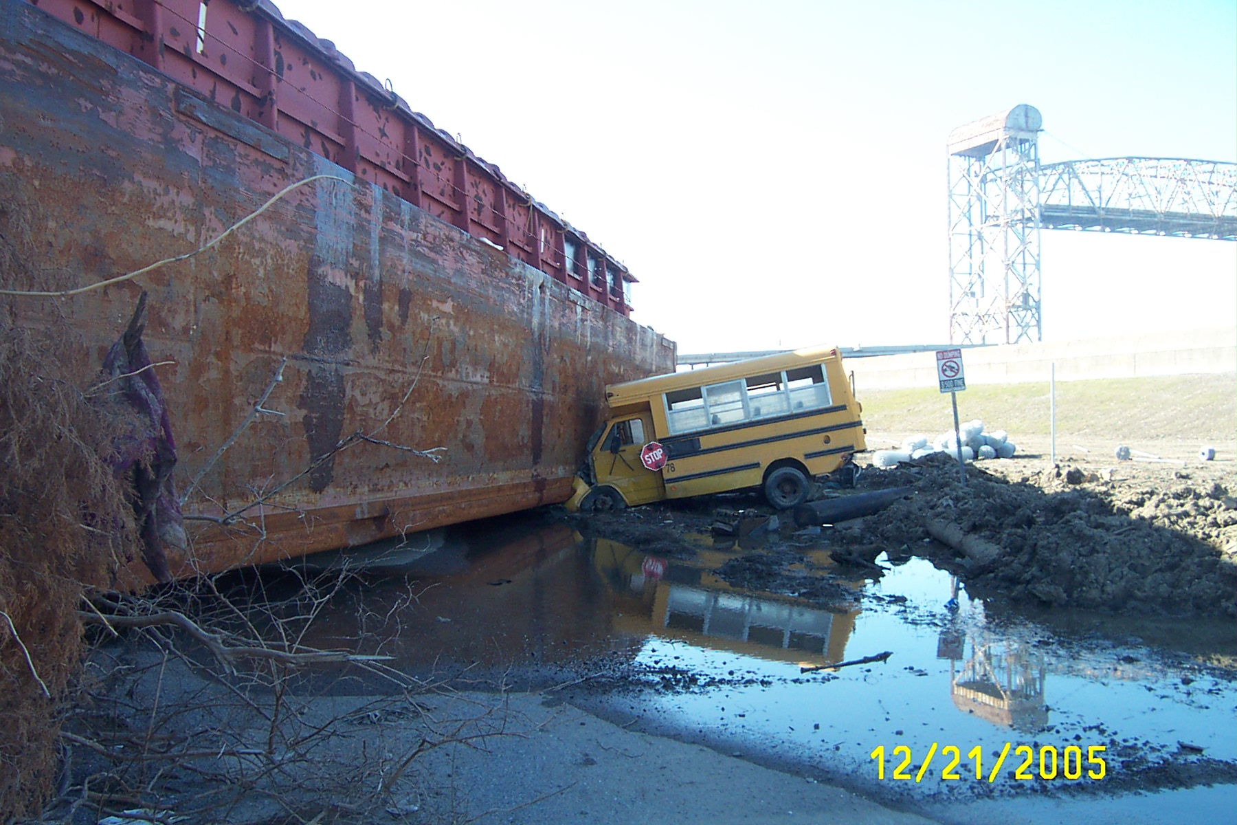
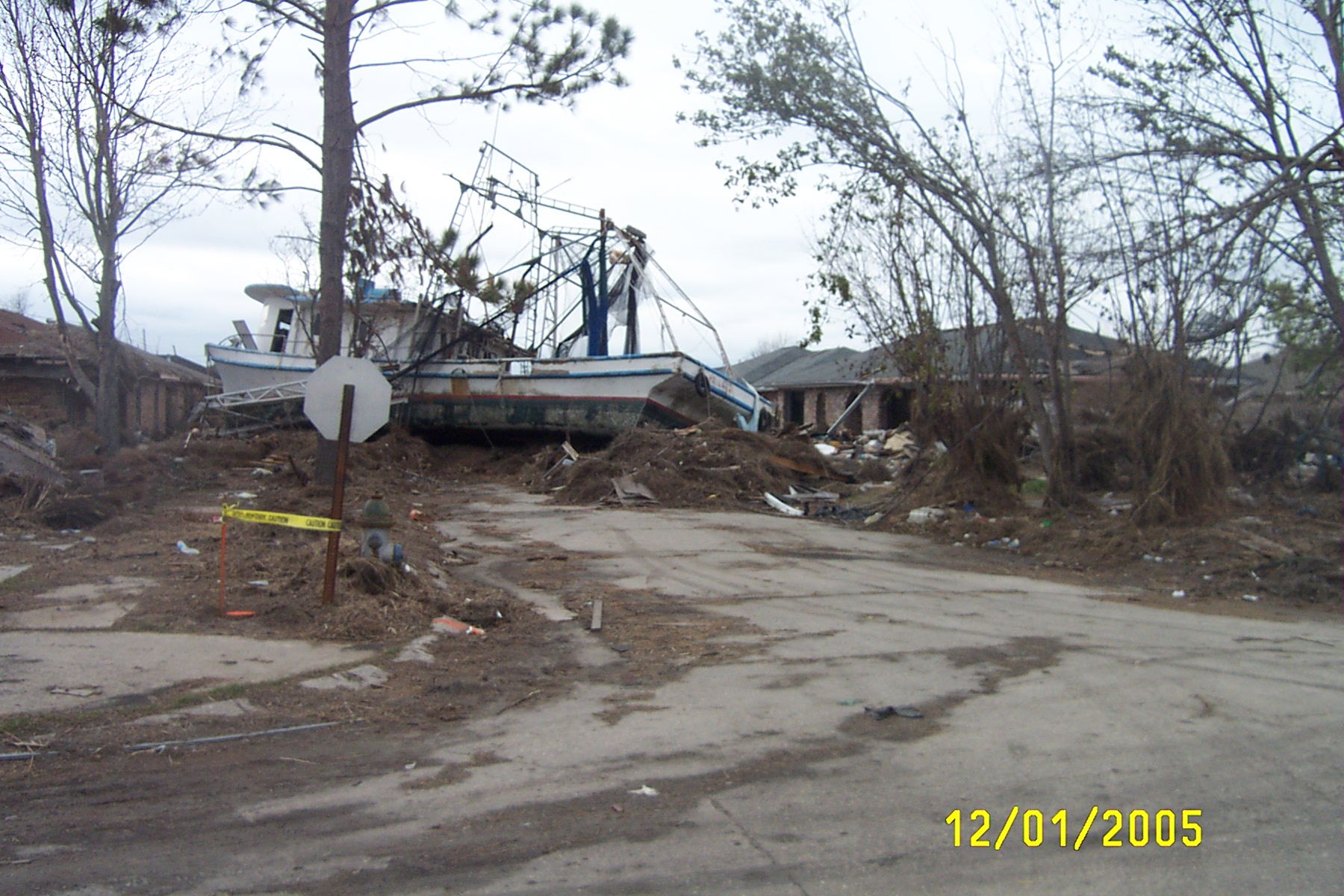
Barge on bus
Barge on bus
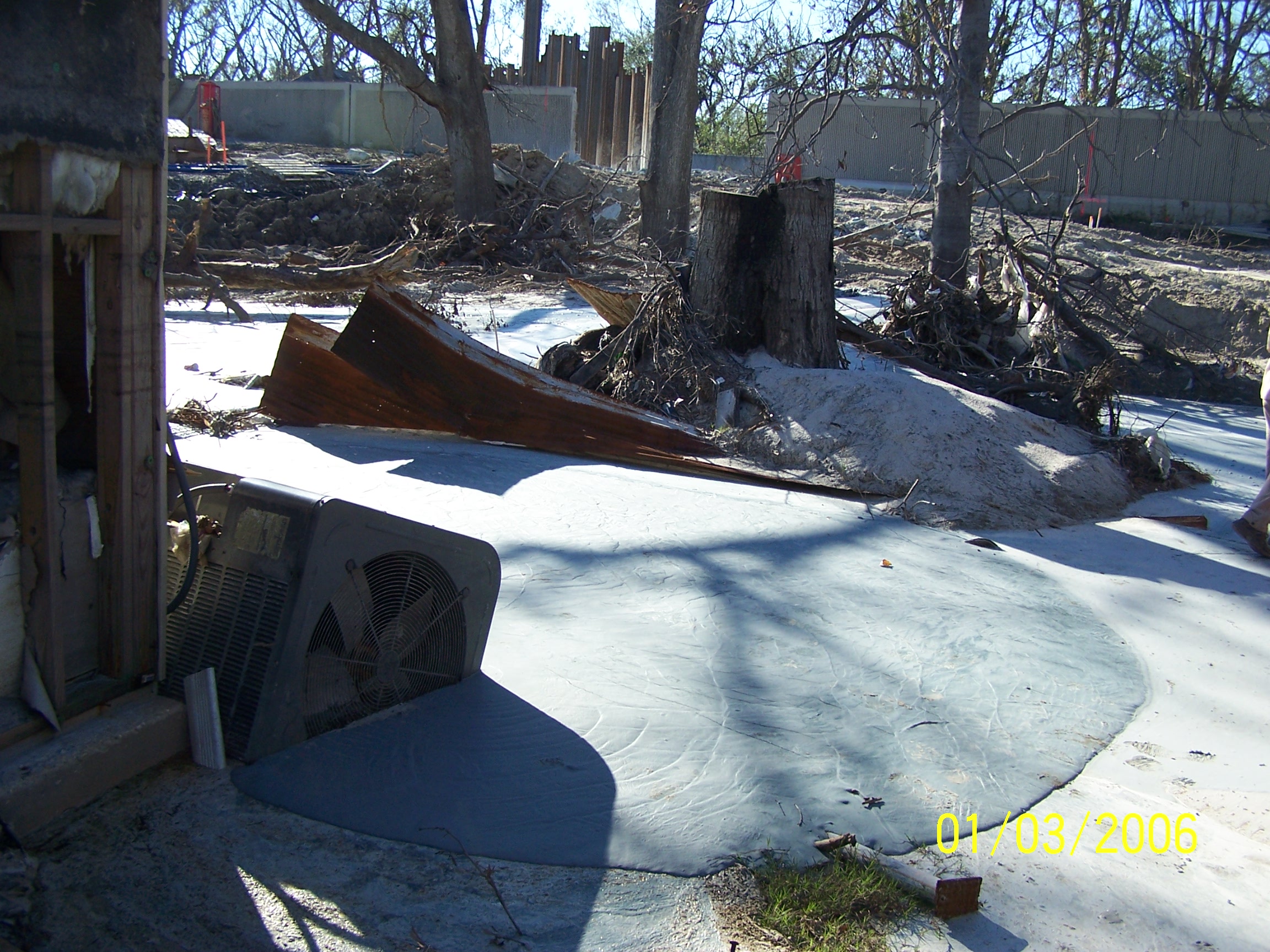
Bent sheet piling at southern breach on Industrial Canal
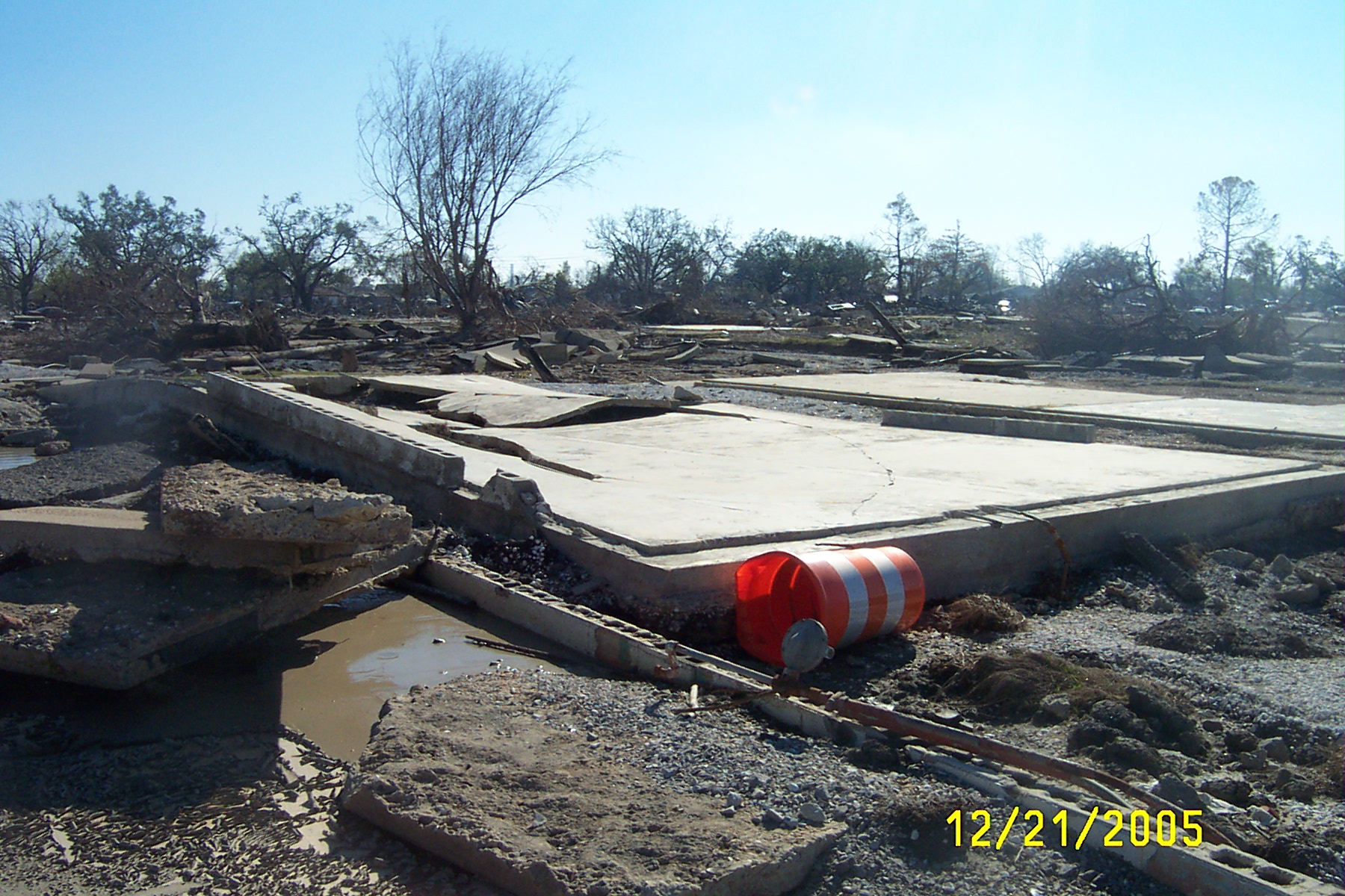
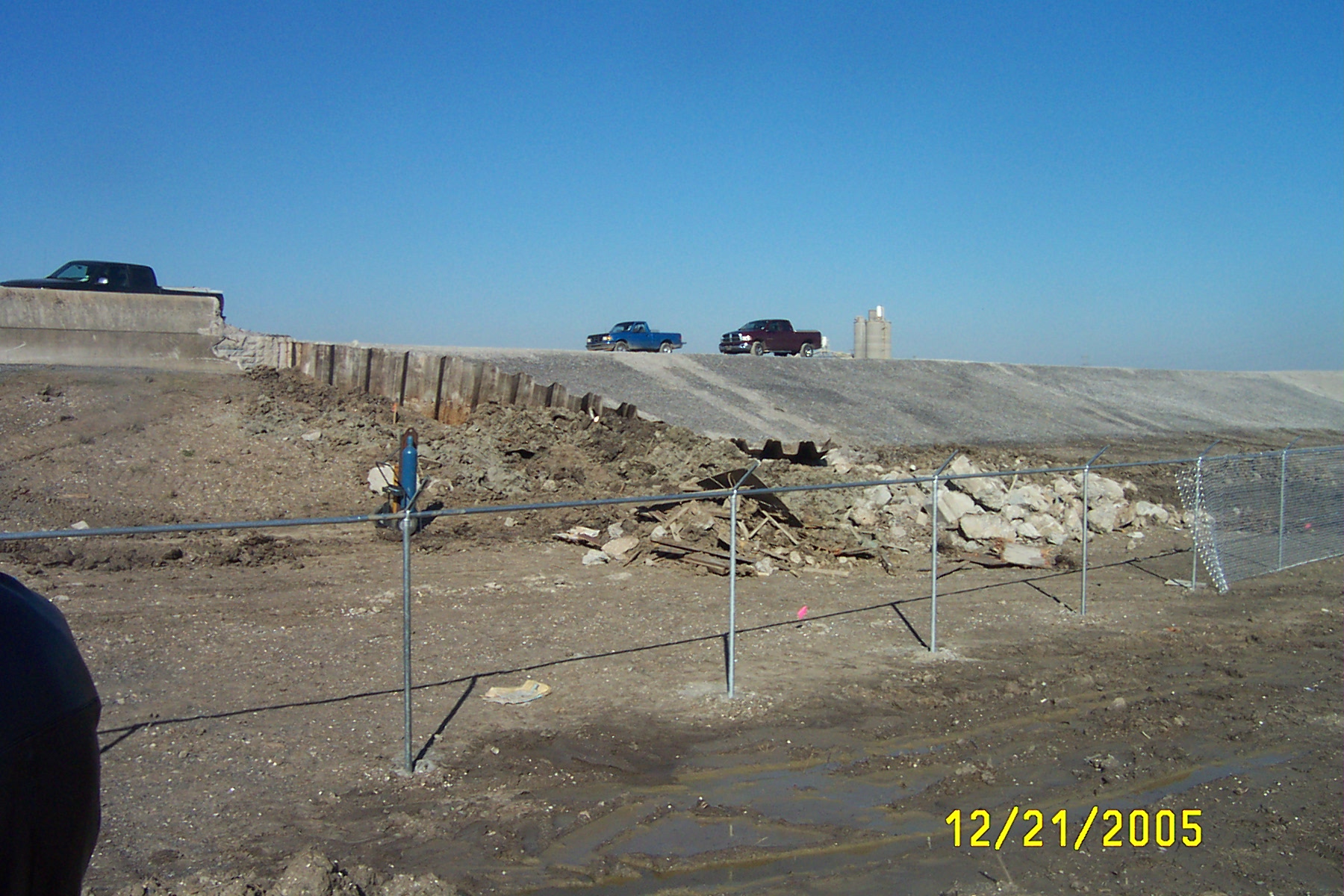
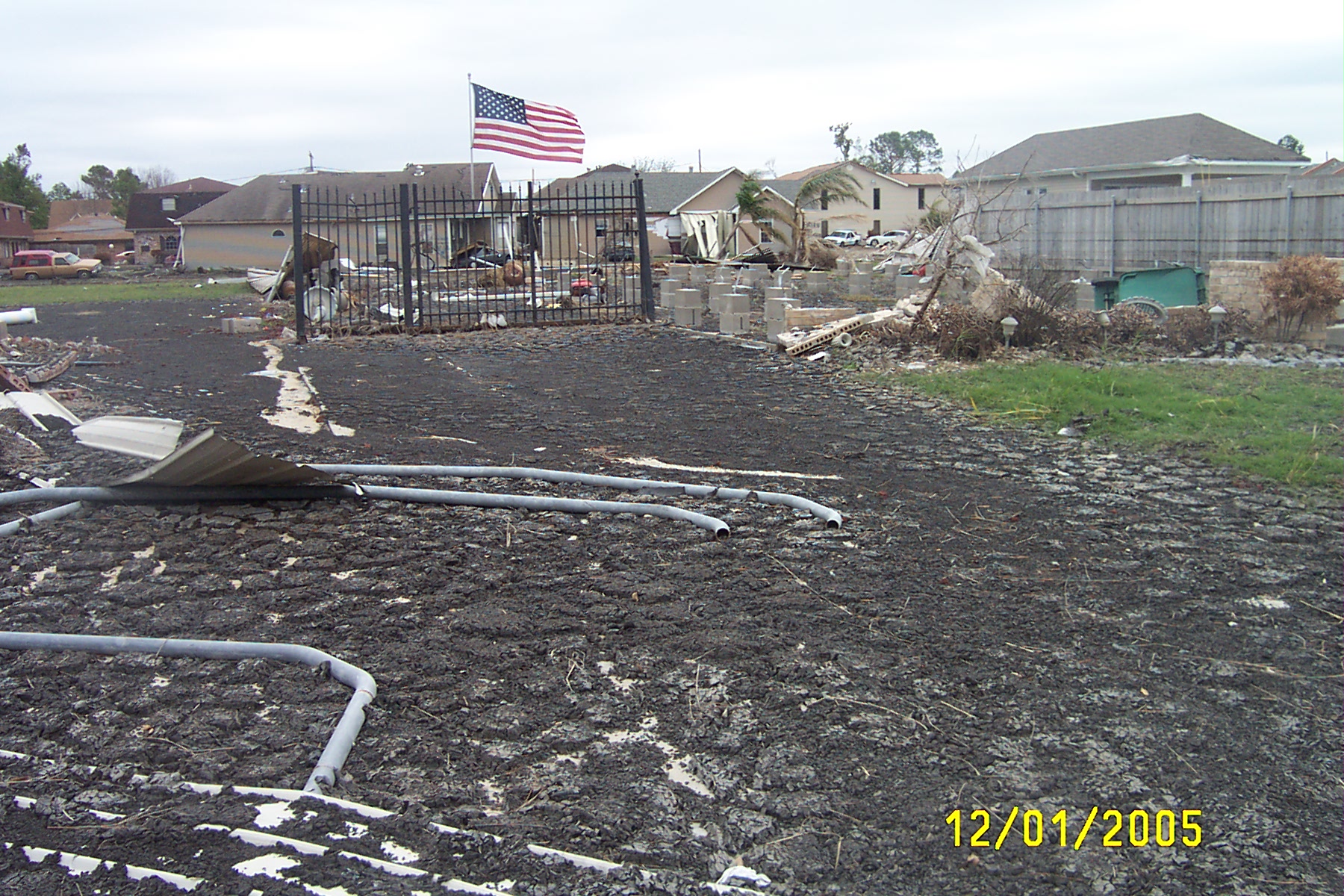
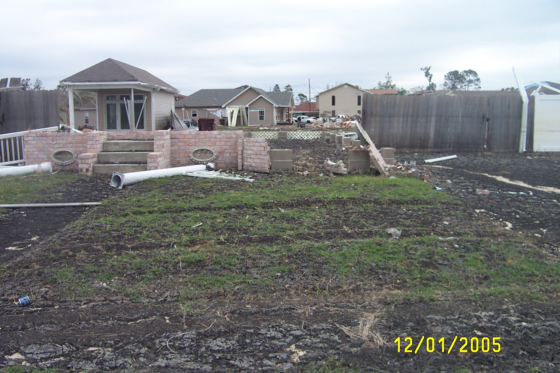
Foundations near south breach of Industrial Canal
Bent sheet pilings at northern end of southern breach
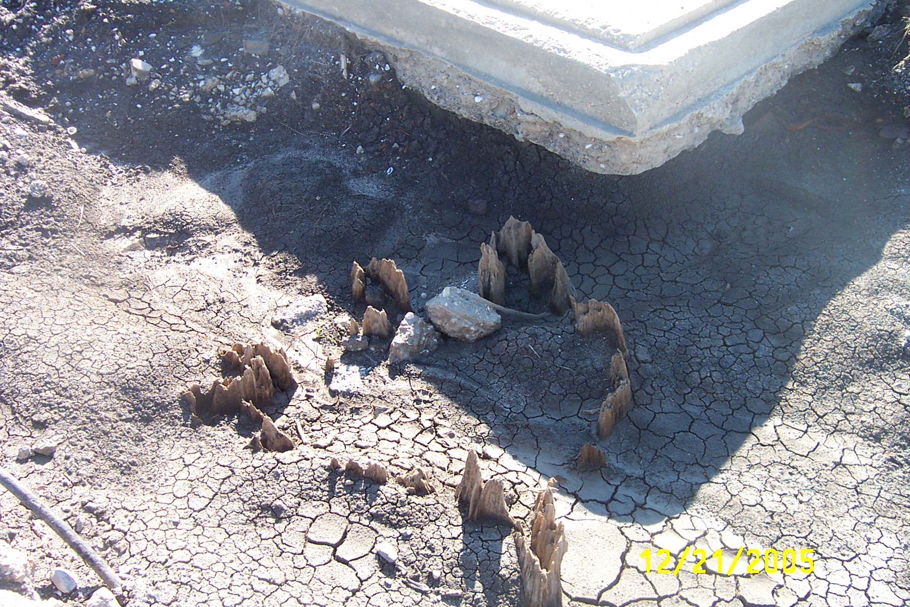
Cyprus stump exposed by erosion beneath slab near southern breach
From southern breach looking east.
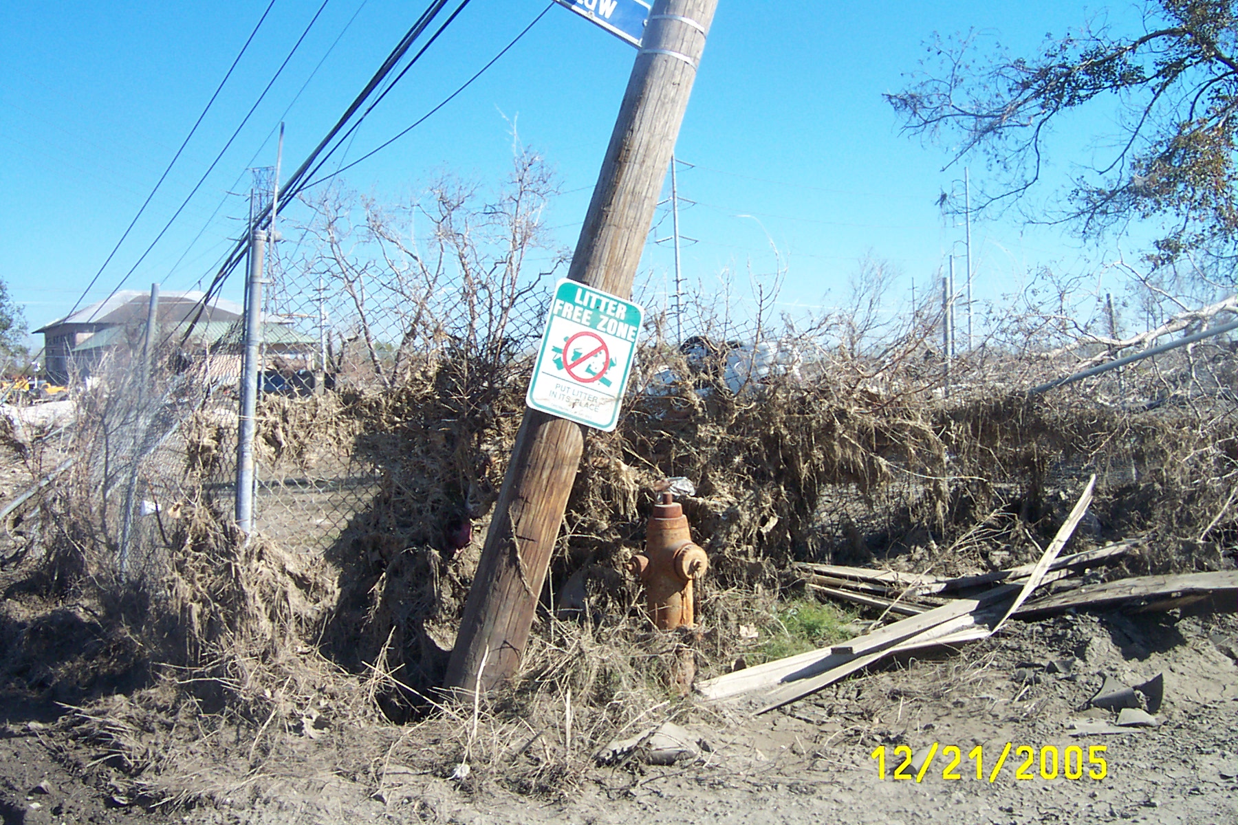
Litter Free Zone
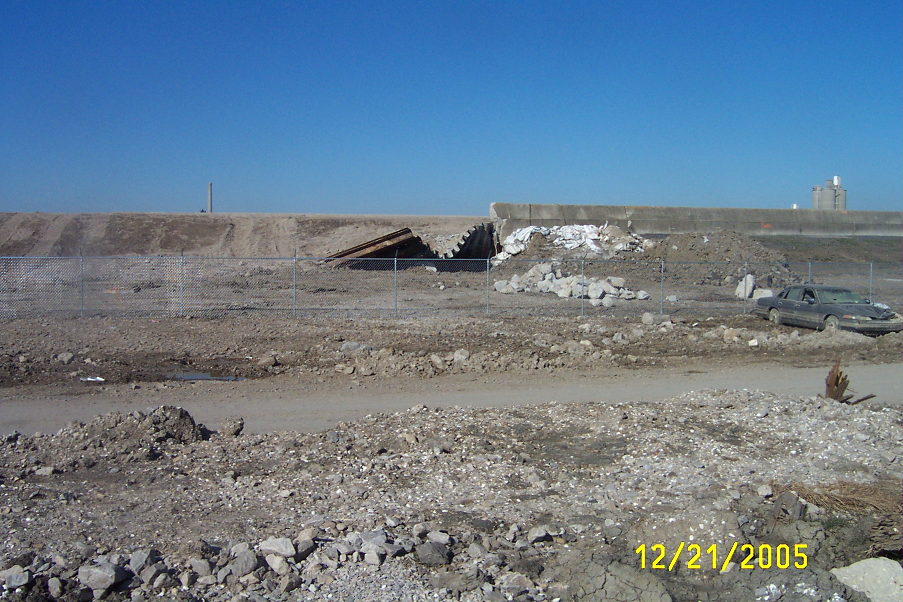
Bent sheet pilings and repaired northern breach on Industrial Canal
Foundations remaining near north breach on Industrial Canal
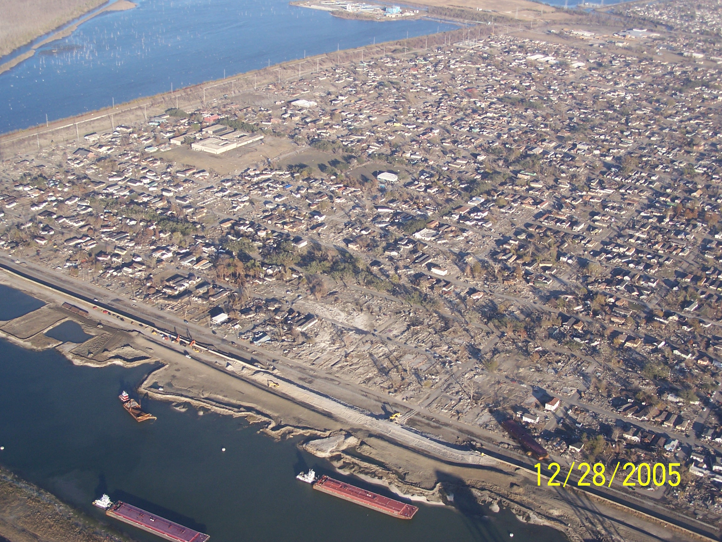
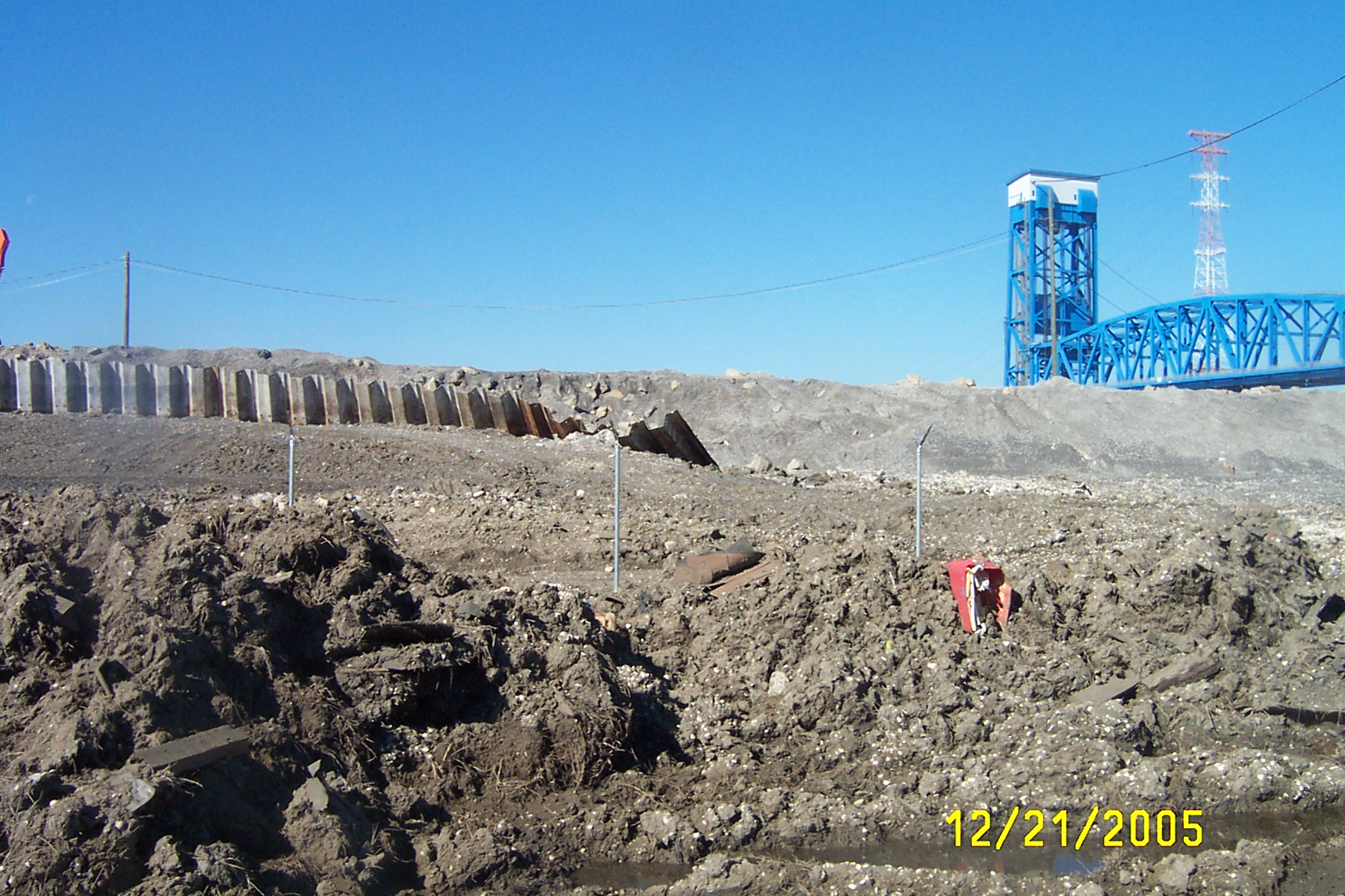
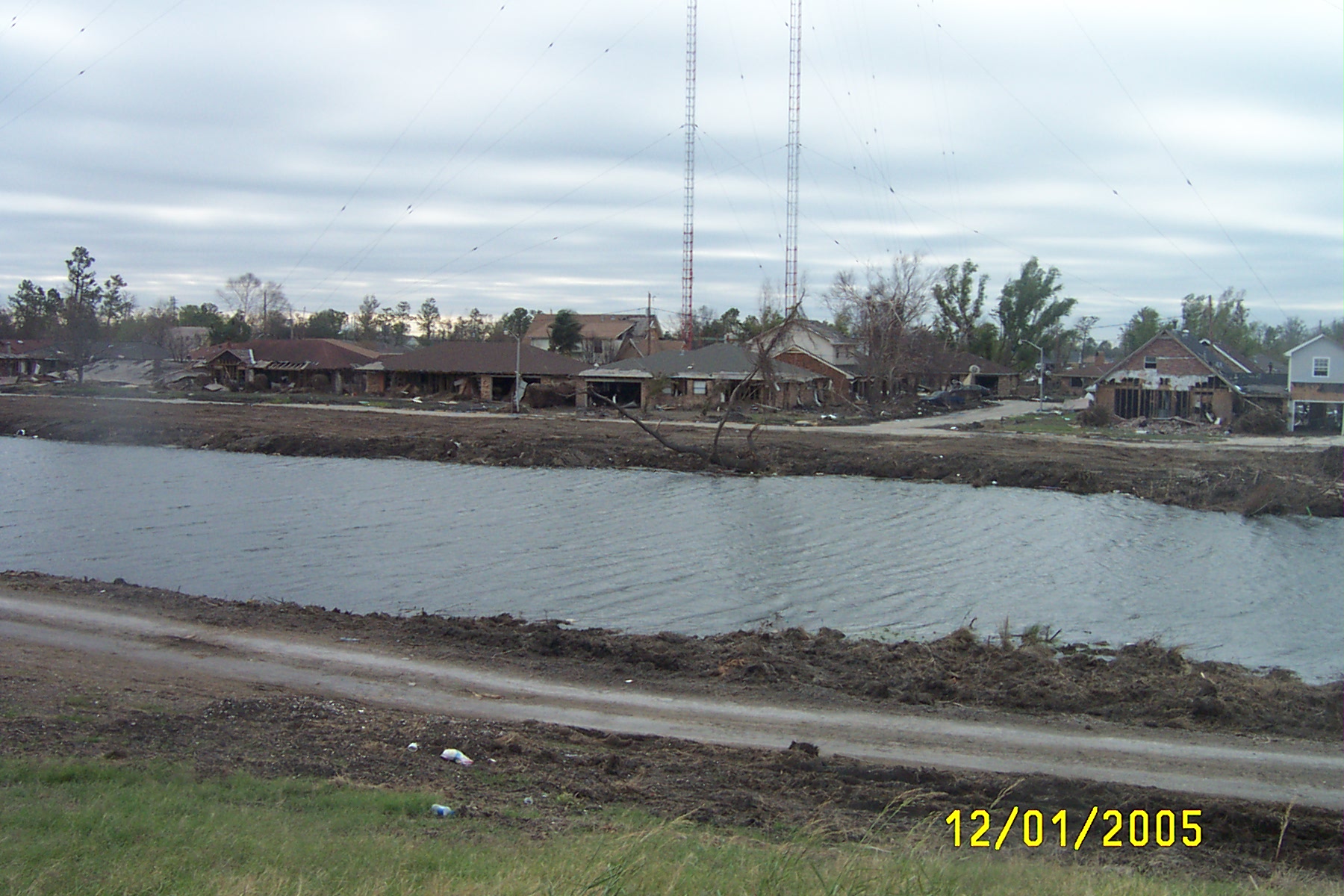
Lower 9th Ward and breach from air 12/28/05
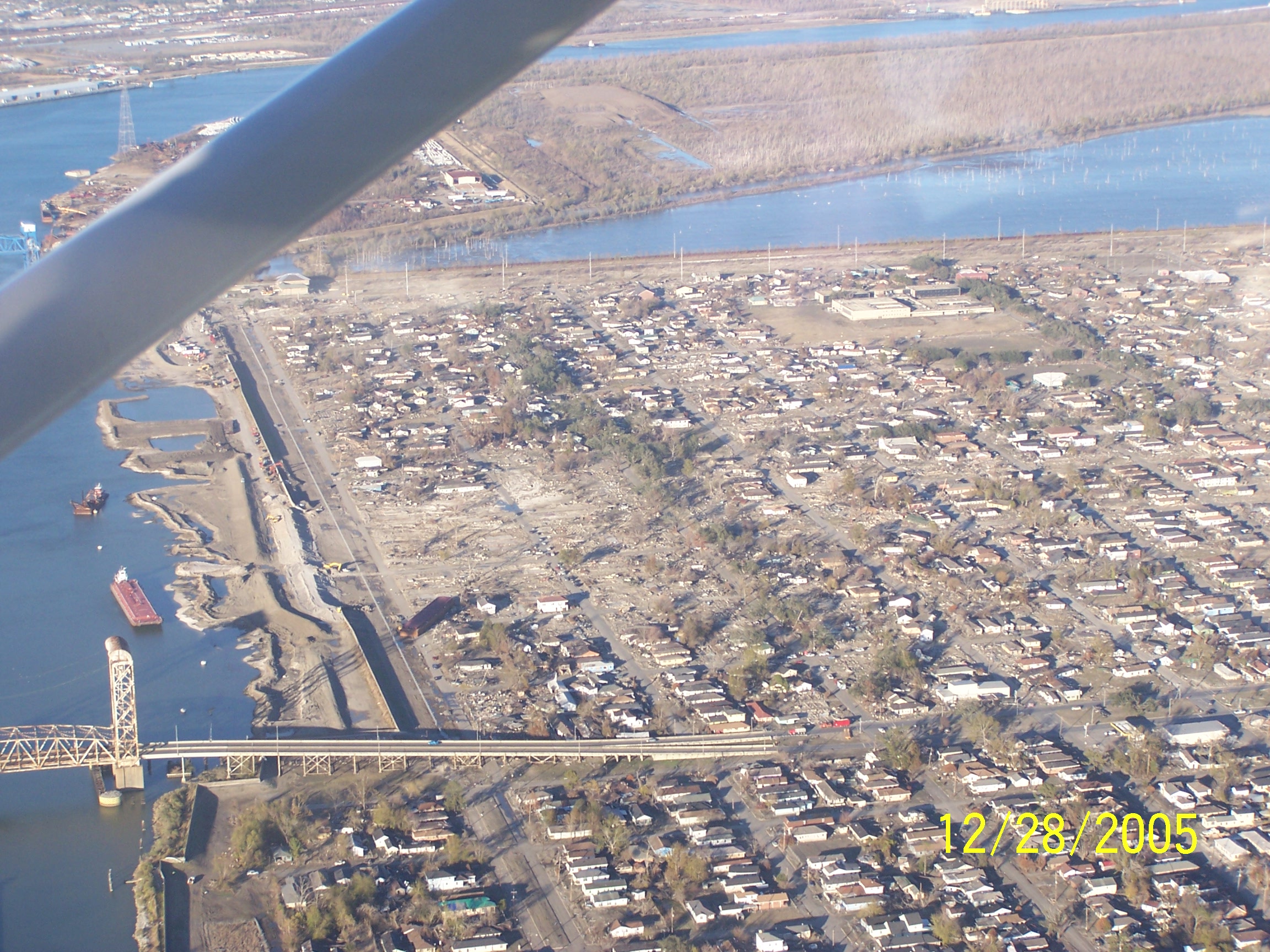
Lower 9th Ward and breach from air 12/28/05
Return to Katrina - What
Happened Page
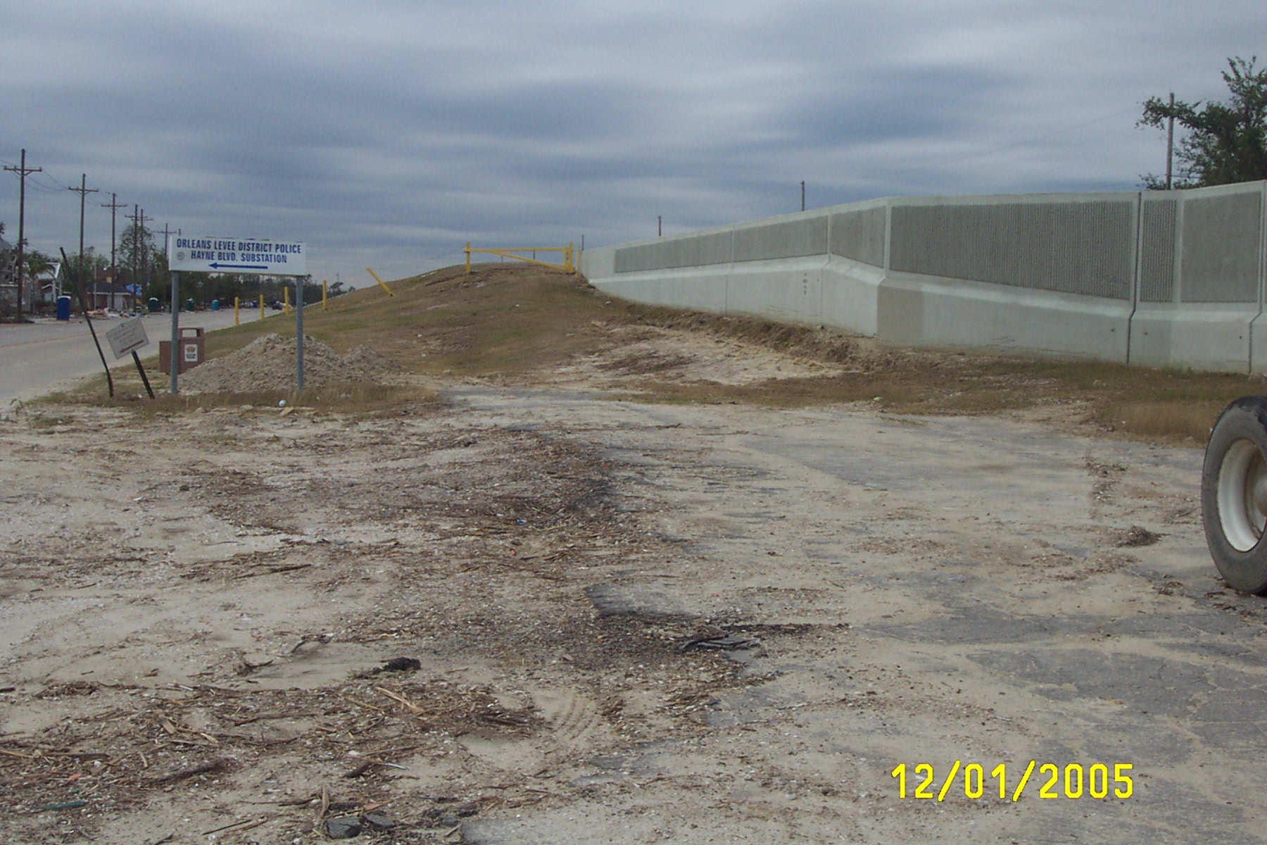
Condition of Levees in New Orleans East
(Sequence runs along Hayne Blvd. form NE
to SW)
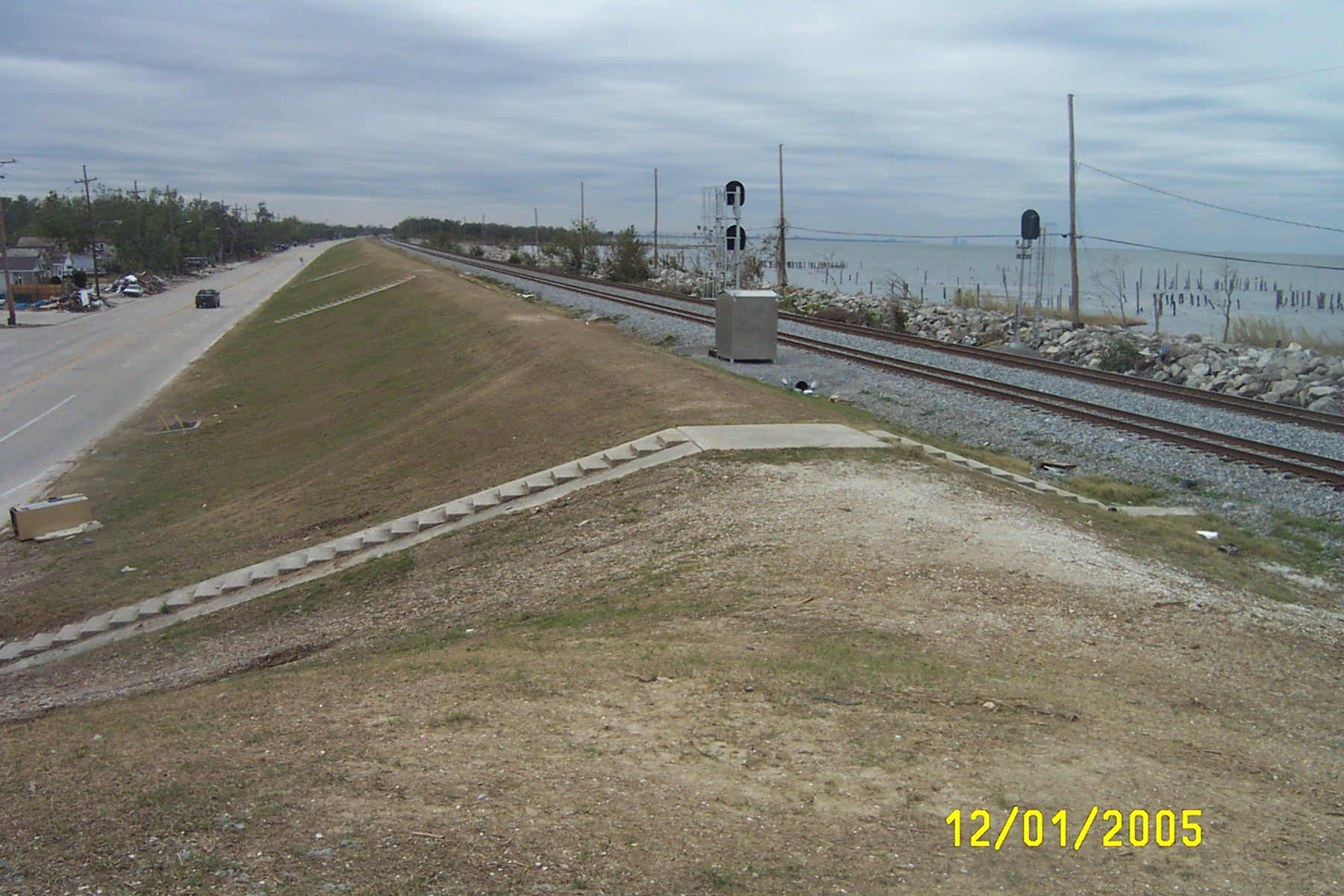
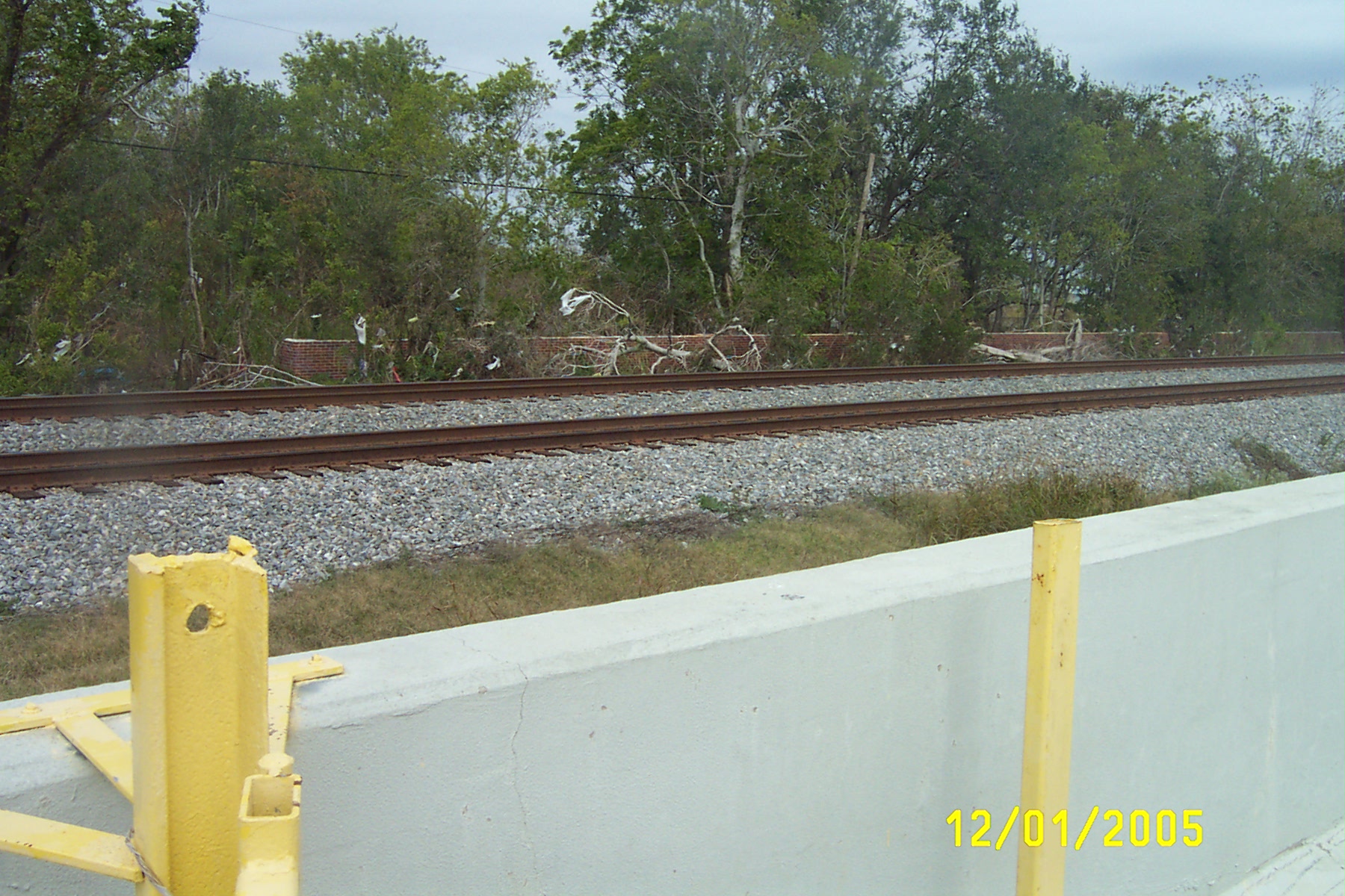
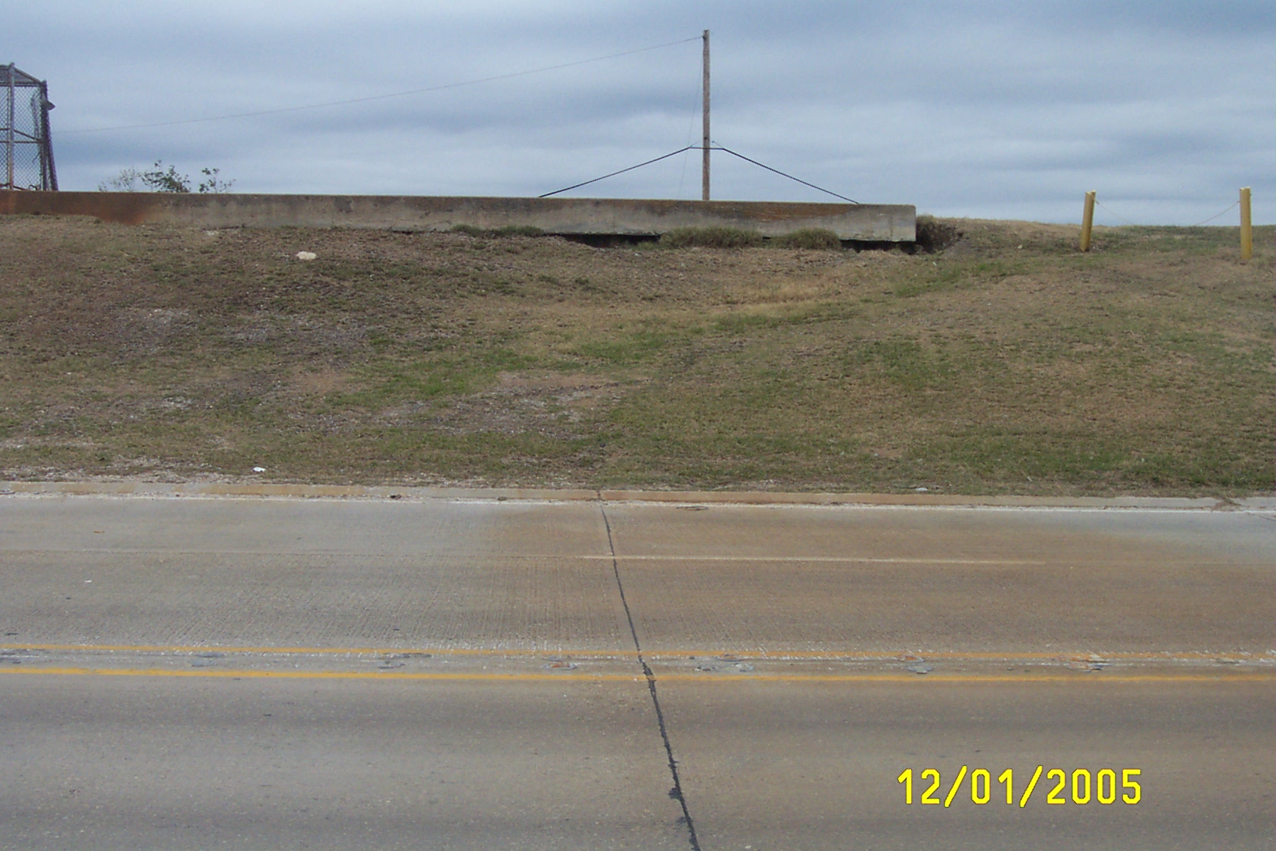
Lakefront levee at Paris Rd. (hwy 47) & Hayne Blvd. with minor scouring
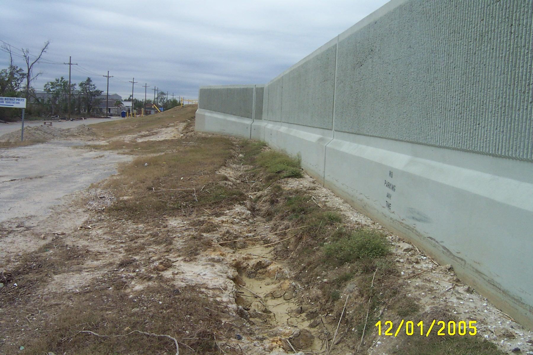
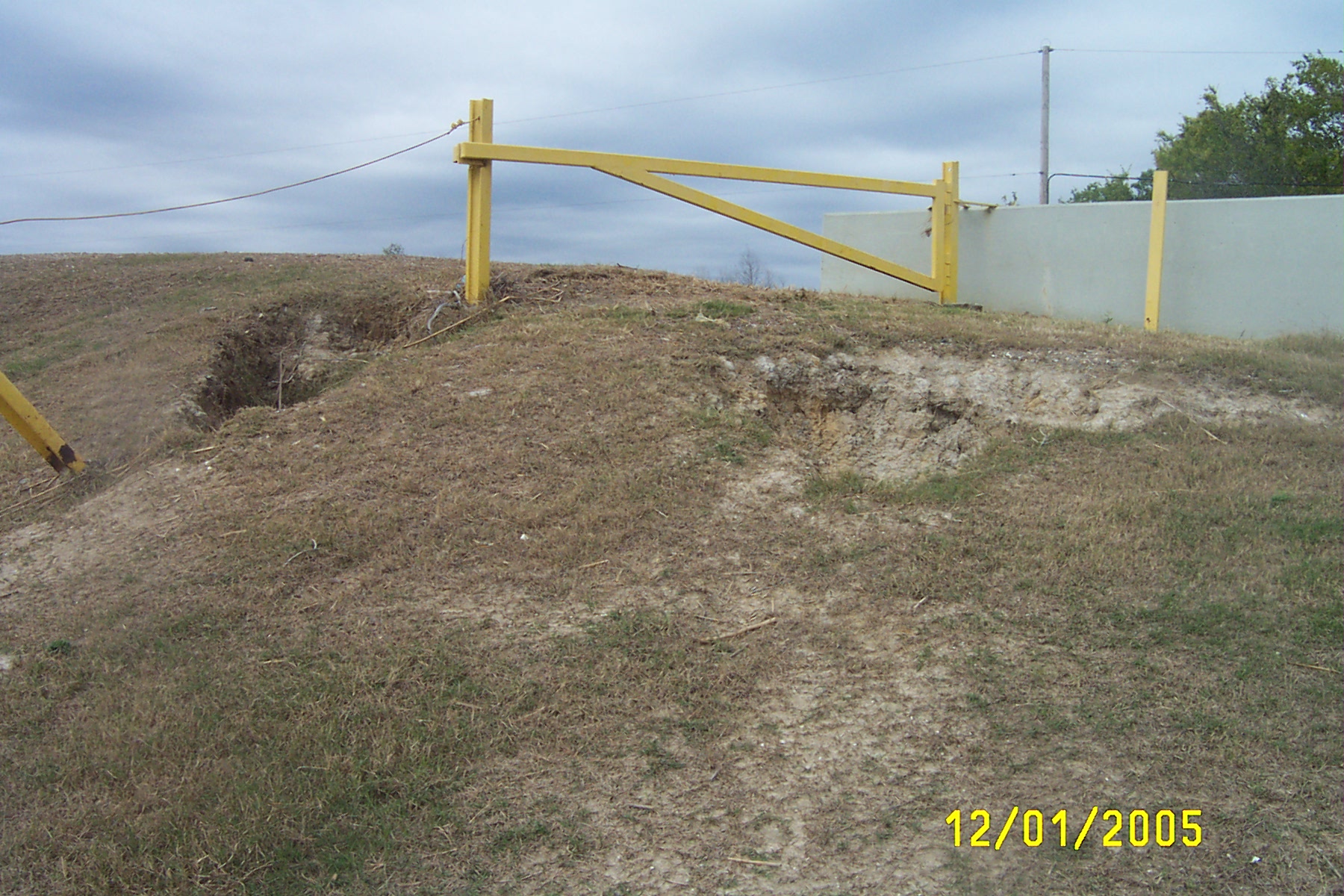
Trenching along inboard side of Lakefront Levee at base of floodwall due to overtopping of floodwall
Debris line in trees above brick wall at Lincoln Beach on Lakefront levee showing high debris line higher than floodwall.
Scour near top of Lakefront levee on Hayne Blvd. near Vincent Road.
Scour trench at base of floodwall on Lakefront levee on Hayne Blvd. near Vincent Road.
Scour under levee cap at Hayne Blvd. near Jahncke Road
Scour under levee cap at Hayne Blvd. near Jahncke Road
Undulations along top and scour in Lakefront Levee at Hayne Blvd. near hansbrough St.
Large scour & undulations along top of Lakefront levee at Hayne Blvd. near Hansbrough St.
Eroded levee due to flood wall overtopping at juncture with concrete inboard apron, on Hayne Blvd.near Edward St.
Eroded Levee at Hayne Blvd. near Downman Road & Lake Front Airport
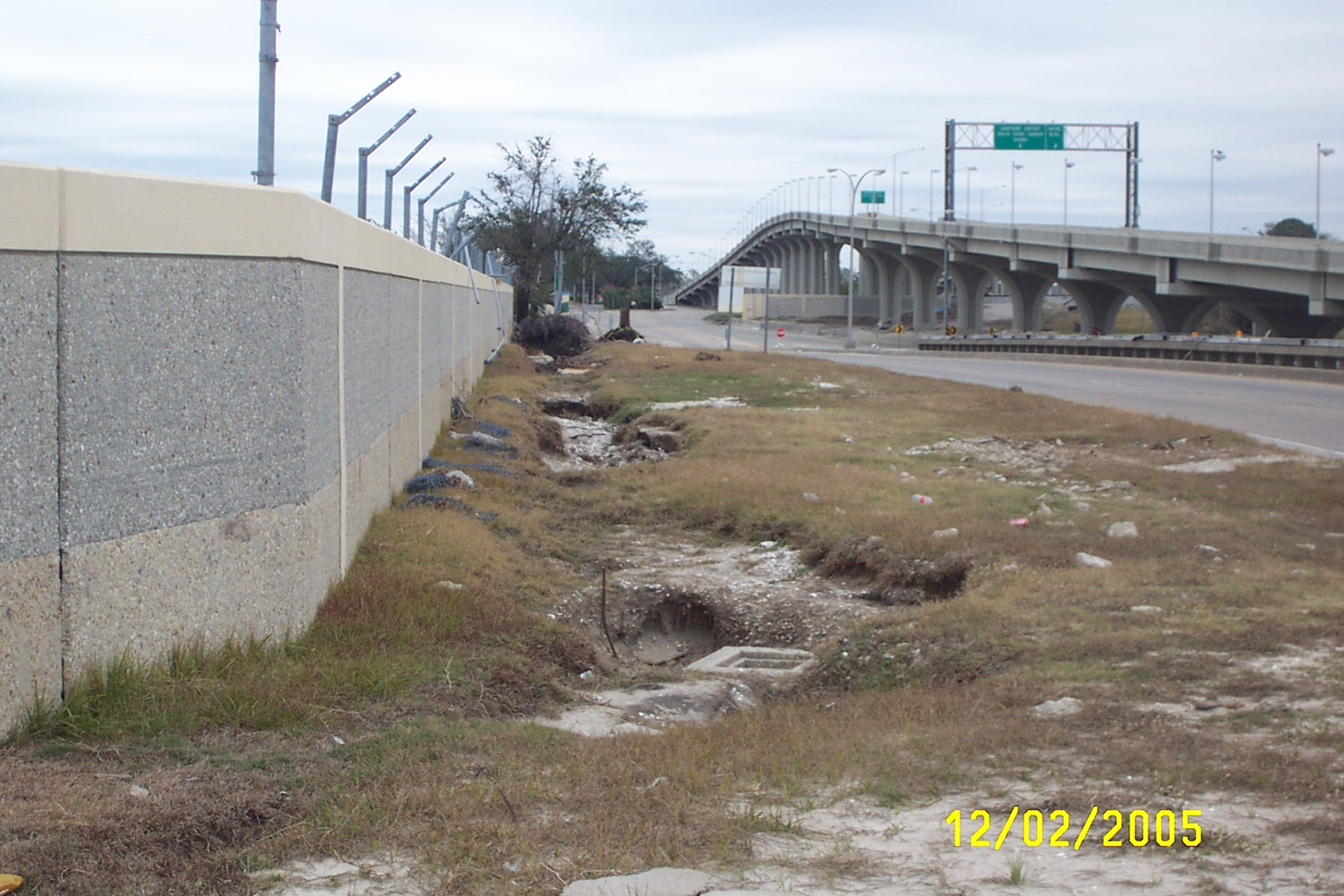
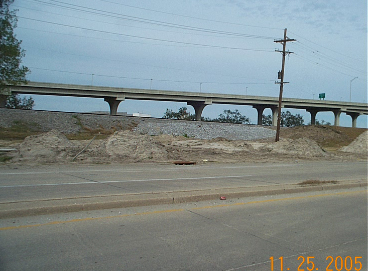
Trench at base of floodwall formed by overtopping of floodwall on Stars & Stripes Blvd. near Lakefront Airport (view looking east)
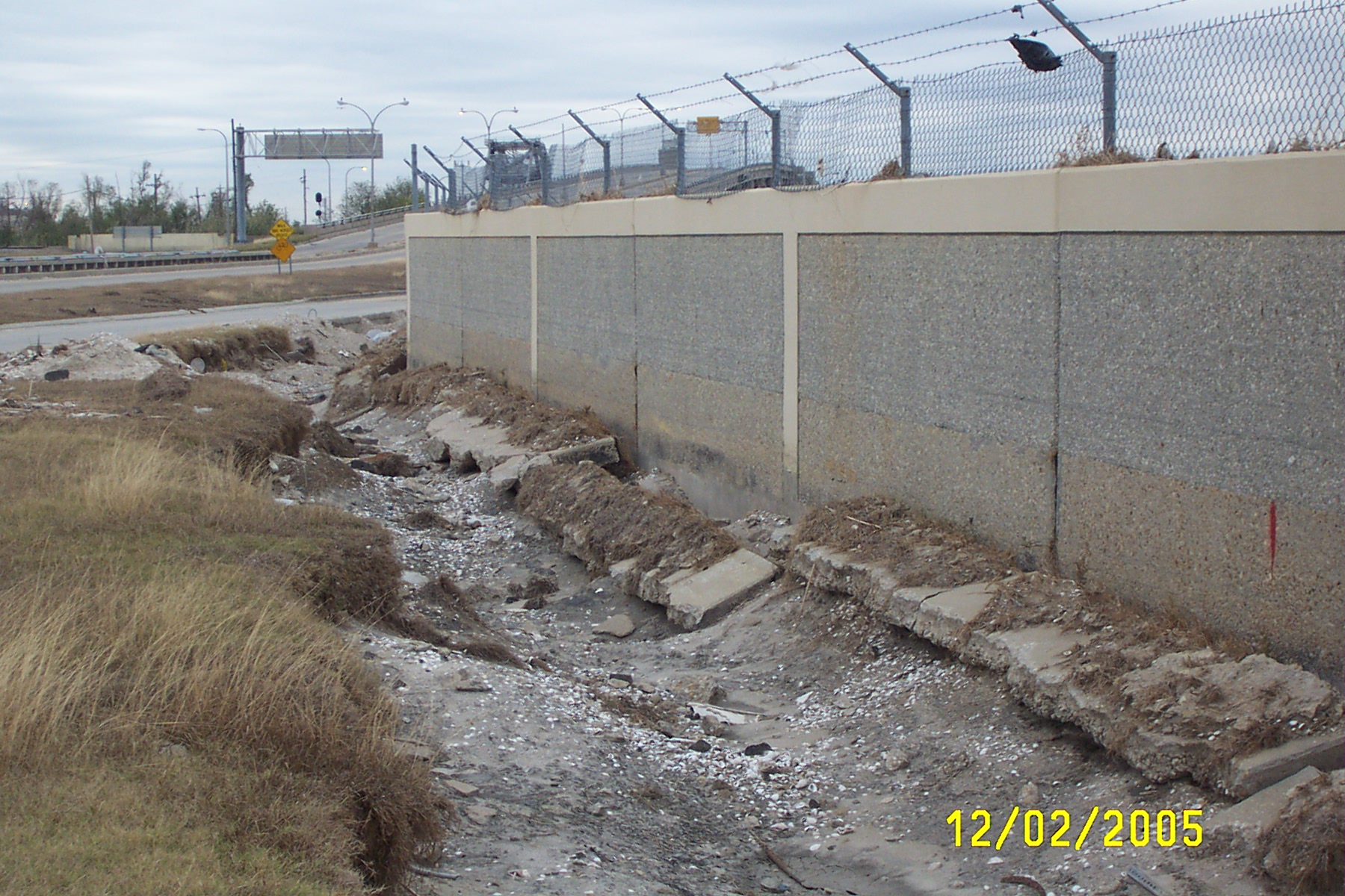
Trench at base of floodwall formed by overtopping of floodwall on Stars & Stripes Blvd. near Lakefront Airport - note debris trapped in fence at top (view looking west)
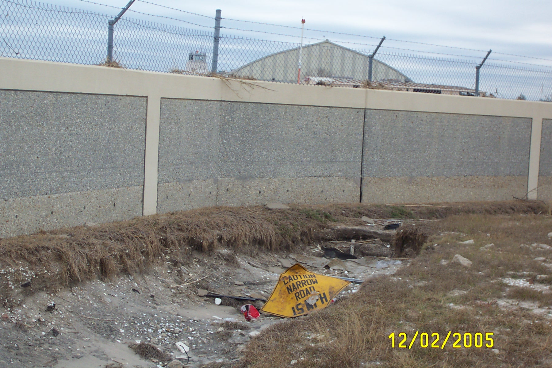
Trench at base of floodwall formed by overtopping of floodwall on Stars & Stripes Blvd. near Lakefront Airport - note debris trapped in fence at top of floodwall (view looking east)
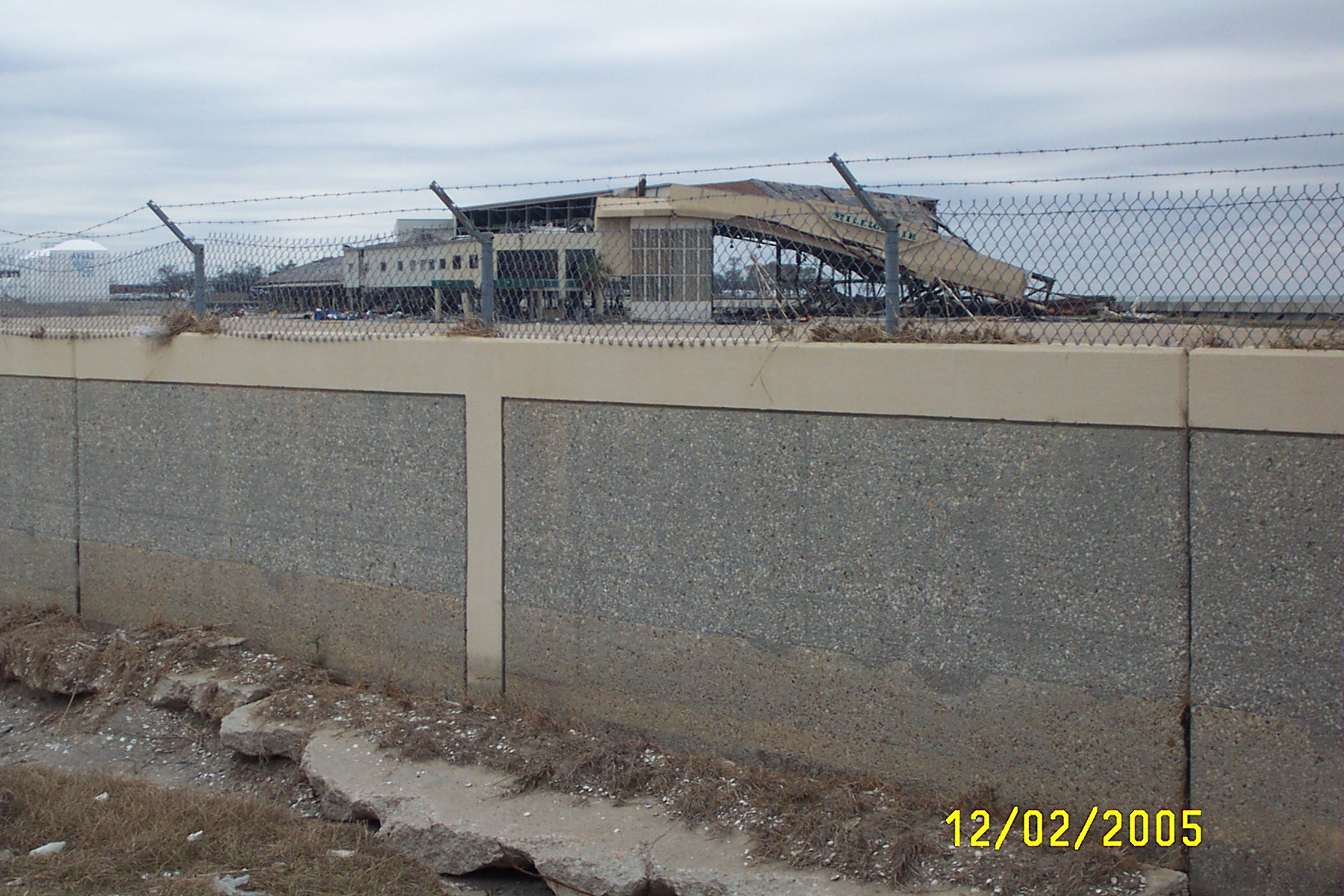
Hangar destruction, debris in fence, floodwall & trench on Stars & Stripes Blvd. (view looking north)
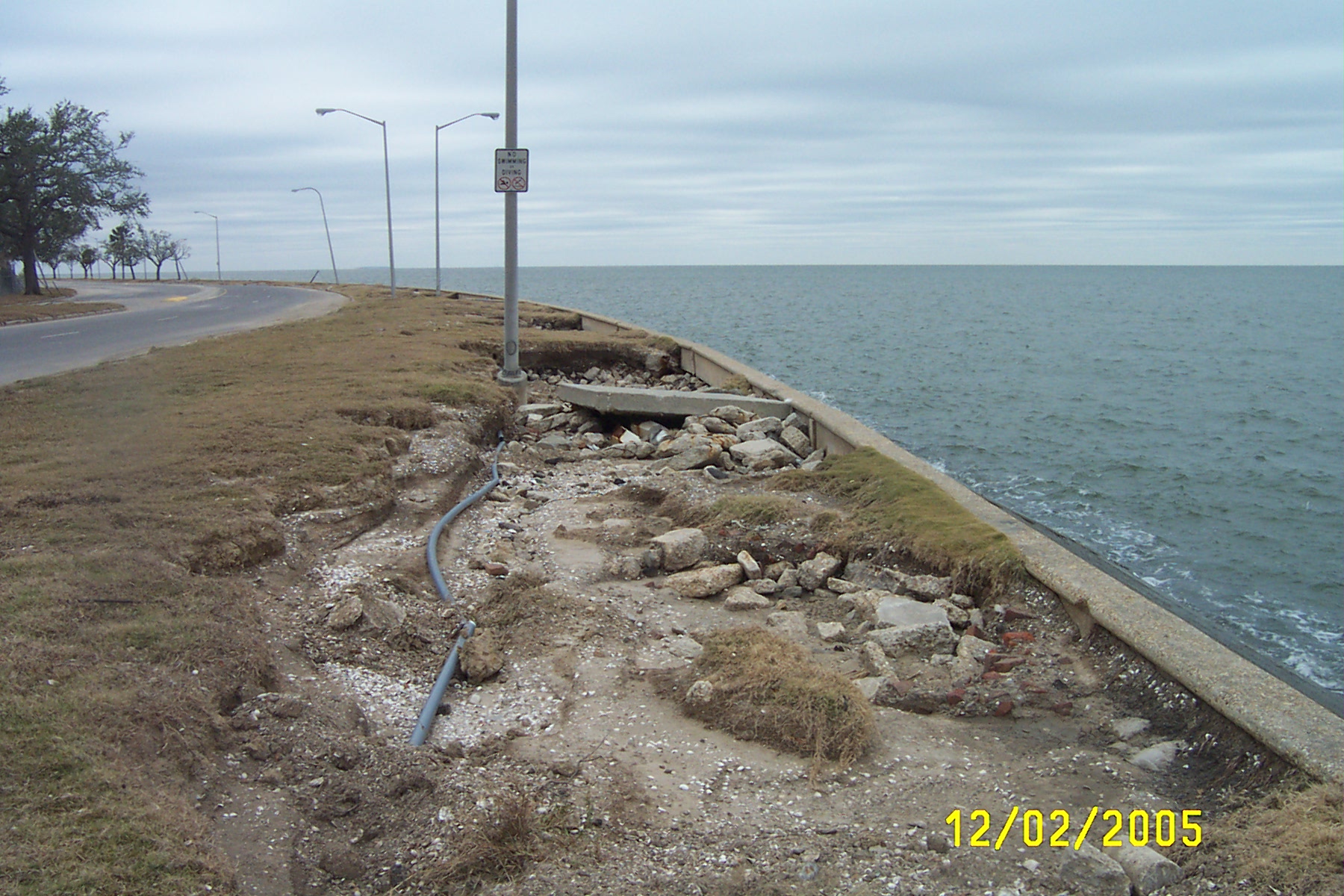
Erosion behind seawall (lakeside of Lakefront levee), Lakeshore Drive west of Industrial Canal
Return to Katrina - What
Happened Page
St. Bernard Parish
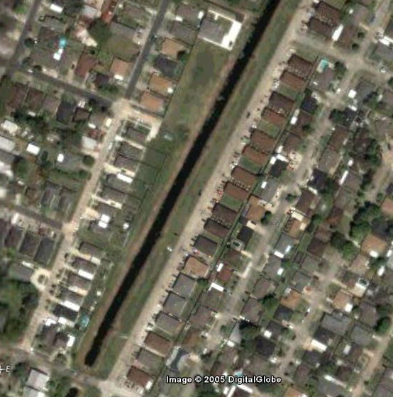
This pre-Katrina Google Earth image shows a row of houses, built on piers along Delambert Street in Chalmette which are backed on the Delambert Canal.
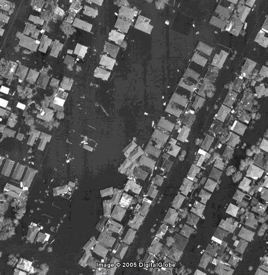
This Image America image shows the same view as the image to the left, but row of houses on Delambert St. have crossed the Delambert Canal and run into the houses on Golden Drive
View from Delambert St. across canal to the houses now resting against those on Golden Drive.
Gate and former location of one of the houses now resting across canal along Golden Drive.
Front steps and piers of one of the houses now resting on the other side of the canal. Note lattice work between piers is still in place.
Home near corner of Delambert & E. Prosper St. twisted away from front steps
Pier foundation of house on Delambert St. now resting on Golden Dr. against other houses
Corner of Florida Ave, looking down Volpe Dr. Note debris on roof of house from floodwaters
Former location of house on Florida Ave. & Gallo Dr.
Boat now resting in Mumphrey Rd near Florida Ave.
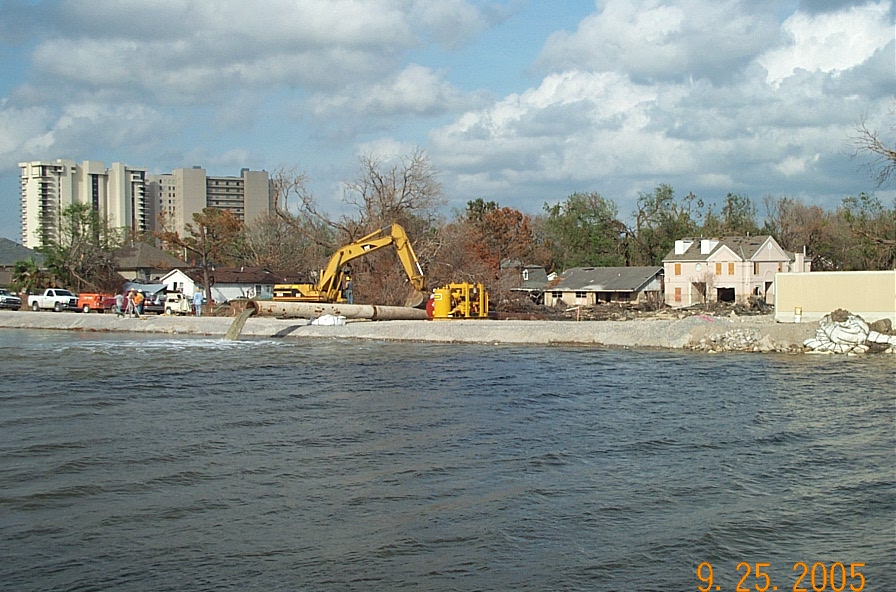
View across Forty Arpent Canal showing overtopped area
View across Forty Arpent Canal looking south into Chalmette