Prof. Stephen A. Nelson

Geology 204

Tulane University

Natural Disasters

Homework Assignment V. Flooding Exercises


Typewritten answers to the following questions should be turned in by the due date (November 13).
  1. Flood frequency information can be determined from knowledge of the peak discharge (highest discharge) in any given year provided enough years worth of information has been collected.  This allows one to relate the expected recurrence interval for a given discharge, and determine the probability that a flood of a given discharge will occur in any given year.  The recurrence interval for a given discharge can be calculated by first ranking the discharges. 
  1. In the table below for Dry Creek. Louisiana, fill in the Rank column.  To do this, enter a 1 for the maximum discharge that has occurred during the 20 years of available data. The second highest discharge will be given a rank of 2, etc. with the lowest discharge given a value of 20.

Date

Discharge
(m3/sec)

Rank, m

Recurrence Interval, R

13-Mar-79

990


06-Mar-80

1450


28-Feb-81

1650


04-Mar-82

3190


22-Mar-83

2150


03-Mar-84

1090


12-Mar-85

1250


01-Feb-86

950


04-Apr-87

1550


02-May-88

1350


16-Mar-89

1100


06-Jul-90

2700


21-Feb-91

1220


30-Jan-92

1710


16-Mar-93

1800


21-Feb-94

1500


12-May-95

1880


08-Apr-96

2400


01-Mar-97

2030


08-Feb-98

1300

   
    1. After you have filled in the Rank column, you can now calculate the recurrence interval for each peak discharge.  The recurrence interval, R,  is given by the Weibull Equation:

R = (n+1)/m

      where n is the number of years over which the data was collected (20 years in this case) and m is the rank of each peak discharge.  Use this equation to calculate the recurrence interval for each peak discharge. 

    1. Next, use the graph below to plot a graph of discharge (on the y-axis) versus recurrence interval (on the x-axis).  Note that the x-axis is a logarithmic scale, and thus you should try to estimate as best you can where the data point will fall between the lines on the graph. Once you have plotted the points use a ruler to draw the best fit straight line through the data points (that is lay a ruler on the graph and try to draw a line that most closely approximates all of the data points). Do not draw lines that connect individual data pointsMake sure you turn in the completed table above and the graph below.

disvsrecurint99.gif (29560 bytes)


    1. By extrapolating your line on the graph, determine the peak discharge expected in a flood with a recurrence interval of 50 years and 100 years.  These are the discharges expected in a 50 year flood and a 100 year flood.
    1. From reading of your text and lecture notes, is it possible that discharges associated with a 100 year flood could occur 5 years apart, 10 years apart, or even one year apart?
    1. The annual exceedence probability, Pe, is the probability that a given discharge will occur in a given year.  It is calculated as the inverse of the recurrence interval, R:

    Pe = 1/R

      Thus, the probability that a flood with a ten year recurrence interval will occur in any year is 1/10 = 0.1 or 10%.  What are the probabilities that a 50 year flood and a 100 year flood will occur in any given year?

    1. The mean annual discharge can be calculated by summing the peak annual discharges and dividing by the number of years.  What is the mean annual discharge for Dry Creek?
    1. Flood stage, or bankfull stage on Dry Creek occurs at a discharge of 2000 m3/sec. What is the recurrence interval of such a discharge according to your graph?
    1. Someone has offered to sell you a 4-bedroom 2-story house with a 2 car garage and swimming pool on a 1 acre lot on a relatively flat piece of ground on the banks of Dry Creek for what seems like a reasonable price of $50,000.  The last time the house was flooded it cost $40,000 to repair the flood damage.  How often has the house been flooded in the last 20 years?  What is the probability that the house will be flooded in the first year that you own it?  Would you still consider buying the house?   Why or why not?
 
  1. Imagine that in your future work as an executive for an insurance company that you have been reassigned to head up the Fargo, North Dakota office of your company, Denyallclaims Insurance, Inc. You are aware that in 1997 the Red River of the North, which runs through Fargo, crested at the highest level recorded in this century, and you are concerned about buying property and living in the area of Fargo.  One of the other executives in your company has an uncle that lives in Fargo, and he assures you that while flooding was severe in 1997, this was a 250 year flood, and such a flood will not occur for another 250 years!  You know from taking this class that his statement is hogwash, so you decide to check out the discharge history of the Red River in Fargo on the internet.  Because you took a course in natural disasters, you know that if you visit the web site of the U.S.G.S. Water Resources Division:

    http://water.usgs.gov/nwis/

    you can obtain discharge data from thousands of gaging stations throughout the United States.  Go to this web site and do the following:

    On the upper right-hand side of the page are boxes that you can set to take you more directly to the information you want.  Under the line that says "Data category", use the down arrow next to the box to change the box to read "Surface Water".

    Under the line that says "Geographic Area", use the down arrow next to the box to change the  box to read "North Dakota".  Then, click on the "Go" button.  This will take you to the North Dakota surface water page.

    Next, click on the button that says "Stream Flow" from the selection of buttons on the left-hand side of the page. This will take you to the Daily Streamflow for North Dakota page.  Here we need to specifically search for the Data we want.  About the only information that we know is that we are looking for information on the Red River of the North.  Since each river is a different "hydrologic unit", we will use this as our search criteria.  So, click on the box next to "Hydrologic Unit" to place a check mark in the box, then click on the "Submit" button.

    On the page that comes up, there is a box from which we can choose the hydrologic unit we are looking for.  In this case, find and select the unit called "Upper Red", then scroll down and click on the "Submit" button.  The search should then return results for all gaging stations on the Upper Red River.  In this case, you will find 3 possible choices.  The one we want is "RED RIVER OF THE NORTH AT FARGO, ND", which has the station number -  05054000.  Click on this station number. This will bring up the page for the Fargo gaging station.  On this page make sure that it says "Surface Water - Daily Streamflow" in the box next to "Available Data for this site".  Note that records are available from 06/01/1901 to  09/30/2000.
    1. You want to look at this data over a shorter period of time, so scroll down and next to where it says "Retrieve Data from"  type in 1968-01-01  and in the "to" box type in 1998-01-01, to get a graphs showing daily discharge over this 30 year period.  Make sure that you have selected the buttons to select an output format of Graph and arithmetic scale, rather than log scale.  Then click on the "Submit" button. The site is rather slow, but eventually a graph will appear that shows discharge on a daily basis versus time for the 30 year period. Look at the graph.  Floodstage for this gaging station is about  3500 ft3/sec.  Over this 30 year period, how many times has the Red River exceeded flood stage?  In what year did the highest discharge occur, and what was the value of that discharge?

    1. Notice that there seems to be a periodicity to where the peaks of high discharge occur on the hydrograph (that is the distance between peak discharge points are approximately equally spaced).  In order to better understand what may be the cause of this periodicity, and perhaps the cause of the flooding,  click on the "Back" button to return to the data retrieval page.  Now ask to retrieve data over a shorter period of time (5 years), this time use range between 1978-01-01 to 1984-12-31. Click on the "Submit" button again, and look at the graph that is eventually displayed. What is your best estimate the approximate month or months in which the peak discharge occurs in each year of this 5 year period?  Knowing that North Dakota is in the northern part of the United States, why do you think that the peak discharge occurs in this month or range of months?

    2. To find out more about floods on the Red River of the North go to the Fargo Flood Home Page:

      http://www.ndsu.nodak.edu/fargoflood/

      then page down and select the link - "Flood Information for Fargo".   Now answer the question - What makes the Red River Valley so prone to flooding?

    3. Is there any information at this web site that suggests that nay floods have occurred at Fargo since the 1997 flood?  If so, when was the latest flood and how severe was it? (Note: to answer the question about the severity of the any recent flood, you might want to consult flood hydrographs for the 1997 and any possible more recent flood and compare them with each other and to the flood 
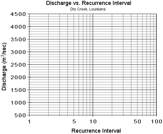
frequency diagram for the Red River at Fargo that appears in your lecture notes.)

    4. What precautions should you take in choosing your home and home site in the Fargo area if you decide to move there to head up the Denyallclaims office in Fargo?  Is there any information or links on the Fargo Flood Home Page that would help you in making this decision?  If so, describe any information that is available.

    5. From what you have learned by visiting the web sites for this assignment, how to you respond to your uncle who said that severe flooding would not occur for another 250 years?
 
  1. Go back to the USGS water resources data base page:

      http://water.usgs.gov/nwis/

    We next want to look at some data for the area of Rapid Creek, South Dakota.  So, make sure "Surface Water" and "South Dakota" are selected at the top of the page, and click on the "Go" button.  On the next page, click on the Streamflow button.  This time we know the station number that we want - it is 06414000, so on the "Site Selection Criteria" page, put a check mark next to "Site Number" under "Site Identifier", and click on the "Submit" button.  Enter the number 06414000 in the box under "Site Number", then and scroll down and click on the "Submit" button.  A screen for the stream gauge on Rapid Creek at Rapid City, S. Dakota will come up.  

    Rapid creek drains the area of the Black Hills, which is a spectacular tourist site.  On Friday, June 9, 1972 shortly after 6 PM a severe thunderstorm dropped about 15 inches of rain on the Black Hills over a period of 6 hours. You want to see what the effects of this thunderstorm were on Rapid Creek in Rapid City.  So on the Rapid Creek page, choose to retrieve data for the period between 1972-06-05 and 1972-06-14, Make sure "Graph of Data" and "Arithmetic" scale is selected, then click on the "Submit" button.  Note that the graph only reports one value of discharge for each day, so it is difficult to know exactly what time the peak discharge occurred on the June 10. Other data suggest that the peak discharge occurred about 6:00 AM on the morning of June 10th, and the rain ended at 11:59 PM on June 9.
    1. What was the value of peak discharge on June 10th?  By what percentage did this peak discharge exceed the normal discharge (assuming normal discharge is 200 cfs)?

    2. Approximately what was the lag time between the end of the rainstorm and the peak discharge?

    3. This flood killed 238 people.  Why do you think it was it so costly in terms of human lives?

    4. What kind of flood was this?
 
  1. Several sites on the internet provide flood forecast information based on current storm tracks, data from current stream gaging stations, and information about the state of water saturation of the ground.  One of theses sites is Earthsat's Floodwatch:

    http://www.earthsat.com/wx/flooding/floodcast.html

      Go to this site, page down to see the links to "FloodRisk" and "FloodThreat" 
    1. Choose the link to "FloodThreat".  On the page that loads, click on the link to "Quantitative Precipitation" (on the bottom line of text, just above the map).  This will load a map that shows a color coded quantitative precipitation forecast for the United States. What areas of the United States are likely to receive the most rain in the next 24 hours [give your answer by state name(s)]?  For the areas that are forecast to receive the most rain, how much rain is expected?  Be sure to also state the date on which this forecast is valid. (Note, if you don't know the states of the U.S. by their shape, you should also consult another map of the U.S. that shows state names while you are looking at the web page  map so that you can state exactly which states are forecast to receive the most rainfall).

    2. Now close the Quantitative Precipitation Map window, and look at the Flood Threat map.  This is a map of the U.S. that shows the amount of rain in a 3 hour period necessary to cause flooding.   Using your answer to question a, are any of the areas expected to receive enough rain to cause flooding?  If so, which areas and how much rain is necessary to cause flooding in these areas.  Make sure you answer this question on the same day that you answered question a.

    3. Return to the Main Page by hitting the "Back" button on your browser.   Choose the link to "FloodRisk".   This will load a map of the United States, updated daily, that shows areas where there are various levels of risk for flooding, or where the National Weather Service has already issued a flood warning or flood watch.   Do any of the areas you listed in questions a and b show moderate to high risk of a flood in the next day or are any of these areas currently under a flood watch or warning?   If so, state which areas.  Note that you may find this set of pages useful in the future if you are concerned about the possibility of flooding in the area where you live.

Return to Geology 204 Homepage