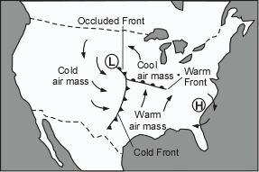
The Ocean-Atmosphere System
The oceans and the atmosphere are the two large reservoirs of water in the
Earth's hydrologic cycle. The two systems are complexly linked to one another and
are responsible for Earth's weather and climate. The oceans help to regulate
temperature in the lower part of the atmosphere. The atmosphere is in
large part responsible for the circulation of ocean water through waves and currents. In this
section we first look at how the atmosphere controls weather and climate, and we will
explore some the introductory material necessary to understand our upcoming lectures on
severe weather.
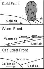
Weather and Climate
Weather is the condition of the atmosphere at a
particular time and place. It refers to such conditions of the local atmosphere as
temperature, atmospheric pressure, humidity (the amount of water contained in the
atmosphere), precipitation (rain, snow, sleet, & hail), and wind velocity. Because the
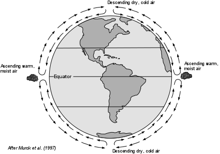
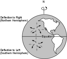
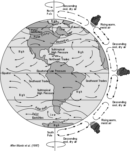
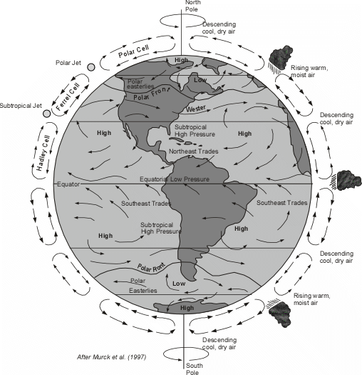
amount of heat in the atmosphere varies with location above the Earth's surface, and
because differing amounts of heat in different parts of the atmosphere control atmospheric
circulation, the atmosphere is in constant motion. Thus, weather is continually
changing in a complex and dynamic manner.
Climate refers to the average weather
characteristics of a given region. Climate, although it does change over longer
periods of geologic time, is more stable over short periods of time like years and
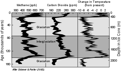
centuries. The fact that the Earth has undergone fluctuation between ice ages and
warmer periods in the recent past (the last ice age ended about 10,000 years ago) is
testament to the fact that climate throughout the world as has been changing through time.
The Earth's weather and climate system represent complex interactions
between the oceans, the land, the sun, and the atmosphere. That these interactions
are complex is evidence by the difficulty meteorologists have in predicting weather on a
daily basis. Understanding climate change is even more difficult because humans have not
been around long enough to record data on the long term effects of these processes. Still,
we do know that the main energy source for changing weather patterns and climate is solar
energy from the Sun.
|